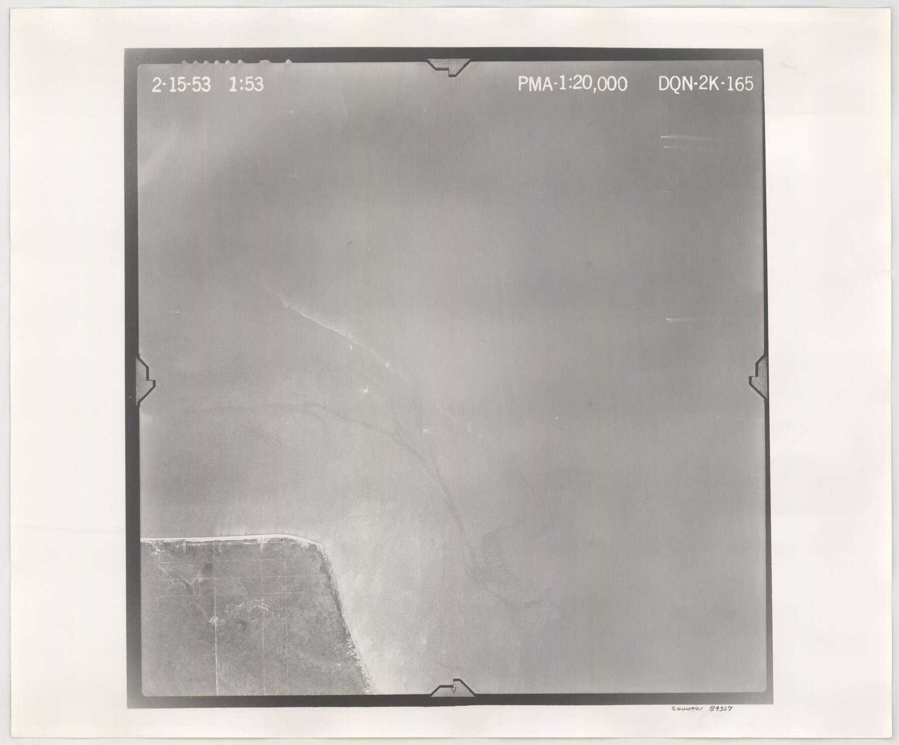
Flight Mission No. DQN-2K, Frame 165, Calhoun County
DQN-2K-165
-
Map/Doc
84327
-
Collection
General Map Collection
-
Object Dates
1953/2/15 (Creation Date)
-
People and Organizations
U. S. Department of Agriculture (Publisher)
-
Counties
Calhoun
-
Subjects
Aerial Photograph
-
Height x Width
18.5 x 22.3 inches
47.0 x 56.6 cm
-
Comments
Flown by Aero Exploration Company of Tulsa, Oklahoma.
Part of: General Map Collection
Briscoe County Sketch File 1

Print $5.00
- Digital $50.00
Briscoe County Sketch File 1
1880
Size 9.1 x 14.8 inches
Map/Doc 16413
Flight Mission No. CRE-2R, Frame 162, Jackson County

Print $20.00
- Digital $50.00
Flight Mission No. CRE-2R, Frame 162, Jackson County
1956
Size 18.5 x 22.3 inches
Map/Doc 85373
[Cotton Belt, St. Louis Southwestern Railway of Texas, Alignment through Smith County]
![64375, [Cotton Belt, St. Louis Southwestern Railway of Texas, Alignment through Smith County], General Map Collection](https://historictexasmaps.com/wmedia_w700/maps/64375.tif.jpg)
Print $20.00
- Digital $50.00
[Cotton Belt, St. Louis Southwestern Railway of Texas, Alignment through Smith County]
1903
Size 21.3 x 28.5 inches
Map/Doc 64375
Culberson County Working Sketch 33

Print $20.00
- Digital $50.00
Culberson County Working Sketch 33
1960
Size 26.9 x 34.1 inches
Map/Doc 68486
Potter County Working Sketch 3

Print $20.00
- Digital $50.00
Potter County Working Sketch 3
1920
Size 42.1 x 16.8 inches
Map/Doc 71663
El Paso County Rolled Sketch Z59

Print $40.00
- Digital $50.00
El Paso County Rolled Sketch Z59
1915
Size 36.5 x 48.1 inches
Map/Doc 8872
Matagorda County Sketch File 28

Print $6.00
- Digital $50.00
Matagorda County Sketch File 28
1909
Size 14.2 x 8.8 inches
Map/Doc 30812
Matagorda County Sketch File 34

Print $6.00
- Digital $50.00
Matagorda County Sketch File 34
1950
Size 14.3 x 8.8 inches
Map/Doc 30820
PSL Field Notes for Blocks 53 and 55 in Culberson and Reeves Counties and Blocks 42, 52, and 54 in Culberson County

PSL Field Notes for Blocks 53 and 55 in Culberson and Reeves Counties and Blocks 42, 52, and 54 in Culberson County
Map/Doc 81673
Val Verde County Rolled Sketch 79

Print $20.00
- Digital $50.00
Val Verde County Rolled Sketch 79
1983
Size 25.6 x 21.7 inches
Map/Doc 8141
Oldham County Boundary File 1a

Print $62.00
- Digital $50.00
Oldham County Boundary File 1a
Size 13.0 x 8.1 inches
Map/Doc 57734
Orange County Working Sketch 25

Print $20.00
- Digital $50.00
Orange County Working Sketch 25
1949
Size 30.7 x 32.6 inches
Map/Doc 71357
You may also like
Map of the southern states, including rail roads, county towns, state capitals, count roads, the southern coast from Delaware to Texas, showing the harbors, inlets, forts and position of blockading ships.

Print $20.00
Map of the southern states, including rail roads, county towns, state capitals, count roads, the southern coast from Delaware to Texas, showing the harbors, inlets, forts and position of blockading ships.
1863
Size 20.1 x 29.9 inches
Map/Doc 93571
Stephens County Working Sketch 1

Print $20.00
- Digital $50.00
Stephens County Working Sketch 1
Size 13.5 x 16.1 inches
Map/Doc 63944
Limestone County Working Sketch 17

Print $20.00
- Digital $50.00
Limestone County Working Sketch 17
1959
Size 42.2 x 33.1 inches
Map/Doc 70567
Flight Mission No. BRE-1P, Frame 36, Nueces County

Print $20.00
- Digital $50.00
Flight Mission No. BRE-1P, Frame 36, Nueces County
1956
Size 18.3 x 22.2 inches
Map/Doc 86632
Crockett County Working Sketch 100

Print $20.00
- Digital $50.00
Crockett County Working Sketch 100
1980
Size 35.6 x 39.9 inches
Map/Doc 68433
Concho County Working Sketch 4

Print $20.00
- Digital $50.00
Concho County Working Sketch 4
1925
Size 18.8 x 20.2 inches
Map/Doc 68186
Dimmit County Working Sketch 58

Print $20.00
- Digital $50.00
Dimmit County Working Sketch 58
2017
Size 24.2 x 36.2 inches
Map/Doc 94121
Flight Mission No. DAG-18K, Frame 70, Matagorda County

Print $20.00
- Digital $50.00
Flight Mission No. DAG-18K, Frame 70, Matagorda County
1952
Size 16.3 x 16.2 inches
Map/Doc 86363
Hardin County Sketch File 69

Print $20.00
- Digital $50.00
Hardin County Sketch File 69
1944
Size 25.1 x 22.0 inches
Map/Doc 11641
Brown County Sketch File 7

Print $6.00
- Digital $50.00
Brown County Sketch File 7
1860
Size 13.0 x 8.1 inches
Map/Doc 16590

Hamilton County Rolled Sketch 3

Print $20.00
- Digital $50.00
Hamilton County Rolled Sketch 3
1919
Size 20.6 x 26.2 inches
Map/Doc 6070