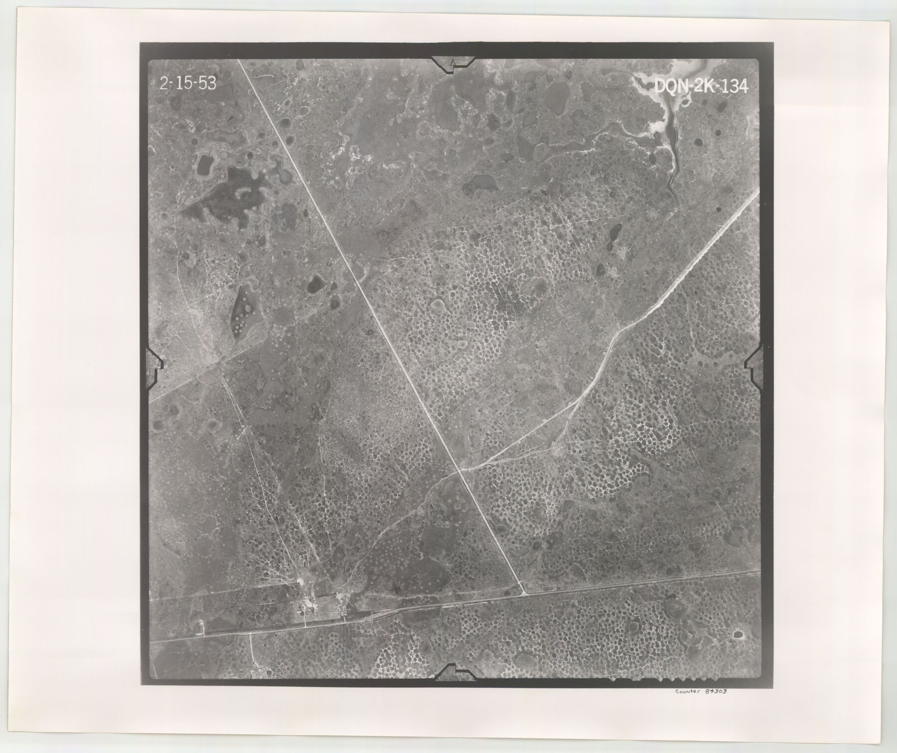
Flight Mission No. DQN-2K, Frame 134, Calhoun County
DQN-2K-134
-
Map/Doc
84303
-
Collection
General Map Collection
-
Object Dates
1953/2/15 (Creation Date)
-
People and Organizations
U. S. Department of Agriculture (Publisher)
-
Counties
Calhoun
-
Subjects
Aerial Photograph
-
Height x Width
18.8 x 22.4 inches
47.8 x 56.9 cm
-
Comments
Flown by Aero Exploration Company of Tulsa, Oklahoma.
Part of: General Map Collection
Falls County Sketch File 26

Print $7.00
- Digital $50.00
Falls County Sketch File 26
1876
Size 10.1 x 8.2 inches
Map/Doc 22433
Cherokee County Sketch File 35

Print $42.00
- Digital $50.00
Cherokee County Sketch File 35
1955
Size 11.5 x 8.8 inches
Map/Doc 18204
Flight Mission No. BRA-7M, Frame 118, Jefferson County

Print $20.00
- Digital $50.00
Flight Mission No. BRA-7M, Frame 118, Jefferson County
1953
Size 18.6 x 22.2 inches
Map/Doc 85512
Rusk County Working Sketch 7

Print $20.00
- Digital $50.00
Rusk County Working Sketch 7
1982
Size 22.3 x 36.7 inches
Map/Doc 63642
Calhoun County Working Sketch Graphic Index

Print $40.00
- Digital $50.00
Calhoun County Working Sketch Graphic Index
1948
Size 48.2 x 40.1 inches
Map/Doc 76484
Dallas County Boundary File 7 and 7a and 7b

Print $8.00
- Digital $50.00
Dallas County Boundary File 7 and 7a and 7b
Size 11.2 x 8.6 inches
Map/Doc 52291
Matagorda County Working Sketch 25

Print $20.00
- Digital $50.00
Matagorda County Working Sketch 25
1975
Size 20.1 x 27.8 inches
Map/Doc 70883
Crane County Working Sketch 22

Print $20.00
- Digital $50.00
Crane County Working Sketch 22
1961
Size 44.7 x 43.9 inches
Map/Doc 68299
Hays County Sketch File 8

Print $4.00
- Digital $50.00
Hays County Sketch File 8
1848
Size 5.5 x 7.8 inches
Map/Doc 26210
Ochiltree County Working Sketch 4

Print $40.00
- Digital $50.00
Ochiltree County Working Sketch 4
1961
Size 89.2 x 38.4 inches
Map/Doc 71317
Map of Portion of Laguna Madre in Nueces & Kleberg Counties showing subdivision thereof for mineral development

Print $20.00
- Digital $50.00
Map of Portion of Laguna Madre in Nueces & Kleberg Counties showing subdivision thereof for mineral development
1937
Size 38.6 x 30.8 inches
Map/Doc 2918

You may also like
General Highway Map, Rusk County, Texas

Print $20.00
General Highway Map, Rusk County, Texas
1939
Size 24.7 x 18.2 inches
Map/Doc 79232
Mapa de los Estados Unidos Mejicanos arreglado a la distribucion que en diversos decretos ha hecho del territorio el Congreso General Mejicano

Print $20.00
- Digital $50.00
Mapa de los Estados Unidos Mejicanos arreglado a la distribucion que en diversos decretos ha hecho del territorio el Congreso General Mejicano
1837
Size 24.3 x 29.4 inches
Map/Doc 96515
Flight Mission No. DQN-2K, Frame 88, Calhoun County

Print $20.00
- Digital $50.00
Flight Mission No. DQN-2K, Frame 88, Calhoun County
1953
Size 18.6 x 22.3 inches
Map/Doc 84278
Zapata County Rolled Sketch 17A

Print $40.00
- Digital $50.00
Zapata County Rolled Sketch 17A
1953
Size 40.6 x 52.2 inches
Map/Doc 10170
Flight Mission No. CGI-1N, Frame 141, Cameron County

Print $20.00
- Digital $50.00
Flight Mission No. CGI-1N, Frame 141, Cameron County
1955
Size 18.5 x 22.2 inches
Map/Doc 84497
Fayette County Working Sketch Graphic Index

Print $40.00
- Digital $50.00
Fayette County Working Sketch Graphic Index
1978
Size 42.9 x 54.7 inches
Map/Doc 76541
San Patricio County Rolled Sketch 55

Print $20.00
- Digital $50.00
San Patricio County Rolled Sketch 55
1999
Size 25.1 x 36.7 inches
Map/Doc 7741
Borden County Boundary File 6

Print $28.00
- Digital $50.00
Borden County Boundary File 6
1908
Size 11.3 x 25.1 inches
Map/Doc 1717
Presidio County Working Sketch 53

Print $20.00
- Digital $50.00
Presidio County Working Sketch 53
1955
Size 28.6 x 18.9 inches
Map/Doc 71730
Houston County Working Sketch 34

Print $40.00
- Digital $50.00
Houston County Working Sketch 34
Size 50.9 x 37.3 inches
Map/Doc 66264
Grandfield Bridge Sheet

Print $20.00
Grandfield Bridge Sheet
1920
Size 39.4 x 35.8 inches
Map/Doc 79751
Robertson County Rolled Sketch 1

Print $20.00
- Digital $50.00
Robertson County Rolled Sketch 1
1966
Size 45.5 x 28.9 inches
Map/Doc 9862