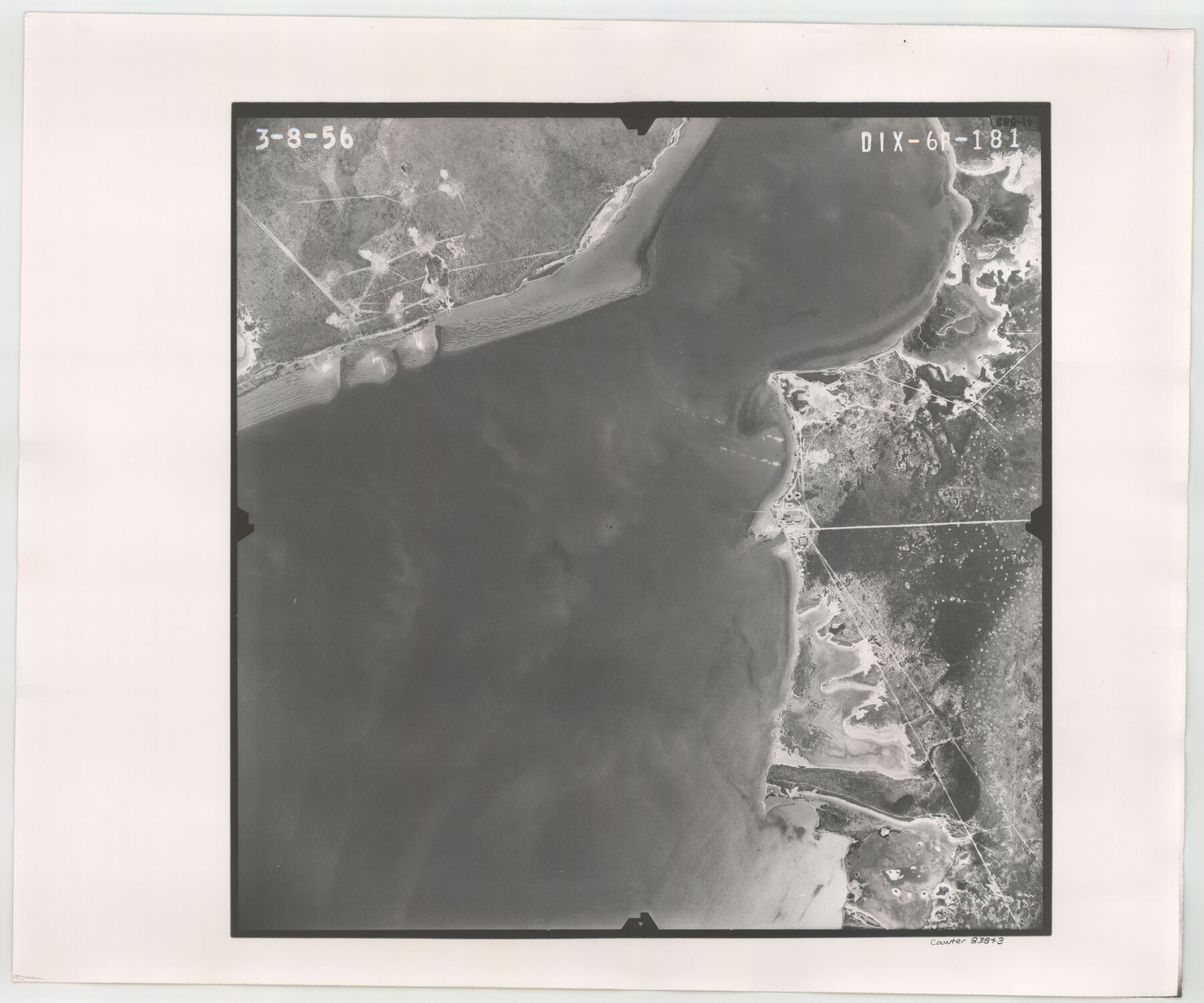
Flight Mission No. DIX-6P, Frame 181, Aransas County
DIX-6P-181
-
Map/Doc
83843
-
Collection
General Map Collection
-
Object Dates
1956/3/8 (Creation Date)
-
People and Organizations
U. S. Department of Agriculture (Publisher)
-
Counties
Aransas
-
Subjects
Aerial Photograph
-
Height x Width
18.9 x 22.6 inches
48.0 x 57.4 cm
-
Comments
Flown by V. L. Beavers and Associates of San Antonio, Texas.
Part of: General Map Collection
Coryell County Working Sketch 8

Print $20.00
- Digital $50.00
Coryell County Working Sketch 8
1945
Size 36.5 x 33.0 inches
Map/Doc 68215
Americae Nova Descriptio

Print $20.00
- Digital $50.00
Americae Nova Descriptio
1663
Size 14.5 x 18.0 inches
Map/Doc 95708

Wharton County Working Sketch 23

Print $20.00
- Digital $50.00
Wharton County Working Sketch 23
1919
Size 22.0 x 36.0 inches
Map/Doc 72487
Upton County Rolled Sketch 52

Print $20.00
- Digital $50.00
Upton County Rolled Sketch 52
Size 24.5 x 29.2 inches
Map/Doc 8087
Northwest Section of Ramsey State Farm

Print $20.00
- Digital $50.00
Northwest Section of Ramsey State Farm
Size 12.6 x 17.2 inches
Map/Doc 94281
Lipscomb County Working Sketch 1

Print $20.00
- Digital $50.00
Lipscomb County Working Sketch 1
1964
Size 30.7 x 34.1 inches
Map/Doc 70577
Motley County Sketch File 23 (S)

Print $2.00
- Digital $50.00
Motley County Sketch File 23 (S)
Size 4.2 x 8.4 inches
Map/Doc 32203
Wharton County Rolled Sketch 3

Print $20.00
- Digital $50.00
Wharton County Rolled Sketch 3
Size 28.9 x 31.4 inches
Map/Doc 8228
Liberty County Working Sketch 60

Print $20.00
- Digital $50.00
Liberty County Working Sketch 60
1969
Size 41.3 x 34.1 inches
Map/Doc 70520
Baylor County Sketch File A

Print $6.00
- Digital $50.00
Baylor County Sketch File A
Size 7.5 x 9.2 inches
Map/Doc 14072
Gordonville Quadrangle

Print $20.00
- Digital $50.00
Gordonville Quadrangle
1999
Size 35.4 x 23.4 inches
Map/Doc 97362
You may also like
Blocks 2, 8, and 9. Capitol Syndicate Subdivision of Capitol Leagues or Portions of Capitol Leagues 59, 60, 61, 62, 63, 64, 65, 66, 69, 70, 71, 72, 73, 74, 75, 76, 83, 84, 85, 86, 87, 88, 89, 90, 91, 92, 108, 109, and 110. Dallam County, Texas

Print $20.00
- Digital $50.00
Blocks 2, 8, and 9. Capitol Syndicate Subdivision of Capitol Leagues or Portions of Capitol Leagues 59, 60, 61, 62, 63, 64, 65, 66, 69, 70, 71, 72, 73, 74, 75, 76, 83, 84, 85, 86, 87, 88, 89, 90, 91, 92, 108, 109, and 110. Dallam County, Texas
1906
Size 31.7 x 28.3 inches
Map/Doc 92581
Irion County Rolled Sketch 8

Print $20.00
- Digital $50.00
Irion County Rolled Sketch 8
Size 42.9 x 34.1 inches
Map/Doc 9251
Subdivision of Mallet Land and Cattle Company's Ranch Hockley, Cochran, Terry, and Yoakum Counties, Texas

Print $20.00
- Digital $50.00
Subdivision of Mallet Land and Cattle Company's Ranch Hockley, Cochran, Terry, and Yoakum Counties, Texas
Size 17.3 x 16.4 inches
Map/Doc 92207
Hardeman County Working Sketch 17

Print $20.00
- Digital $50.00
Hardeman County Working Sketch 17
1986
Size 18.4 x 26.1 inches
Map/Doc 63398

Runnels County Sketch File 24

Print $20.00
Runnels County Sketch File 24
1930
Size 25.2 x 21.3 inches
Map/Doc 12258
Hamilton County Sketch File 10

Print $24.00
- Digital $50.00
Hamilton County Sketch File 10
1874
Size 12.8 x 8.5 inches
Map/Doc 24919
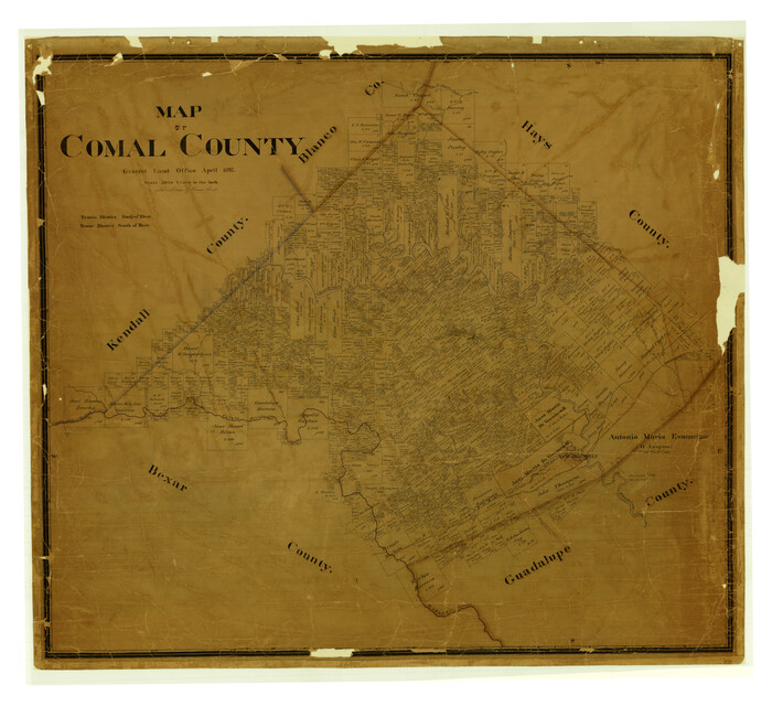
Map of Comal County
Print $40.00
- Digital $50.00
Map of Comal County
1897
Size 44.3 x 48.5 inches
Map/Doc 4681
Morris County Rolled Sketch 2A

Print $20.00
- Digital $50.00
Morris County Rolled Sketch 2A
Size 36.5 x 20.0 inches
Map/Doc 10283
Jim Wells Co.

Print $20.00
- Digital $50.00
Jim Wells Co.
1966
Size 42.7 x 31.0 inches
Map/Doc 73198
Flight Mission No. DQN-1K, Frame 121, Calhoun County

Print $20.00
- Digital $50.00
Flight Mission No. DQN-1K, Frame 121, Calhoun County
1953
Size 18.6 x 22.2 inches
Map/Doc 84187
Flight Mission No. DAG-24K, Frame 54, Matagorda County

Print $20.00
- Digital $50.00
Flight Mission No. DAG-24K, Frame 54, Matagorda County
1953
Size 17.2 x 19.1 inches
Map/Doc 86541