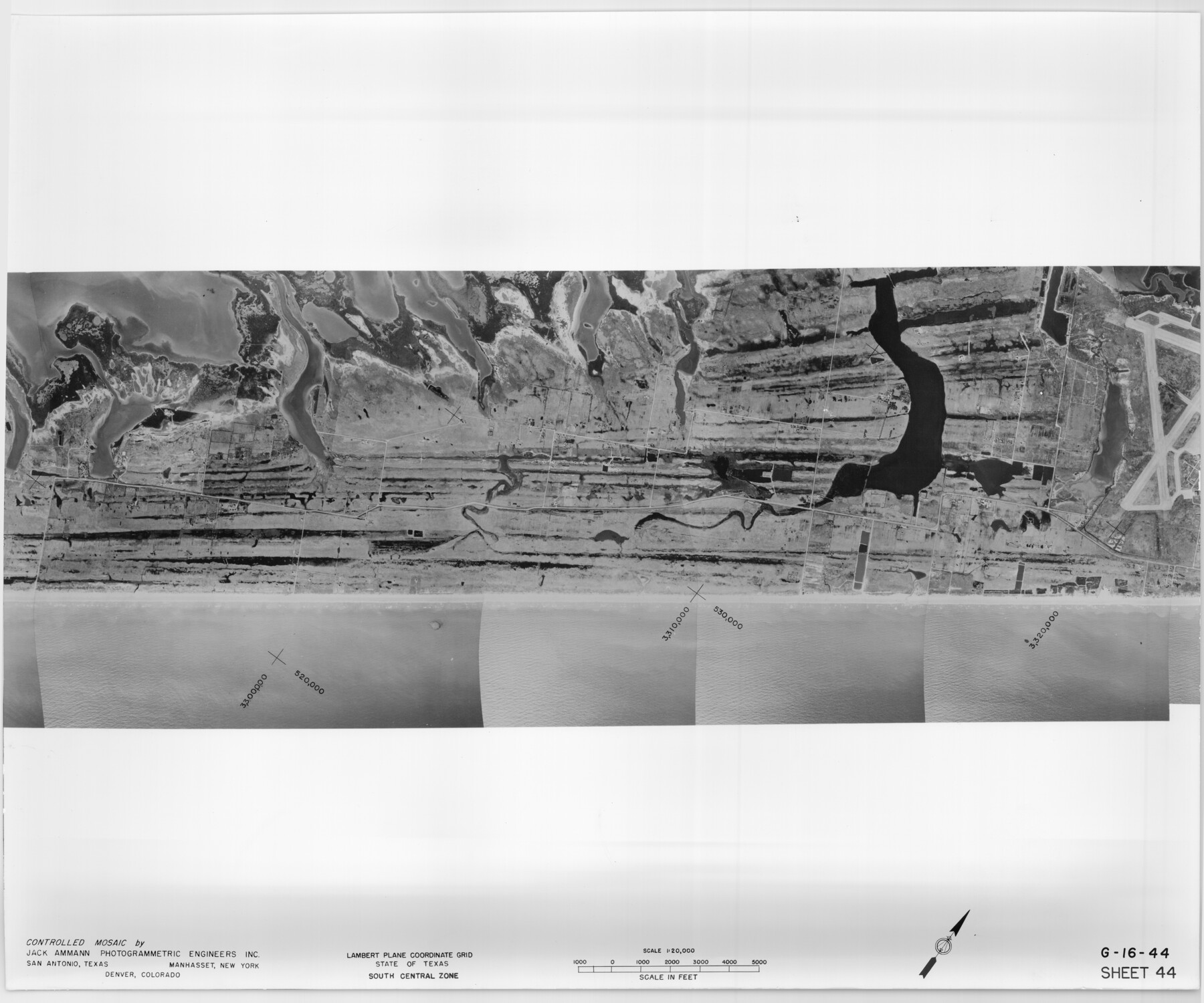
Controlled Mosaic by Jack Amman Photogrammetric Engineers, Inc - Sheet 44
[Coastal Aerial Photograph]
G-16-44
-
Map/Doc
83503
-
Collection
General Map Collection
-
Object Dates
1954 (Creation Date)
-
Subjects
Aerial Photograph
-
Height x Width
20.0 x 24.0 inches
50.8 x 61.0 cm
-
Comments
Statement on reverse side: "The reverse reflects the data shown thereon which was obtained by aerial survey made from December 31, 1953 to March 17, 1954 by Jack Ammann Photogrammetric Engineers, Inc."
Part of: General Map Collection
Starr County Sketch File 32A

Print $26.00
- Digital $50.00
Starr County Sketch File 32A
1938
Size 14.2 x 8.6 inches
Map/Doc 36967
Brazoria County NRC Article 33.136 Sketch 9

Print $24.00
- Digital $50.00
Brazoria County NRC Article 33.136 Sketch 9
2007
Size 24.2 x 34.1 inches
Map/Doc 87929
Flight Mission No. BQY-1T, Frame 74, Harris County

Print $20.00
- Digital $50.00
Flight Mission No. BQY-1T, Frame 74, Harris County
1957
Size 17.5 x 17.6 inches
Map/Doc 85294
Parker County Sketch File B

Print $24.00
- Digital $50.00
Parker County Sketch File B
1858
Size 12.5 x 8.2 inches
Map/Doc 33509
Map of Yoakum County

Print $20.00
- Digital $50.00
Map of Yoakum County
1902
Size 47.2 x 35.3 inches
Map/Doc 16934
Treaty to Resolve Pending Boundary Differences and Maintain the Rio Grande and Colorado River as the International Boundary Between the United States of American and Mexico

Print $20.00
- Digital $50.00
Treaty to Resolve Pending Boundary Differences and Maintain the Rio Grande and Colorado River as the International Boundary Between the United States of American and Mexico
1970
Size 11.1 x 35.8 inches
Map/Doc 83102
Midland County Working Sketch 20

Print $20.00
- Digital $50.00
Midland County Working Sketch 20
1953
Size 22.0 x 14.9 inches
Map/Doc 71001
Township 3 North Range 14 West, North Western District, Louisiana

Print $20.00
- Digital $50.00
Township 3 North Range 14 West, North Western District, Louisiana
1844
Size 19.8 x 24.7 inches
Map/Doc 65862
Jefferson County Working Sketch 34

Print $20.00
- Digital $50.00
Jefferson County Working Sketch 34
1981
Size 33.4 x 18.8 inches
Map/Doc 66578
Hardin County Rolled Sketch 12

Print $20.00
- Digital $50.00
Hardin County Rolled Sketch 12
1949
Size 36.3 x 47.3 inches
Map/Doc 10200
Brewster County Rolled Sketch 121A

Print $40.00
- Digital $50.00
Brewster County Rolled Sketch 121A
1946
Size 37.4 x 54.5 inches
Map/Doc 8518
Orange County Sketch File 15

Print $6.00
- Digital $50.00
Orange County Sketch File 15
1900
Size 11.0 x 15.4 inches
Map/Doc 33330
You may also like
Bosque County Sketch File 22

Print $4.00
- Digital $50.00
Bosque County Sketch File 22
1863
Size 13.8 x 8.5 inches
Map/Doc 14804
[Sketch of "B" Blocks]
![89749, [Sketch of "B" Blocks], Twichell Survey Records](https://historictexasmaps.com/wmedia_w700/maps/89749-1.tif.jpg)
Print $40.00
- Digital $50.00
[Sketch of "B" Blocks]
Size 61.7 x 38.1 inches
Map/Doc 89749
El Paso County Working Sketch 17

Print $20.00
- Digital $50.00
El Paso County Working Sketch 17
1958
Size 28.4 x 26.3 inches
Map/Doc 69039

Jeff Davis County Working Sketch 20

Print $40.00
- Digital $50.00
Jeff Davis County Working Sketch 20
1957
Size 63.0 x 32.8 inches
Map/Doc 66515
Morris County Boundary File 1

Print $18.00
- Digital $50.00
Morris County Boundary File 1
Size 14.1 x 8.7 inches
Map/Doc 57473
La Salle County Sketch File 35

Print $40.00
- Digital $50.00
La Salle County Sketch File 35
Size 12.1 x 19.7 inches
Map/Doc 29587
Map of the O-X Ranch in Cottle County, Texas

Print $20.00
- Digital $50.00
Map of the O-X Ranch in Cottle County, Texas
1916
Size 30.4 x 35.7 inches
Map/Doc 4439
Hudspeth County Sketch File 39

Print $42.00
- Digital $50.00
Hudspeth County Sketch File 39
Size 8.8 x 11.5 inches
Map/Doc 27010
Coleman County Working Sketch 16

Print $20.00
- Digital $50.00
Coleman County Working Sketch 16
1950
Size 41.7 x 35.7 inches
Map/Doc 68082
[Gunter & Munson, Maddox Bros. & Anderson Block F] / [PSL Block B19]
![91852, [Gunter & Munson, Maddox Bros. & Anderson Block F] / [PSL Block B19], Twichell Survey Records](https://historictexasmaps.com/wmedia_w700/maps/91852-1.tif.jpg)
Print $20.00
- Digital $50.00
[Gunter & Munson, Maddox Bros. & Anderson Block F] / [PSL Block B19]
Size 20.1 x 18.6 inches
Map/Doc 91852
Blanco County Working Sketch 11

Print $3.00
- Digital $50.00
Blanco County Working Sketch 11
1941
Size 10.8 x 10.4 inches
Map/Doc 67371