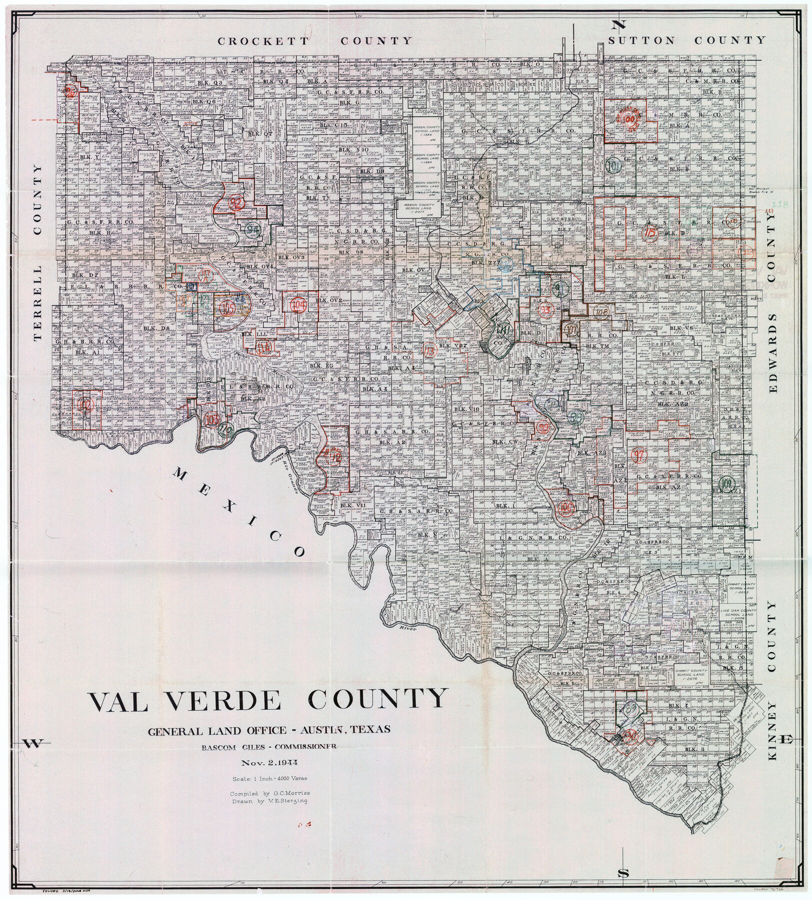
Val Verde County Working Sketch Graphic Index, Sheet 3 (Sketches 89 to Most Recent)
- 
                          Map/Doc
76726
 - 
                            Collection
General Map Collection
 - 
                            Object Dates
11/2/1944 (Creation Date)
 - 
                            People and Organizations
G.C. Morriss (Compiler)
Victor E. Sterzing (Draftsman)
 - 
                            Counties
Val Verde
 - 
                            Subjects
County Surveying Working Sketch
 - 
                            Height x Width
40.3 x 36.6 inches
102.4 x 93.0 cm
 - 
                            Scale
1" = 4000 varas
 
Part of: General Map Collection
            Right of Way & Track Map Houston & Brazos Valley Ry. operated by Houston & Brazos Valley Ry. Co., Hoskins Mound Branch


                                            Print $40.00                    
                                             -                         Digital $50.00                                    
                Right of Way & Track Map Houston & Brazos Valley Ry. operated by Houston & Brazos Valley Ry. Co., Hoskins Mound Branch
1924
Size 25.3 x 56.4 inches
                                Map/Doc 64609
            
            Freestone County Sketch File 14a


                                            Print $6.00                    
                                             -                         Digital $50.00                                    
                Freestone County Sketch File 14a
1861
Size 5.3 x 5.9 inches
                                Map/Doc 23067
            
            [Surveys near Calaveras Creek]


                                            Print $2.00                    
                                             -                         Digital $50.00                                    
                [Surveys near Calaveras Creek]
1846
Size 10.9 x 8.0 inches
                                Map/Doc 364
            
            Right of Way and Track Map, the Missouri, Kansas & Texas Ry. Of Texas operated by the Missouri, Kansas & Texas Ry. Of  Texas, Houston Division


                                            Print $40.00                    
                                             -                         Digital $50.00                                    
                Right of Way and Track Map, the Missouri, Kansas & Texas Ry. Of Texas operated by the Missouri, Kansas & Texas Ry. Of Texas, Houston Division
1918
Size 24.7 x 73.8 inches
                                Map/Doc 64565
            
            Henderson County


                                            Print $40.00                    
                                             -                         Digital $50.00                                    
                Henderson County
1922
Size 33.3 x 62.4 inches
                                Map/Doc 1854
            
            Dickens County Sketch File M


                                            Print $59.00                    
                                             -                         Digital $50.00                                    
                Dickens County Sketch File M
1908
Size 14.6 x 9.1 inches
                                Map/Doc 20911
            
            Flight Mission No. DQO-7K, Frame 82, Galveston County


                                            Print $20.00                    
                                             -                         Digital $50.00                                    
                Flight Mission No. DQO-7K, Frame 82, Galveston County
1952
Size 18.8 x 22.5 inches
                                Map/Doc 85109
            
            San Augustine County Sketch File 2


                                            Print $4.00                    
                                    
                San Augustine County Sketch File 2
1846
Size 8.2 x 8.2 inches
                                Map/Doc 35633
            
            Baylor County Aerial Photograph Index Sheet 3


                                            Print $20.00                    
                                             -                         Digital $50.00                                    
                Baylor County Aerial Photograph Index Sheet 3
1950
Size 20.4 x 15.5 inches
                                Map/Doc 83665
            
            Fayette County Working Sketch 5


                                            Print $20.00                    
                                             -                         Digital $50.00                                    
                Fayette County Working Sketch 5
1981
Size 16.2 x 14.6 inches
                                Map/Doc 69169
            
            Mitchell County Boundary File 66a


                                            Print $11.00                    
                                             -                         Digital $50.00                                    
                Mitchell County Boundary File 66a
Size 12.6 x 8.3 inches
                                Map/Doc 57378
            
            Texas Land Commissioner Jerry Patterson's Great Military Map of Texas showing Significant Conflicts and Events between 1685 and 1916


                                            Print $20.00                    
                                             -                         Digital $50.00                                    
                Texas Land Commissioner Jerry Patterson's Great Military Map of Texas showing Significant Conflicts and Events between 1685 and 1916
2006
Size 36.7 x 24.8 inches
                                Map/Doc 83432
            You may also like
            Pecos County Sketch File 24


                                            Print $22.00                    
                                             -                         Digital $50.00                                    
                Pecos County Sketch File 24
Size 7.6 x 5.6 inches
                                Map/Doc 33680
            
            Freestone County Sketch File 9


                                            Print $4.00                    
                                             -                         Digital $50.00                                    
                Freestone County Sketch File 9
1859
Size 7.9 x 8.3 inches
                                Map/Doc 23056
            
            Dallas County Working Sketch 3


                                            Print $20.00                    
                                             -                         Digital $50.00                                    
                Dallas County Working Sketch 3
1922
Size 14.2 x 12.2 inches
                                Map/Doc 68569
            
            Asher and Adams' Texas


                                            Print $20.00                    
                                             -                         Digital $50.00                                    
                Asher and Adams' Texas
1871
Size 25.4 x 18.5 inches
                                Map/Doc 93788
            
            Duval County Boundary File 3l


                                            Print $40.00                    
                                             -                         Digital $50.00                                    
                Duval County Boundary File 3l
Size 13.4 x 17.1 inches
                                Map/Doc 52761
            
            McMullen County Sketch File 24


                                            Print $22.00                    
                                             -                         Digital $50.00                                    
                McMullen County Sketch File 24
Size 8.7 x 12.6 inches
                                Map/Doc 31381
            
            Williamson County Rolled Sketch 5


                                            Print $20.00                    
                                             -                         Digital $50.00                                    
                Williamson County Rolled Sketch 5
1940
Size 23.7 x 34.5 inches
                                Map/Doc 8263
            
            Flight Mission No. CGI-3N, Frame 167, Cameron County


                                            Print $20.00                    
                                             -                         Digital $50.00                                    
                Flight Mission No. CGI-3N, Frame 167, Cameron County
1954
Size 18.6 x 22.4 inches
                                Map/Doc 84631
            
            Donley County Rolled Sketch 1


                                            Print $20.00                    
                                             -                         Digital $50.00                                    
                Donley County Rolled Sketch 1
1939
Size 19.6 x 15.1 inches
                                Map/Doc 5728
            
            Falls County Working Sketch 2


                                            Print $20.00                    
                                             -                         Digital $50.00                                    
                Falls County Working Sketch 2
1922
Size 19.0 x 30.0 inches
                                Map/Doc 69177
            
            Burnet County Boundary File 8


                                            Print $88.00                    
                                             -                         Digital $50.00                                    
                Burnet County Boundary File 8
Size 8.7 x 32.2 inches
                                Map/Doc 50908
            
            Mason County Sketch File 6


                                            Print $4.00                    
                                             -                         Digital $50.00                                    
                Mason County Sketch File 6
1875
Size 8.8 x 14.5 inches
                                Map/Doc 30687