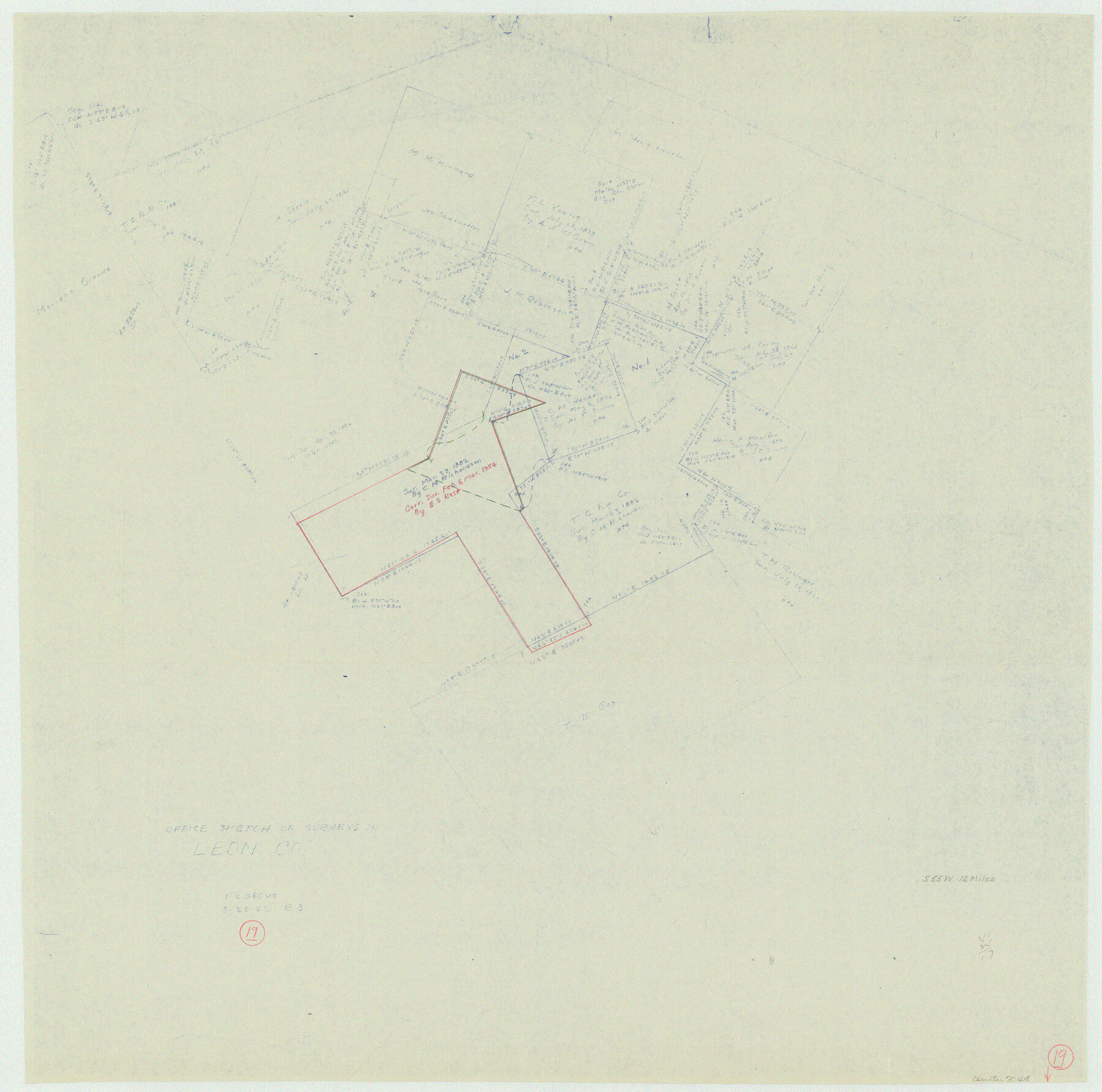
Leon County Working Sketch 19
-
Map/Doc
70418
-
Collection
General Map Collection
-
Object Dates
3/20/1962 (Creation Date)
-
People and Organizations
Roy Buckholts (Draftsman)
-
Counties
Leon
-
Subjects
Surveying Working Sketch
-
Height x Width
31.2 x 31.4 inches
79.3 x 79.8 cm
-
Scale
1" = 360 varas
Part of: General Map Collection
Brazoria County Rolled Sketch 38

Print $20.00
- Digital $50.00
Brazoria County Rolled Sketch 38
1949
Size 44.6 x 39.5 inches
Map/Doc 8460
Hemphill County Rolled Sketch 2

Print $20.00
- Digital $50.00
Hemphill County Rolled Sketch 2
Size 26.4 x 29.8 inches
Map/Doc 6185
Castro County Sketch File 4g

Print $4.00
- Digital $50.00
Castro County Sketch File 4g
Size 12.0 x 8.9 inches
Map/Doc 17477
Sutton County Working Sketch 36

Print $20.00
- Digital $50.00
Sutton County Working Sketch 36
1945
Size 31.3 x 25.4 inches
Map/Doc 62379

Maps of Gulf Intracoastal Waterway, Texas - Sabine River to the Rio Grande and connecting waterways including ship channels

Print $20.00
- Digital $50.00
Maps of Gulf Intracoastal Waterway, Texas - Sabine River to the Rio Grande and connecting waterways including ship channels
1966
Size 14.4 x 22.2 inches
Map/Doc 61943
San Patricio County Rolled Sketch 49

Print $20.00
- Digital $50.00
San Patricio County Rolled Sketch 49
1979
Size 19.7 x 17.7 inches
Map/Doc 7734
Stephens County

Print $20.00
- Digital $50.00
Stephens County
1940
Size 42.5 x 40.4 inches
Map/Doc 73293
Flight Mission No. DQN-2K, Frame 81, Calhoun County

Print $20.00
- Digital $50.00
Flight Mission No. DQN-2K, Frame 81, Calhoun County
1953
Size 18.7 x 22.3 inches
Map/Doc 84273
Hardin County Sketch File 9a

Print $4.00
- Digital $50.00
Hardin County Sketch File 9a
1860
Size 9.9 x 8.4 inches
Map/Doc 25108
Map of Europe engraved to illustrate the new intermediate geography

Print $20.00
- Digital $50.00
Map of Europe engraved to illustrate the new intermediate geography
1885
Size 9.0 x 12.2 inches
Map/Doc 93526
Jack County Working Sketch 22

Print $20.00
- Digital $50.00
Jack County Working Sketch 22
1995
Size 23.9 x 36.7 inches
Map/Doc 66448
You may also like
Aransas County Working Sketch 19

Print $20.00
- Digital $50.00
Aransas County Working Sketch 19
1978
Size 25.1 x 31.1 inches
Map/Doc 67186
Houston Ship Channel, Alexander Island to Carpenter Bayou

Print $40.00
- Digital $50.00
Houston Ship Channel, Alexander Island to Carpenter Bayou
1982
Size 35.7 x 49.4 inches
Map/Doc 69914
Waco Village, County Seat of McLennan County

Print $20.00
Waco Village, County Seat of McLennan County
1850
Size 15.8 x 12.4 inches
Map/Doc 76268
Coke County Working Sketch 25
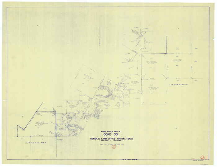
Print $20.00
- Digital $50.00
Coke County Working Sketch 25
1961
Size 31.4 x 40.7 inches
Map/Doc 68062

Bastrop County Sketch File 3

Print $4.00
- Digital $50.00
Bastrop County Sketch File 3
1860
Size 8.9 x 9.2 inches
Map/Doc 14044
Roberts County Working Sketch 18

Print $20.00
- Digital $50.00
Roberts County Working Sketch 18
1975
Size 35.6 x 39.7 inches
Map/Doc 63544
Cherokee County Rolled Sketch 4

Print $20.00
- Digital $50.00
Cherokee County Rolled Sketch 4
1972
Size 30.7 x 23.6 inches
Map/Doc 5436
A Pocket Guide to Austin, Texas - Area Map and Downtown Map

A Pocket Guide to Austin, Texas - Area Map and Downtown Map
Size 17.2 x 20.2 inches
Map/Doc 94386
General Highway Map. Detail of Cities and Towns in Smith County, Texas. City Map, Tyler, Smith County, Texas

Print $20.00
General Highway Map. Detail of Cities and Towns in Smith County, Texas. City Map, Tyler, Smith County, Texas
1961
Size 18.1 x 24.9 inches
Map/Doc 79656
Galveston County Sketch File 32

Print $20.00
- Digital $50.00
Galveston County Sketch File 32
1916
Size 15.2 x 34.3 inches
Map/Doc 11535
Travis County Rolled Sketch 43

Print $20.00
- Digital $50.00
Travis County Rolled Sketch 43
1962
Size 27.3 x 22.7 inches
Map/Doc 8041