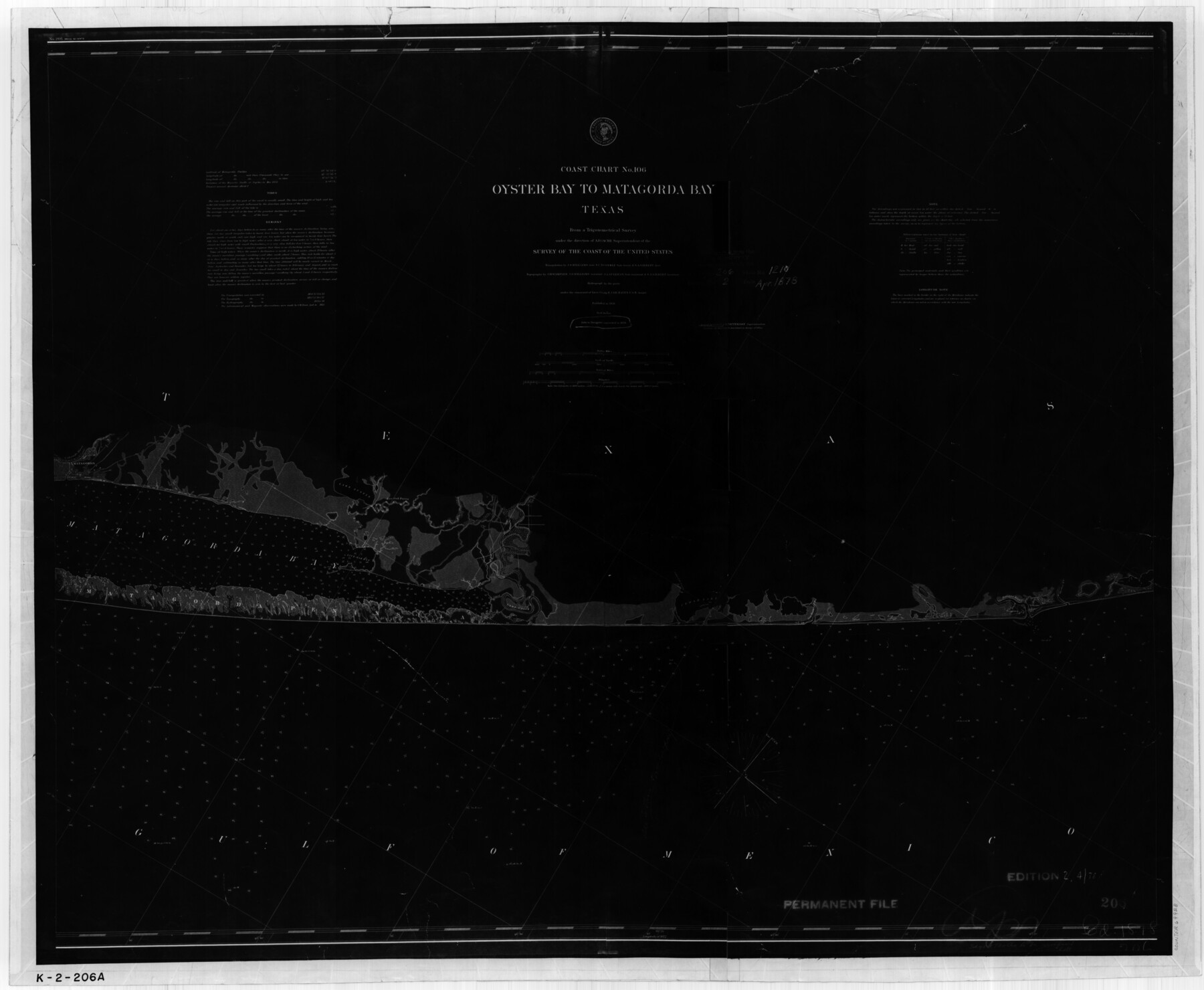
Coast Chart No. 106 - Oyster Bay to Matagorda Bay, Texas
K-2-206a
-
Map/Doc
69928
-
Collection
General Map Collection
-
Object Dates
1878 (Creation Date)
-
Counties
Brazoria Matagorda
-
Subjects
Nautical Charts
-
Height x Width
24.7 x 30.0 inches
62.7 x 76.2 cm
Part of: General Map Collection
Map of Jasper County

Print $40.00
- Digital $50.00
Map of Jasper County
1898
Size 48.6 x 39.2 inches
Map/Doc 4990
Sutton County Working Sketch 38

Print $20.00
- Digital $50.00
Sutton County Working Sketch 38
1942
Size 35.2 x 26.1 inches
Map/Doc 62381
Hockley County Rolled Sketch 9

Print $20.00
- Digital $50.00
Hockley County Rolled Sketch 9
1947
Size 21.2 x 16.5 inches
Map/Doc 6218
Waller County Sketch File 9

Print $4.00
- Digital $50.00
Waller County Sketch File 9
Size 9.1 x 7.8 inches
Map/Doc 39610
Chambers County Rolled Sketch 14

Print $20.00
- Digital $50.00
Chambers County Rolled Sketch 14
1935
Size 33.3 x 41.7 inches
Map/Doc 8616
Jefferson County NRC Article 33.136 Location Key Sheet

Print $20.00
- Digital $50.00
Jefferson County NRC Article 33.136 Location Key Sheet
1970
Size 27.0 x 23.0 inches
Map/Doc 77028
Lampasas County Boundary File 16a

Print $28.00
- Digital $50.00
Lampasas County Boundary File 16a
Size 13.9 x 8.4 inches
Map/Doc 56223
Wichita County Sketch File F

Print $4.00
- Digital $50.00
Wichita County Sketch File F
1887
Size 6.9 x 10.9 inches
Map/Doc 40093
Angelina County Sketch File 21c

Print $4.00
- Digital $50.00
Angelina County Sketch File 21c
1889
Size 14.1 x 8.7 inches
Map/Doc 13047
Pecos County Working Sketch 94

Print $20.00
- Digital $50.00
Pecos County Working Sketch 94
1968
Size 37.8 x 38.7 inches
Map/Doc 71567
Potter County Working Sketch 10

Print $20.00
- Digital $50.00
Potter County Working Sketch 10
1964
Size 32.6 x 25.0 inches
Map/Doc 71670
Hemphill County Working Sketch 33

Print $20.00
- Digital $50.00
Hemphill County Working Sketch 33
1976
Size 39.6 x 32.3 inches
Map/Doc 66128
You may also like
Presidio County Working Sketch 146

Print $20.00
- Digital $50.00
Presidio County Working Sketch 146
1989
Size 20.7 x 20.6 inches
Map/Doc 71824
Kimble County Working Sketch 64

Print $20.00
- Digital $50.00
Kimble County Working Sketch 64
1964
Size 15.1 x 16.9 inches
Map/Doc 70132
Current Miscellaneous File 111

Print $8.00
- Digital $50.00
Current Miscellaneous File 111
1996
Size 11.3 x 8.7 inches
Map/Doc 74714
Map of Kendall County

Print $20.00
- Digital $50.00
Map of Kendall County
1899
Size 36.7 x 34.4 inches
Map/Doc 4999
St. Louis Southwestern Railway of Texas

Print $20.00
- Digital $50.00
St. Louis Southwestern Railway of Texas
1900
Size 21.6 x 29.9 inches
Map/Doc 64446
Williamson County Rolled Sketch 8

Print $20.00
- Digital $50.00
Williamson County Rolled Sketch 8
Size 15.1 x 18.0 inches
Map/Doc 8265
Navigation Maps of Gulf Intracoastal Waterway, Port Arthur to Brownsville, Texas

Print $4.00
- Digital $50.00
Navigation Maps of Gulf Intracoastal Waterway, Port Arthur to Brownsville, Texas
1951
Size 16.7 x 21.5 inches
Map/Doc 65443
Flight Mission No. CGI-4N, Frame 146, Cameron County

Print $20.00
- Digital $50.00
Flight Mission No. CGI-4N, Frame 146, Cameron County
1955
Size 18.7 x 22.3 inches
Map/Doc 84665
Moore County Rolled Sketch 4

Print $20.00
- Digital $50.00
Moore County Rolled Sketch 4
Size 21.1 x 12.1 inches
Map/Doc 6824
Harris County Working Sketch 40

Print $20.00
- Digital $50.00
Harris County Working Sketch 40
1940
Size 42.0 x 41.2 inches
Map/Doc 65932

General Highway Map, Chambers County, Texas

Print $20.00
General Highway Map, Chambers County, Texas
1961
Size 18.3 x 24.8 inches
Map/Doc 79404