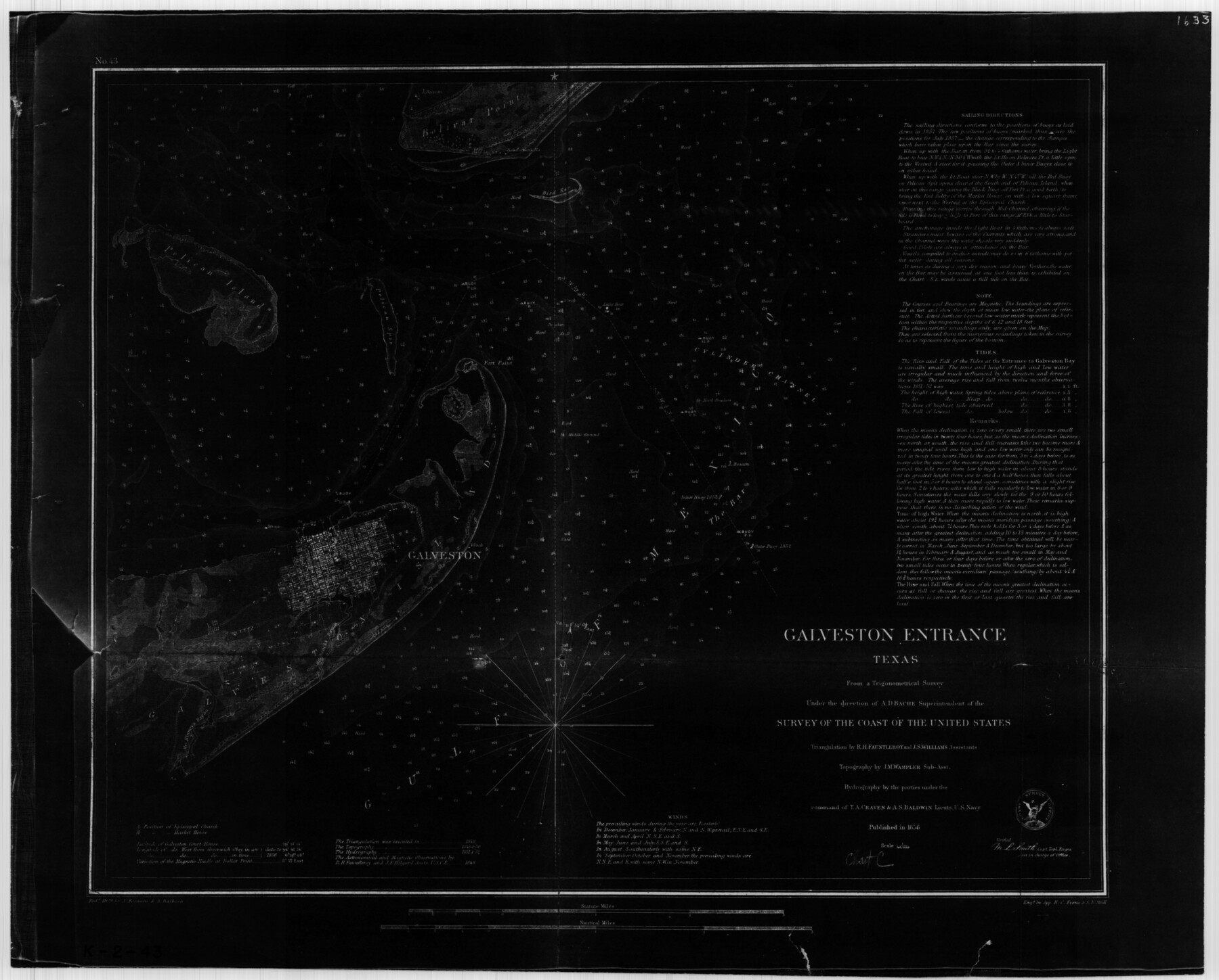
Galveston Entrance
K-2-520b
-
Map/Doc
69857
-
Collection
General Map Collection
-
Object Dates
1856 (Creation Date)
-
Counties
Galveston
-
Subjects
Nautical Charts
-
Height x Width
16.4 x 20.3 inches
41.7 x 51.6 cm
Part of: General Map Collection
Val Verde County Working Sketch 17

Print $20.00
- Digital $50.00
Val Verde County Working Sketch 17
1926
Size 16.5 x 27.8 inches
Map/Doc 72152
Newton County Sketch File 37

Print $6.00
- Digital $50.00
Newton County Sketch File 37
Size 16.2 x 10.7 inches
Map/Doc 32415
[East Line & Red River Railroad from Sulphur Springs to Jefferson]
![64769, [East Line & Red River Railroad from Sulphur Springs to Jefferson], General Map Collection](https://historictexasmaps.com/wmedia_w700/maps/64769.tif.jpg)
Print $20.00
- Digital $50.00
[East Line & Red River Railroad from Sulphur Springs to Jefferson]
1879
Size 37.8 x 33.6 inches
Map/Doc 64769
Presidio County Sketch File 59

Print $12.00
- Digital $50.00
Presidio County Sketch File 59
1935
Size 8.7 x 7.5 inches
Map/Doc 34637
Zavala County

Print $20.00
- Digital $50.00
Zavala County
1977
Size 36.6 x 41.6 inches
Map/Doc 77468
Port Aransas-Corpus Christi Waterway, Texas, Avery Point Turning Basin to Vicinity of Tule Lake - Dredging

Print $20.00
- Digital $50.00
Port Aransas-Corpus Christi Waterway, Texas, Avery Point Turning Basin to Vicinity of Tule Lake - Dredging
1947
Size 28.5 x 41.4 inches
Map/Doc 60301
Terrell County Rolled Sketch 40

Print $20.00
- Digital $50.00
Terrell County Rolled Sketch 40
1943
Size 16.7 x 18.1 inches
Map/Doc 7944
Flight Mission No. DQN-2K, Frame 28, Calhoun County

Print $20.00
- Digital $50.00
Flight Mission No. DQN-2K, Frame 28, Calhoun County
1953
Size 18.6 x 22.2 inches
Map/Doc 84235
Jeff Davis County Working Sketch Graphic Index - west part

Print $20.00
- Digital $50.00
Jeff Davis County Working Sketch Graphic Index - west part
1977
Size 34.0 x 45.3 inches
Map/Doc 76594
Gaines County Rolled Sketch 28

Print $20.00
- Digital $50.00
Gaines County Rolled Sketch 28
1989
Size 25.6 x 19.7 inches
Map/Doc 5941
King County Working Sketch 7

Print $20.00
- Digital $50.00
King County Working Sketch 7
1952
Size 34.7 x 24.9 inches
Map/Doc 70171
Coke County Sketch File 31

Print $4.00
- Digital $50.00
Coke County Sketch File 31
Size 14.1 x 8.8 inches
Map/Doc 18643
You may also like
Hardin County Sketch File 65

Print $15.00
- Digital $50.00
Hardin County Sketch File 65
Size 14.4 x 9.0 inches
Map/Doc 25245
Archer County Working Sketch 1

Print $20.00
- Digital $50.00
Archer County Working Sketch 1
Size 42.4 x 42.0 inches
Map/Doc 67141
Flight Mission No. BRA-7M, Frame 8, Jefferson County

Print $20.00
- Digital $50.00
Flight Mission No. BRA-7M, Frame 8, Jefferson County
1953
Size 18.6 x 22.4 inches
Map/Doc 85459
Fractional Township No. 9 South Range No. 2 East of the Indian Meridian, Indian Territory

Print $20.00
- Digital $50.00
Fractional Township No. 9 South Range No. 2 East of the Indian Meridian, Indian Territory
1898
Size 19.1 x 24.2 inches
Map/Doc 75203
Flight Mission No. DIX-7P, Frame 15, Aransas County

Print $20.00
- Digital $50.00
Flight Mission No. DIX-7P, Frame 15, Aransas County
1956
Size 18.8 x 22.8 inches
Map/Doc 83867
Crosby County Boundary File 5

Print $60.00
- Digital $50.00
Crosby County Boundary File 5
Size 14.3 x 8.8 inches
Map/Doc 52033
Harris County Boundary File 39 (15)

Print $8.00
- Digital $50.00
Harris County Boundary File 39 (15)
Size 7.2 x 8.3 inches
Map/Doc 54350
Collingsworth County Working Sketch 2

Print $20.00
- Digital $50.00
Collingsworth County Working Sketch 2
1957
Size 42.5 x 20.1 inches
Map/Doc 63761
Kent County Working Sketch 22

Print $20.00
- Digital $50.00
Kent County Working Sketch 22
1987
Size 42.7 x 43.1 inches
Map/Doc 70029
Sketch of Sabine Lake and Pass

Print $20.00
- Digital $50.00
Sketch of Sabine Lake and Pass
1840
Size 24.8 x 18.2 inches
Map/Doc 72725
Hemphill County Working Sketch 11

Print $20.00
- Digital $50.00
Hemphill County Working Sketch 11
1965
Size 23.1 x 41.2 inches
Map/Doc 66106
Trinity County Sketch File 18

Print $20.00
- Digital $50.00
Trinity County Sketch File 18
Size 21.9 x 20.7 inches
Map/Doc 12483