![65680, [Sketch for Mineral Application 15559 - Hutchinson County, Canadian River], General Map Collection](https://historictexasmaps.com/wmedia_w1800h1800/maps/65680-1.tif.jpg)
[Sketch for Mineral Application 15559 - Hutchinson County, Canadian River]
K-1-5
-
Map/Doc
65680
-
Collection
General Map Collection
-
Object Dates
1926 (Creation Date)
-
Subjects
Energy Offshore Submerged Area
-
Height x Width
12.0 x 13.2 inches
30.5 x 33.5 cm
Part of: General Map Collection
Jackson County Rolled Sketch 14

Print $20.00
- Digital $50.00
Jackson County Rolled Sketch 14
1978
Size 28.3 x 37.0 inches
Map/Doc 6345
Hutchinson County Rolled Sketch 28

Print $20.00
- Digital $50.00
Hutchinson County Rolled Sketch 28
1921
Size 28.1 x 34.7 inches
Map/Doc 6290
Brewster County Rolled Sketch 121
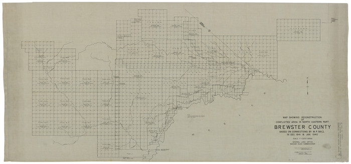
Print $40.00
- Digital $50.00
Brewster County Rolled Sketch 121
1942
Size 43.3 x 92.8 inches
Map/Doc 93790
Cass County Working Sketch 35

Print $20.00
- Digital $50.00
Cass County Working Sketch 35
1982
Size 23.5 x 44.8 inches
Map/Doc 67938
Trip to the West and Texas Comprising a Journey of Eight Thousand Miles, Through New-York, Michigan, Illinois, Missouri, Louisiana and Texas, in the Autumn and Winter of 1834-5. Interspersed with Anecdotes, Incidents and Observations. With a Brief Sketch

Trip to the West and Texas Comprising a Journey of Eight Thousand Miles, Through New-York, Michigan, Illinois, Missouri, Louisiana and Texas, in the Autumn and Winter of 1834-5. Interspersed with Anecdotes, Incidents and Observations. With a Brief Sketch
1836
Map/Doc 97078
Lubbock County Working Sketch 7

Print $20.00
- Digital $50.00
Lubbock County Working Sketch 7
1964
Size 21.9 x 25.3 inches
Map/Doc 70667
Live Oak County Sketch File 6

Print $4.00
- Digital $50.00
Live Oak County Sketch File 6
1847
Size 9.9 x 7.8 inches
Map/Doc 30257
Childress County Sketch File 17

Print $8.00
- Digital $50.00
Childress County Sketch File 17
Size 13.0 x 8.2 inches
Map/Doc 18286
Jeff Davis County Working Sketch 34

Print $20.00
- Digital $50.00
Jeff Davis County Working Sketch 34
1978
Size 20.4 x 38.0 inches
Map/Doc 66529
McMullen County Sketch File 34

Print $25.00
- Digital $50.00
McMullen County Sketch File 34
Size 10.5 x 9.2 inches
Map/Doc 31400
United States - Gulf Coast Texas - Southern part of Laguna Madre

Print $20.00
- Digital $50.00
United States - Gulf Coast Texas - Southern part of Laguna Madre
1941
Size 26.7 x 18.5 inches
Map/Doc 72942
Map of Cherokee County

Print $20.00
- Digital $50.00
Map of Cherokee County
1871
Size 25.0 x 17.6 inches
Map/Doc 3388
You may also like

Index to Titles, Field Notes, Plats: Spanish Archives

Index to Titles, Field Notes, Plats: Spanish Archives
1880
Map/Doc 94534
Flight Mission No. DQN-2K, Frame 26, Calhoun County

Print $20.00
- Digital $50.00
Flight Mission No. DQN-2K, Frame 26, Calhoun County
1953
Size 18.6 x 22.2 inches
Map/Doc 84233
![90573, [Block 3], Twichell Survey Records](https://historictexasmaps.com/wmedia_w700/maps/90573-1.tif.jpg)
Live Oak County Working Sketch 19

Print $20.00
- Digital $50.00
Live Oak County Working Sketch 19
1962
Size 27.4 x 34.5 inches
Map/Doc 70604
Flight Mission No. DQO-2K, Frame 151, Galveston County

Print $20.00
- Digital $50.00
Flight Mission No. DQO-2K, Frame 151, Galveston County
1952
Size 18.9 x 22.6 inches
Map/Doc 85048
Collin County Sketch File 7

Print $40.00
- Digital $50.00
Collin County Sketch File 7
1852
Size 17.3 x 14.0 inches
Map/Doc 18866
Sketch showing the Connnecting Lines run by Olliver Hedgcoxe for the Texan Emigration and Land Company connecting their Surveys made by them in Peters' Colony, Texas

Print $40.00
- Digital $50.00
Sketch showing the Connnecting Lines run by Olliver Hedgcoxe for the Texan Emigration and Land Company connecting their Surveys made by them in Peters' Colony, Texas
1854
Size 45.8 x 61.9 inches
Map/Doc 1969
Map of Falls County

Print $20.00
- Digital $50.00
Map of Falls County
1874
Size 19.8 x 22.6 inches
Map/Doc 3530
Val Verde County Rolled Sketch 70

Print $20.00
- Digital $50.00
Val Verde County Rolled Sketch 70
1958
Size 23.2 x 18.8 inches
Map/Doc 8132
Hudspeth County Sketch File 39

Print $42.00
- Digital $50.00
Hudspeth County Sketch File 39
Size 8.8 x 11.5 inches
Map/Doc 27010
Brazoria County Sketch File 48

Print $4.00
- Digital $50.00
Brazoria County Sketch File 48
Size 14.2 x 8.8 inches
Map/Doc 15110