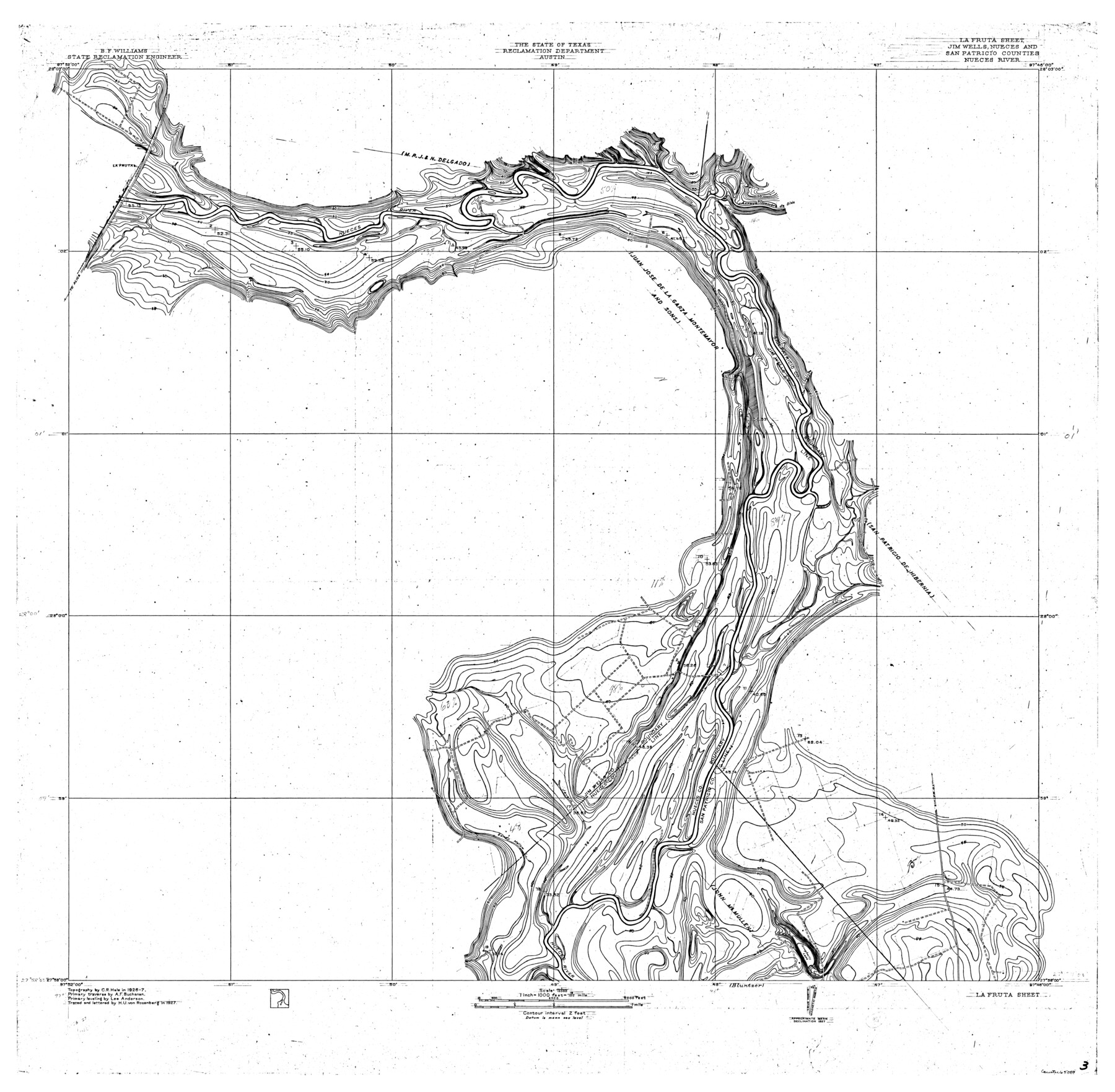
Nueces River, La Fruta Sheet
-
Map/Doc
65089
-
Collection
General Map Collection
-
Object Dates
1927 (Creation Date)
-
People and Organizations
Texas State Reclamation Department (Publisher)
Curtis R. Hale (Surveyor/Engineer)
Lee Anderson (Surveyor/Engineer)
H.U. von Rosenberg (Compiler)
H.U. von Rosenberg (Draftsman)
A.F. Buchanan (Surveyor/Engineer)
-
Counties
Jim Wells Nueces San Patricio
-
Subjects
River Surveys Topographic
-
Height x Width
36.4 x 37.2 inches
92.5 x 94.5 cm
-
Comments
La Fruta Sheet located North of the Bluntzer Sheet.
Part of: General Map Collection
Hardin County Sketch File 5a

Print $6.00
- Digital $50.00
Hardin County Sketch File 5a
Size 8.1 x 3.5 inches
Map/Doc 25094
Map of Matagorda County

Print $20.00
- Digital $50.00
Map of Matagorda County
1865
Size 26.9 x 25.0 inches
Map/Doc 3842
Kent County Working Sketch 9

Print $20.00
- Digital $50.00
Kent County Working Sketch 9
1953
Size 33.0 x 43.8 inches
Map/Doc 70016
Mills County Working Sketch 5

Print $3.00
- Digital $50.00
Mills County Working Sketch 5
1914
Size 13.1 x 10.8 inches
Map/Doc 71035
PSL Field Notes for Blocks 53 and 55 in Culberson and Reeves Counties and Blocks 42, 52, and 54 in Culberson County

PSL Field Notes for Blocks 53 and 55 in Culberson and Reeves Counties and Blocks 42, 52, and 54 in Culberson County
Map/Doc 81673
Grayson County Working Sketch 16

Print $20.00
- Digital $50.00
Grayson County Working Sketch 16
1954
Size 44.2 x 24.7 inches
Map/Doc 63255
Dickens County Sketch File E

Print $8.00
- Digital $50.00
Dickens County Sketch File E
Size 11.3 x 8.7 inches
Map/Doc 20843
Bowie County Sketch File 1

Print $8.00
- Digital $50.00
Bowie County Sketch File 1
Size 8.6 x 10.0 inches
Map/Doc 14833
Flight Mission No. DQN-4K, Frame 8, Calhoun County

Print $20.00
- Digital $50.00
Flight Mission No. DQN-4K, Frame 8, Calhoun County
1953
Size 18.8 x 22.5 inches
Map/Doc 84373
Hardeman County Sketch File 26

Print $40.00
- Digital $50.00
Hardeman County Sketch File 26
Size 16.3 x 13.2 inches
Map/Doc 25037
La Salle County Rolled Sketch 2

Print $20.00
- Digital $50.00
La Salle County Rolled Sketch 2
1915
Size 25.2 x 23.2 inches
Map/Doc 6567
Nacogdoches County Sketch File 16

Print $20.00
- Digital $50.00
Nacogdoches County Sketch File 16
1945
Size 24.6 x 18.5 inches
Map/Doc 42155
You may also like
Wichita County Rolled Sketch 16

Print $20.00
- Digital $50.00
Wichita County Rolled Sketch 16
1940
Size 36.5 x 35.0 inches
Map/Doc 10658
Sabine River, Greenville Sheet/Cowleach Fork of the Sabine River

Print $20.00
- Digital $50.00
Sabine River, Greenville Sheet/Cowleach Fork of the Sabine River
1935
Size 37.2 x 37.1 inches
Map/Doc 65146
Map of Washburn, Armstrong County, Texas junction of Pan-Handle (Southern Kansas) and Fort Worth & Denver City R'ys

Print $20.00
- Digital $50.00
Map of Washburn, Armstrong County, Texas junction of Pan-Handle (Southern Kansas) and Fort Worth & Denver City R'ys
1888
Map/Doc 97426
Fisher County Working Sketch 19

Print $20.00
- Digital $50.00
Fisher County Working Sketch 19
1962
Size 26.2 x 25.5 inches
Map/Doc 69153
Nueces County Sketch File 28

Print $6.00
- Digital $50.00
Nueces County Sketch File 28
Size 10.0 x 10.9 inches
Map/Doc 32596
Culberson County Working Sketch 53

Print $20.00
- Digital $50.00
Culberson County Working Sketch 53
1974
Size 43.3 x 32.8 inches
Map/Doc 68507
Newton County Sketch File 4b

Print $22.00
- Digital $50.00
Newton County Sketch File 4b
Size 7.6 x 12.2 inches
Map/Doc 32364
Sutton County Rolled Sketch 47

Print $20.00
- Digital $50.00
Sutton County Rolled Sketch 47
Size 17.0 x 24.3 inches
Map/Doc 7888
[Survey 9, Block 9 Potter and Randall]
![91721, [Survey 9, Block 9 Potter and Randall], Twichell Survey Records](https://historictexasmaps.com/wmedia_w700/maps/91721-1.tif.jpg)
Print $20.00
- Digital $50.00
[Survey 9, Block 9 Potter and Randall]
Size 22.1 x 15.9 inches
Map/Doc 91721
Map of Coryell County

Print $20.00
- Digital $50.00
Map of Coryell County
1874
Size 22.4 x 26.8 inches
Map/Doc 3445
Duval County Sketch File 30

Print $20.00
- Digital $50.00
Duval County Sketch File 30
1932
Size 14.7 x 23.7 inches
Map/Doc 11388
General Highway Map, Trinity County, Texas

Print $20.00
General Highway Map, Trinity County, Texas
1961
Size 18.1 x 24.5 inches
Map/Doc 79688