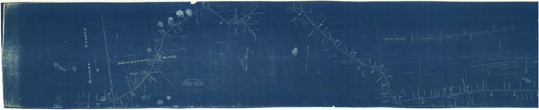
Central & Montgomery
Z-2-161
-
Map/Doc
64522
-
Collection
General Map Collection
-
Object Dates
2/19/1941 (Creation Date)
-
Counties
Montgomery Grimes
-
Subjects
Railroads
-
Height x Width
25.6 x 122.2 inches
65.0 x 310.4 cm
-
Medium
blueprint/diazo
-
Scale
400 ft = 1 inch
-
Comments
Segment 1; see counter nos. 64523 through 64524 for other segments.
-
Features
C&M
Vickers
Bobville
Dobbin
T&BV
Road to Houston
Montgomery
Landrum Creek
Chatham Creek
Mound Creek
West Fork of Mound Creek
Keenan
Honea
Fish Creek
Road to Somerville
Road to Silsbee
Part of: General Map Collection
Texas-United States Boundary Line 1

Print $4.00
- Digital $50.00
Texas-United States Boundary Line 1
1843
Size 12.6 x 7.8 inches
Map/Doc 74974
Flight Mission No. DQN-1K, Frame 140, Calhoun County

Print $20.00
- Digital $50.00
Flight Mission No. DQN-1K, Frame 140, Calhoun County
1953
Size 18.5 x 22.2 inches
Map/Doc 84203
Llano County Boundary File 1a

Print $44.00
- Digital $50.00
Llano County Boundary File 1a
Size 13.2 x 8.1 inches
Map/Doc 56430
Jasper County Sketch File 36

Print $32.00
- Digital $50.00
Jasper County Sketch File 36
1987
Size 11.2 x 8.6 inches
Map/Doc 27872
Stephens County Working Sketch 5

Print $20.00
- Digital $50.00
Stephens County Working Sketch 5
1919
Size 24.8 x 25.3 inches
Map/Doc 63948
Orange County, West Half of Sabine River Showing Leases 5 and 6

Print $20.00
- Digital $50.00
Orange County, West Half of Sabine River Showing Leases 5 and 6
1957
Size 30.6 x 34.3 inches
Map/Doc 1934
Grayson County Sketch File 19

Print $7.00
- Digital $50.00
Grayson County Sketch File 19
1860
Size 12.1 x 7.7 inches
Map/Doc 24490
Orange County Working Sketch 12

Print $20.00
- Digital $50.00
Orange County Working Sketch 12
1922
Size 17.2 x 12.7 inches
Map/Doc 71344
Sketch of a portion of the Texas Coast showing the relative positions of different harbours with the interior Military Posts, and the roads communicating with them, also two new routes from Black Point and Lamar to San Antonio

Print $20.00
- Digital $50.00
Sketch of a portion of the Texas Coast showing the relative positions of different harbours with the interior Military Posts, and the roads communicating with them, also two new routes from Black Point and Lamar to San Antonio
1855
Size 27.3 x 18.3 inches
Map/Doc 72709
Terrell County Working Sketch 59

Print $20.00
- Digital $50.00
Terrell County Working Sketch 59
1961
Size 20.3 x 21.8 inches
Map/Doc 69580
Nueces County Sketch File 41

Print $8.00
- Digital $50.00
Nueces County Sketch File 41
Size 11.1 x 8.6 inches
Map/Doc 32629
Jim Hogg County Sketch File 2

Print $20.00
- Digital $50.00
Jim Hogg County Sketch File 2
1926
Size 24.9 x 17.7 inches
Map/Doc 11884
You may also like
Aransas County NRC Article 33.136 Sketch 21

Print $138.00
Aransas County NRC Article 33.136 Sketch 21
2024
Map/Doc 97269
Montgomery County Rolled Sketch 51

Print $20.00
- Digital $50.00
Montgomery County Rolled Sketch 51
2021
Map/Doc 97369
Comal County Sketch File 18

Print $4.00
- Digital $50.00
Comal County Sketch File 18
Size 6.7 x 13.0 inches
Map/Doc 19037

Flight Mission No. DAH-10M, Frame 40, Orange County

Print $20.00
- Digital $50.00
Flight Mission No. DAH-10M, Frame 40, Orange County
1953
Size 18.8 x 22.6 inches
Map/Doc 86875
Right of Way and Track Map, Houston & Texas Central R.R. operated by the T. and N. O. R.R., Fort Worth Branch

Print $40.00
- Digital $50.00
Right of Way and Track Map, Houston & Texas Central R.R. operated by the T. and N. O. R.R., Fort Worth Branch
1918
Size 31.6 x 57.2 inches
Map/Doc 64780
United States - Gulf Coast - From Latitude 26° 33' to the Rio Grande Texas

Print $20.00
- Digital $50.00
United States - Gulf Coast - From Latitude 26° 33' to the Rio Grande Texas
1913
Size 18.3 x 23.6 inches
Map/Doc 72844
Collin County Working Sketch 4

Print $20.00
- Digital $50.00
Collin County Working Sketch 4
1953
Size 20.4 x 21.8 inches
Map/Doc 68098
Martin County Rolled Sketch 7

Print $20.00
- Digital $50.00
Martin County Rolled Sketch 7
1929
Size 23.0 x 31.2 inches
Map/Doc 6667
Jasper County Working Sketch 23

Print $20.00
- Digital $50.00
Jasper County Working Sketch 23
1944
Size 15.9 x 22.4 inches
Map/Doc 66485
Burnet County Sketch File 38

Print $20.00
- Digital $50.00
Burnet County Sketch File 38
1935
Size 37.8 x 24.5 inches
Map/Doc 11027
Foard County Sketch File 16

Print $6.00
- Digital $50.00
Foard County Sketch File 16
1885
Size 14.2 x 8.7 inches
Map/Doc 22825