Lubbock County Boundary File 7
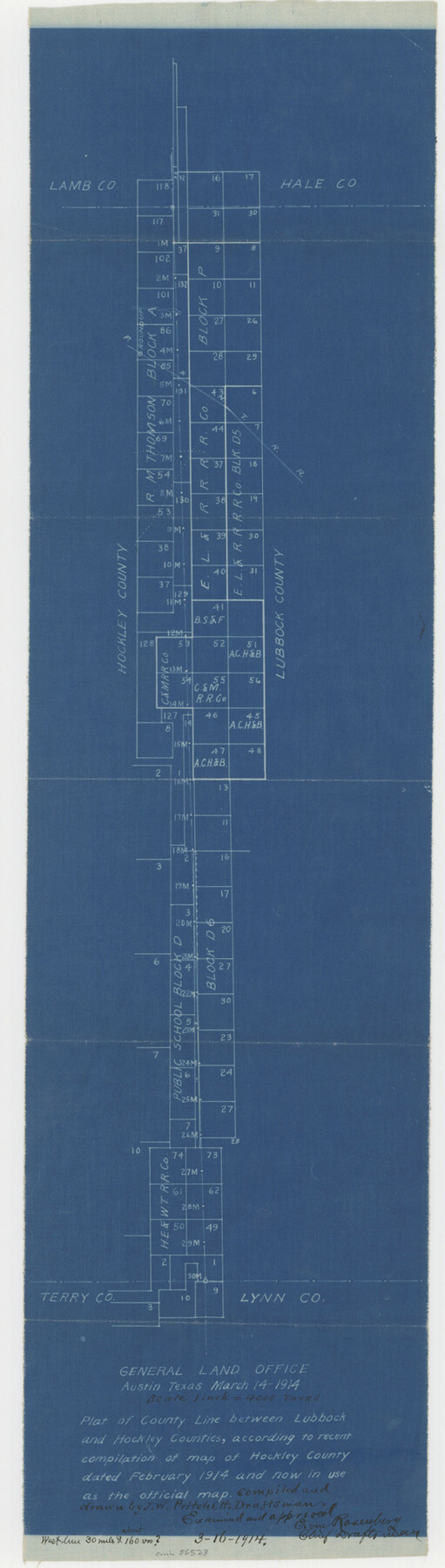
Plat of county line between Lubbock and Hockley Counties, according to recent compilation of map of Hockley County dated February 1914 and now in use as the official map.
-
Map/Doc
56523
-
Collection
General Map Collection
-
Counties
Lubbock
-
Subjects
County Boundaries
-
Height x Width
20.6 x 5.8 inches
52.3 x 14.7 cm
Part of: General Map Collection
Cameron County Sketch File 5

Print $4.00
- Digital $50.00
Cameron County Sketch File 5
1978
Size 11.1 x 8.7 inches
Map/Doc 17030
Henderson County Sketch File 1

Print $8.00
- Digital $50.00
Henderson County Sketch File 1
Size 12.8 x 8.3 inches
Map/Doc 26318
Sketch Showing Land Ties with Houston & Texas Central Railroad Through Harris County, Texas

Print $20.00
- Digital $50.00
Sketch Showing Land Ties with Houston & Texas Central Railroad Through Harris County, Texas
1880
Size 7.3 x 27.0 inches
Map/Doc 66739
Culberson County Rolled Sketch 56

Print $37.00
- Digital $50.00
Culberson County Rolled Sketch 56
1972
Size 11.0 x 15.6 inches
Map/Doc 44267
Motley County Working Sketch 1

Print $20.00
- Digital $50.00
Motley County Working Sketch 1
1895
Size 16.3 x 21.2 inches
Map/Doc 71206
Harris County Working Sketch 21

Print $20.00
- Digital $50.00
Harris County Working Sketch 21
Size 14.1 x 22.6 inches
Map/Doc 65913
Presidio County Rolled Sketch 44

Print $20.00
- Digital $50.00
Presidio County Rolled Sketch 44
1907
Size 14.3 x 25.3 inches
Map/Doc 7341
Morris County Rolled Sketch 2A

Print $20.00
- Digital $50.00
Morris County Rolled Sketch 2A
Size 36.0 x 25.0 inches
Map/Doc 10236
Orange County Working Sketch 44

Print $20.00
- Digital $50.00
Orange County Working Sketch 44
1980
Size 16.5 x 22.0 inches
Map/Doc 71376
Township 15 South Range 15 West and Fractional Township 16 South Range 15 West, South Western District, Louisiana

Print $20.00
- Digital $50.00
Township 15 South Range 15 West and Fractional Township 16 South Range 15 West, South Western District, Louisiana
1875
Size 19.6 x 24.7 inches
Map/Doc 65861
Jackson County Working Sketch 8

Print $20.00
- Digital $50.00
Jackson County Working Sketch 8
1980
Size 30.4 x 29.0 inches
Map/Doc 66456
Harris County Working Sketch 9

Print $20.00
- Digital $50.00
Harris County Working Sketch 9
1908
Size 27.7 x 39.4 inches
Map/Doc 65901
You may also like
Aransas County Sketch File 24

Print $36.00
- Digital $50.00
Aransas County Sketch File 24
1938
Size 10.9 x 8.3 inches
Map/Doc 13177

Eastland County Working Sketch 48

Print $20.00
- Digital $50.00
Eastland County Working Sketch 48
1981
Size 35.1 x 25.5 inches
Map/Doc 68829
Monterey Harbor, California

Print $20.00
- Digital $50.00
Monterey Harbor, California
1852
Size 15.7 x 13.8 inches
Map/Doc 97230
Live Oak County

Print $40.00
- Digital $50.00
Live Oak County
1899
Size 50.3 x 35.3 inches
Map/Doc 16882
Flight Mission No. CUG-3P, Frame 168, Kleberg County

Print $20.00
- Digital $50.00
Flight Mission No. CUG-3P, Frame 168, Kleberg County
1956
Size 18.6 x 22.3 inches
Map/Doc 86288
Marion County Working Sketch 4

Print $20.00
- Digital $50.00
Marion County Working Sketch 4
Size 15.7 x 19.1 inches
Map/Doc 70779
Freestone County Rolled Sketch 13B

Print $20.00
- Digital $50.00
Freestone County Rolled Sketch 13B
1989
Size 25.2 x 20.5 inches
Map/Doc 5915
General Highway Map, San Augustine County, Texas

Print $20.00
General Highway Map, San Augustine County, Texas
1940
Size 24.8 x 18.3 inches
Map/Doc 79235
Hutchinson County Rolled Sketch 42

Print $40.00
- Digital $50.00
Hutchinson County Rolled Sketch 42
1993
Size 38.0 x 49.5 inches
Map/Doc 6310
Hydrographic Survey H-1288B Corpus Christi Pass

Print $40.00
- Digital $50.00
Hydrographic Survey H-1288B Corpus Christi Pass
1875
Size 31.8 x 52.5 inches
Map/Doc 2692
Upton County Working Sketch 8

Print $20.00
- Digital $50.00
Upton County Working Sketch 8
1916
Size 21.9 x 16.8 inches
Map/Doc 69504