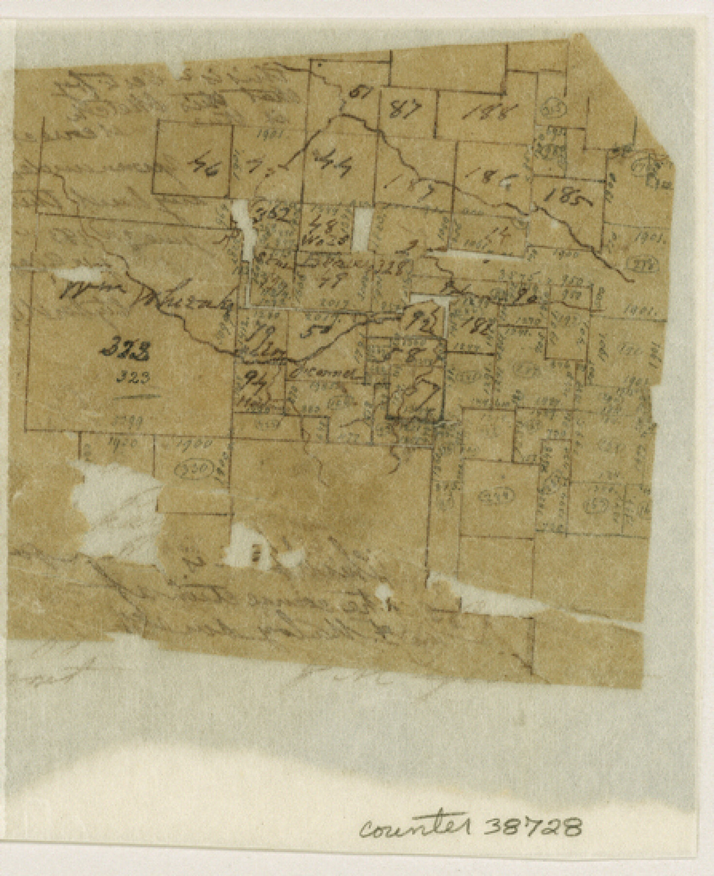
Upshur County Sketch File 1
[Sketch on the west county line on the headwaters of Little Cypress Creek]
-
Map/Doc
38728
-
Collection
General Map Collection
-
Object Dates
6/3/1854 (Creation Date)
8/18/1854 (File Date)
-
People and Organizations
J.M. Glasco (Surveyor/Engineer)
-
Counties
Upshur
-
Subjects
Surveying Sketch File
-
Height x Width
5.5 x 4.5 inches
14.0 x 11.4 cm
-
Medium
paper, manuscript
-
Features
Little Cypress Creek
Part of: General Map Collection
[Sketch from Burnet Co. to Baylor Co. tying center of counties to county site]
![1699, [Sketch from Burnet Co. to Baylor Co. tying center of counties to county site], General Map Collection](https://historictexasmaps.com/wmedia_w700/maps/1699.tif.jpg)
Print $40.00
- Digital $50.00
[Sketch from Burnet Co. to Baylor Co. tying center of counties to county site]
1900
Size 132.6 x 31.9 inches
Map/Doc 1699
Flight Mission No. BRA-7M, Frame 140, Jefferson County

Print $20.00
- Digital $50.00
Flight Mission No. BRA-7M, Frame 140, Jefferson County
1953
Size 18.5 x 22.4 inches
Map/Doc 85534
Presidio County Sketch File P2

Print $6.00
- Digital $50.00
Presidio County Sketch File P2
Size 14.3 x 8.9 inches
Map/Doc 34558
Gonzales County Rolled Sketch 1

Print $20.00
- Digital $50.00
Gonzales County Rolled Sketch 1
1917
Size 21.9 x 23.9 inches
Map/Doc 6027
Bandera County Sketch File 26

Print $6.00
- Digital $50.00
Bandera County Sketch File 26
1879
Size 7.7 x 8.3 inches
Map/Doc 14016
Hunt County Boundary File 11

Print $14.00
- Digital $50.00
Hunt County Boundary File 11
Size 11.3 x 8.9 inches
Map/Doc 55266
Jasper County Working Sketch 35

Print $20.00
- Digital $50.00
Jasper County Working Sketch 35
2008
Size 28.5 x 40.0 inches
Map/Doc 88733
Harrison County Working Sketch 16

Print $20.00
- Digital $50.00
Harrison County Working Sketch 16
1966
Size 29.2 x 33.0 inches
Map/Doc 66036
Flight Mission No. DIX-8P, Frame 83, Aransas County

Print $20.00
- Digital $50.00
Flight Mission No. DIX-8P, Frame 83, Aransas County
1956
Size 18.6 x 22.3 inches
Map/Doc 83908
El Paso County Working Sketch 17

Print $20.00
- Digital $50.00
El Paso County Working Sketch 17
1958
Size 28.4 x 26.3 inches
Map/Doc 69039
Sterling County Sketch File D

Print $8.00
- Digital $50.00
Sterling County Sketch File D
Size 11.2 x 8.6 inches
Map/Doc 37157
Anderson County Sketch File 32

Print $4.00
- Digital $50.00
Anderson County Sketch File 32
2002
Size 11.3 x 8.8 inches
Map/Doc 78312
You may also like
Newton County Rolled Sketch 25

Print $20.00
- Digital $50.00
Newton County Rolled Sketch 25
1893
Size 22.3 x 18.6 inches
Map/Doc 6852
Map of San Saba County : exhibiting the extent of public surveys, land grants, and other official information…

Print $20.00
Map of San Saba County : exhibiting the extent of public surveys, land grants, and other official information…
1876
Size 22.8 x 20.1 inches
Map/Doc 93593
Clay County Sketch File 3

Print $2.00
- Digital $50.00
Clay County Sketch File 3
Size 8.7 x 7.7 inches
Map/Doc 18391
Panola County Sketch File 5

Print $4.00
- Digital $50.00
Panola County Sketch File 5
1860
Size 8.3 x 5.6 inches
Map/Doc 33453
Crockett County Sketch File 46

Print $20.00
- Digital $50.00
Crockett County Sketch File 46
Size 11.1 x 8.7 inches
Map/Doc 19779
Current Miscellaneous File 96

Print $92.00
- Digital $50.00
Current Miscellaneous File 96
Size 8.8 x 13.6 inches
Map/Doc 74283
Carta Particular de la Parte sur del Seno Mexicano que comprehende las Cóstas de Yucatan y Sonda de Campeche, las de Tabasco, Veracruz y Tamaulipas

Carta Particular de la Parte sur del Seno Mexicano que comprehende las Cóstas de Yucatan y Sonda de Campeche, las de Tabasco, Veracruz y Tamaulipas
1825
Size 26.6 x 38.5 inches
Map/Doc 94567
Baylor County Rolled Sketch WAJ

Print $20.00
- Digital $50.00
Baylor County Rolled Sketch WAJ
Size 22.0 x 17.0 inches
Map/Doc 5132
Bosque County Boundary File 1

Print $34.00
- Digital $50.00
Bosque County Boundary File 1
Size 10.7 x 8.2 inches
Map/Doc 50672
Armstrong County Sketch File A-11

Print $40.00
- Digital $50.00
Armstrong County Sketch File A-11
Size 17.0 x 14.8 inches
Map/Doc 10853
Foard County Working Sketch 12

Print $20.00
- Digital $50.00
Foard County Working Sketch 12
1977
Size 43.4 x 36.1 inches
Map/Doc 69203
