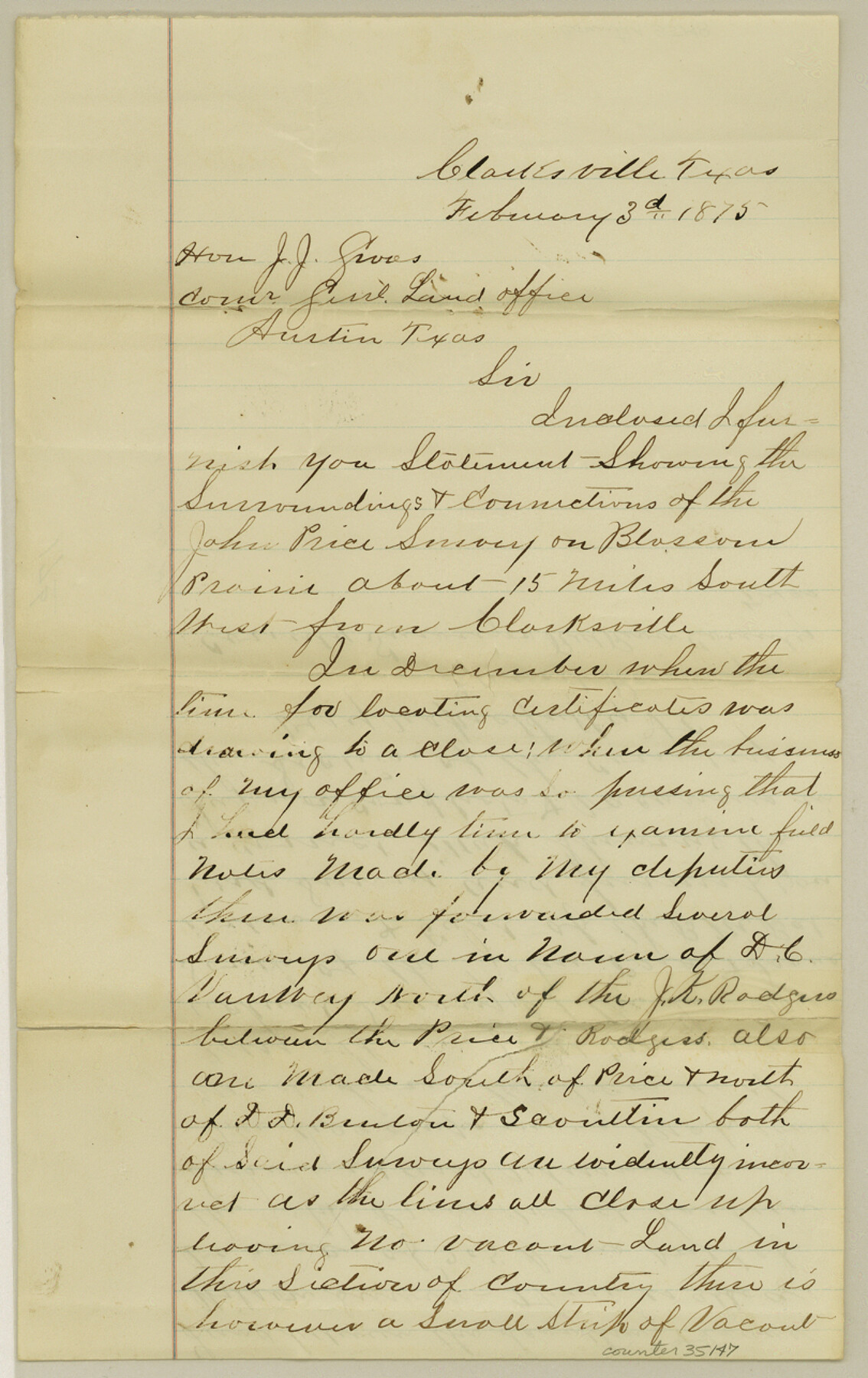
Red River County Sketch File 17b
[Letter regarding John Price survey on Blossom Prairie southwest of Clarksville]
-
Map/Doc
35147
-
Collection
General Map Collection
-
Object Dates
2/3/1875 (Creation Date)
-
People and Organizations
David Rainey (Surveyor/Engineer)
-
Counties
Red River
-
Subjects
Surveying Sketch File
-
Height x Width
12.9 x 8.1 inches
32.8 x 20.6 cm
-
Medium
paper, manuscript
-
Features
Blossom Prairie
Part of: General Map Collection
Map of Texas and Pacific Ry. Company's Surveys in the 80 Mile Reserve

Print $20.00
- Digital $50.00
Map of Texas and Pacific Ry. Company's Surveys in the 80 Mile Reserve
1885
Size 44.0 x 46.6 inches
Map/Doc 83558
Pecos County Sketch File 86

Print $22.00
- Digital $50.00
Pecos County Sketch File 86
1917
Size 13.4 x 9.0 inches
Map/Doc 33964
Van Zandt County Sketch File 5

Print $22.00
- Digital $50.00
Van Zandt County Sketch File 5
Size 20.5 x 6.3 inches
Map/Doc 39371
Flight Mission No. DAG-23K, Frame 180, Matagorda County

Print $20.00
- Digital $50.00
Flight Mission No. DAG-23K, Frame 180, Matagorda County
1953
Size 18.4 x 16.0 inches
Map/Doc 86515
Flight Mission No. CRC-3R, Frame 56, Chambers County

Print $20.00
- Digital $50.00
Flight Mission No. CRC-3R, Frame 56, Chambers County
1956
Size 18.6 x 22.3 inches
Map/Doc 84828
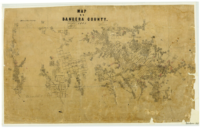
Map of Bandera County
Print $20.00
- Digital $50.00
Map of Bandera County
1862
Size 19.0 x 30.1 inches
Map/Doc 3271
Calhoun County Rolled Sketch 13

Print $20.00
- Digital $50.00
Calhoun County Rolled Sketch 13
1948
Size 43.0 x 41.0 inches
Map/Doc 8547

Chambers County NRC Article 33.136 Location Key Sheet

Print $20.00
- Digital $50.00
Chambers County NRC Article 33.136 Location Key Sheet
1983
Size 24.0 x 44.0 inches
Map/Doc 77014
San Saba County Sketch File 1

Print $46.00
- Digital $50.00
San Saba County Sketch File 1
1854
Size 9.1 x 7.8 inches
Map/Doc 36400
North Part of Brewster Co.

Print $20.00
- Digital $50.00
North Part of Brewster Co.
1956
Size 42.1 x 40.2 inches
Map/Doc 73088
Menard County Boundary File 3

Print $4.00
- Digital $50.00
Menard County Boundary File 3
Size 10.6 x 8.0 inches
Map/Doc 57072
You may also like
Hutchinson County Rolled Sketch 8

Print $20.00
- Digital $50.00
Hutchinson County Rolled Sketch 8
Size 32.0 x 29.1 inches
Map/Doc 6279
Erath County Sketch File 28

Print $40.00
- Digital $50.00
Erath County Sketch File 28
1895
Size 16.5 x 12.0 inches
Map/Doc 22309
Rio Grande, Fernando Sheet

Print $4.00
- Digital $50.00
Rio Grande, Fernando Sheet
1935
Size 20.8 x 25.8 inches
Map/Doc 65114
Fractional Township No. 10 South Range No. 10 East of the Indian Meridian, Indian Territory

Print $20.00
- Digital $50.00
Fractional Township No. 10 South Range No. 10 East of the Indian Meridian, Indian Territory
1898
Size 19.3 x 24.3 inches
Map/Doc 75218
The Republic County of Fort Bend. December 29, 1845

Print $20.00
The Republic County of Fort Bend. December 29, 1845
2020
Size 14.7 x 21.6 inches
Map/Doc 96142
Nolan County Sketch File 13

Print $20.00
- Digital $50.00
Nolan County Sketch File 13
1886
Size 17.8 x 29.9 inches
Map/Doc 42207
Guadalupe County Sketch File 25

Print $22.00
- Digital $50.00
Guadalupe County Sketch File 25
Size 12.7 x 15.7 inches
Map/Doc 24717
Jack County Working Sketch 1

Print $20.00
- Digital $50.00
Jack County Working Sketch 1
Size 28.4 x 27.1 inches
Map/Doc 66427
Galveston County Sketch File 26

Print $4.00
- Digital $50.00
Galveston County Sketch File 26
1860
Size 11.8 x 5.7 inches
Map/Doc 23397
Cooke County Working Sketch 24

Print $20.00
- Digital $50.00
Cooke County Working Sketch 24
1972
Size 22.1 x 24.4 inches
Map/Doc 68261
Parker County Sketch File 41

Print $4.00
- Digital $50.00
Parker County Sketch File 41
1877
Size 8.9 x 10.6 inches
Map/Doc 33587
Comanche County Working Sketch 28

Print $20.00
- Digital $50.00
Comanche County Working Sketch 28
1984
Size 22.9 x 25.7 inches
Map/Doc 68162