Presidio County Sketch File 116
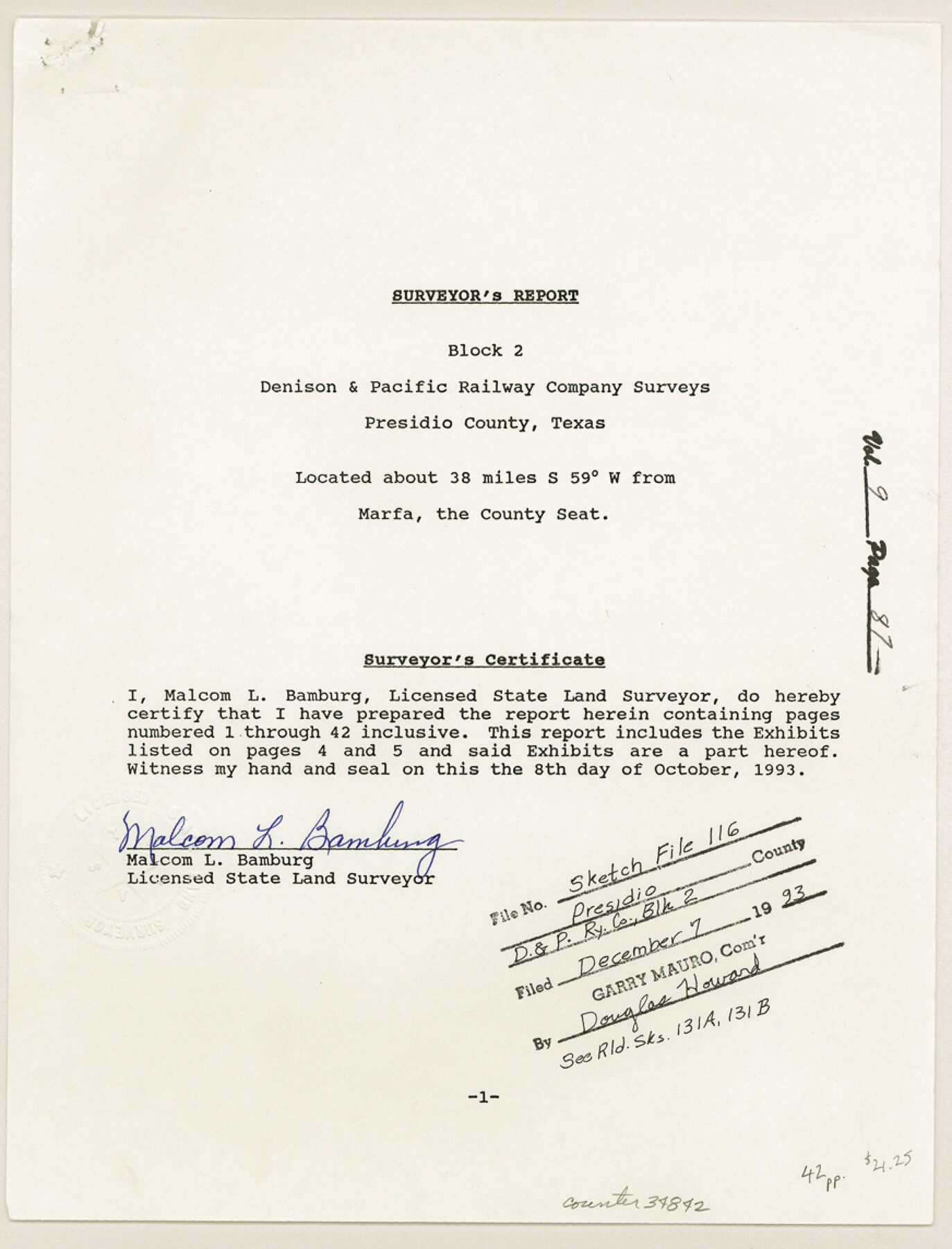
[Surveyor's report of Block 2, Denison and Pacific Railway Company surveys]
-
Map/Doc
34842
-
Collection
General Map Collection
-
Object Dates
10/8/1993 (Creation Date)
12/7/1993 (File Date)
-
People and Organizations
J.P. Moore (Surveyor/Engineer)
G.F. Brooks (Surveyor/Engineer)
Paul Hesse (Surveyor/Engineer)
J.B. Ammerman (Surveyor/Engineer)
W.S. Mabry (Surveyor/Engineer)
Reavis (Surveyor/Engineer)
S.A. Thompson (Surveyor/Engineer)
W.J. Glenn (Surveyor/Engineer)
W.C. Wilson (Surveyor/Engineer)
McCamant (Surveyor/Engineer)
J.P. Dod (Surveyor/Engineer)
J.L. Corbin (Surveyor/Engineer)
Robert C. Withers (Surveyor/Engineer)
P.T. Duryea (Surveyor/Engineer)
H. Brooks (Surveyor/Engineer)
E.M. Gleim (Surveyor/Engineer)
Randolph (Surveyor/Engineer)
Malcom L. Bamburg (Surveyor/Engineer)
A.H. French (Surveyor/Engineer)
R.L. McCamant (Surveyor/Engineer)
Murray Harris (Surveyor/Engineer)
John Stovell (Surveyor/Engineer)
Nick M. Thee (Surveyor/Engineer)
J.R. Marmion (Surveyor/Engineer)
Will H. Bonnell (Surveyor/Engineer)
Dan Buckley (Surveyor/Engineer)
J.W. Tays (Surveyor/Engineer)
Bill Burson (Surveyor/Engineer)
T.C. Nelson (Surveyor/Engineer)
L.E. Edwards (Surveyor/Engineer)
C.N. Comly (Surveyor/Engineer)
Jarvis Hubbell (Surveyor/Engineer)
Stevenson Archer (Surveyor/Engineer)
R.S. Dod (Surveyor/Engineer)
F.W. Cook (Surveyor/Engineer)
-
Counties
Presidio
-
Subjects
Surveying Sketch File
-
Height x Width
11.4 x 8.7 inches
29.0 x 22.1 cm
-
Medium
paper, print
-
Comments
See Presidio County Sketch File 116A (34885), Presidio County Rolled Sketch 131A (10706-10713, 9801, and 9802), and Presidio County Rolled Sketch 131B (9803) for exhibits and related sketches.
-
Features
Russell's Mill
Hot Springs Creek
Arroyo de Aqua Caliente
Presidio
Fort Davis
Capote Creek
John Lee's House
Related maps
Presidio County Rolled Sketch 131A

Print $20.00
- Digital $50.00
Presidio County Rolled Sketch 131A
1975
Size 30.5 x 24.9 inches
Map/Doc 10706
Presidio County Rolled Sketch 131A

Print $20.00
- Digital $50.00
Presidio County Rolled Sketch 131A
Size 17.5 x 14.1 inches
Map/Doc 10707
Presidio County Rolled Sketch 131A

Print $3.00
- Digital $50.00
Presidio County Rolled Sketch 131A
Size 15.8 x 9.3 inches
Map/Doc 10708
Presidio County Rolled Sketch 131A

Print $3.00
- Digital $50.00
Presidio County Rolled Sketch 131A
Size 14.5 x 9.1 inches
Map/Doc 10709
Presidio County Rolled Sketch 131A

Print $20.00
- Digital $50.00
Presidio County Rolled Sketch 131A
Size 17.7 x 11.9 inches
Map/Doc 10710
Presidio County Rolled Sketch 131A

Print $20.00
- Digital $50.00
Presidio County Rolled Sketch 131A
Size 47.5 x 36.6 inches
Map/Doc 10711
Presidio County Rolled Sketch 131A

Print $20.00
- Digital $50.00
Presidio County Rolled Sketch 131A
Size 25.5 x 26.3 inches
Map/Doc 10712
Presidio County Rolled Sketch 131A

Print $40.00
- Digital $50.00
Presidio County Rolled Sketch 131A
1991
Size 37.6 x 49.7 inches
Map/Doc 10713
Presidio County Sketch File 116A

Print $63.00
- Digital $50.00
Presidio County Sketch File 116A
Size 17.0 x 11.0 inches
Map/Doc 34885
Presidio County Rolled Sketch 131A

Print $20.00
- Digital $50.00
Presidio County Rolled Sketch 131A
1992
Size 36.0 x 45.5 inches
Map/Doc 9801
Presidio County Rolled Sketch 131A

Print $20.00
- Digital $50.00
Presidio County Rolled Sketch 131A
1992
Size 36.5 x 46.7 inches
Map/Doc 9802
Presidio County Rolled Sketch 131B

Print $20.00
- Digital $50.00
Presidio County Rolled Sketch 131B
1993
Size 33.4 x 46.7 inches
Map/Doc 9803
Part of: General Map Collection
Lampasas County Boundary File 3

Print $10.00
- Digital $50.00
Lampasas County Boundary File 3
Size 8.4 x 7.3 inches
Map/Doc 56101
Calhoun County Rolled Sketch 33

Print $73.00
- Digital $50.00
Calhoun County Rolled Sketch 33
1979
Size 10.0 x 15.2 inches
Map/Doc 43687
Dickens County Sketch File 18

Print $6.00
- Digital $50.00
Dickens County Sketch File 18
1959
Size 11.3 x 8.8 inches
Map/Doc 20979
Val Verde County Working Sketch 49

Print $20.00
- Digital $50.00
Val Verde County Working Sketch 49
1949
Size 26.7 x 41.9 inches
Map/Doc 72184

Hemphill County

Print $20.00
- Digital $50.00
Hemphill County
1888
Size 23.9 x 18.3 inches
Map/Doc 3653
Rockwall County Working Sketch 4

Print $20.00
- Digital $50.00
Rockwall County Working Sketch 4
1966
Size 34.9 x 28.9 inches
Map/Doc 63596
Flight Mission No. CRC-3R, Frame 8, Chambers County

Print $20.00
- Digital $50.00
Flight Mission No. CRC-3R, Frame 8, Chambers County
1956
Size 18.6 x 22.2 inches
Map/Doc 84782
Matagorda County Rolled Sketch 16

Print $20.00
- Digital $50.00
Matagorda County Rolled Sketch 16
Size 25.7 x 41.6 inches
Map/Doc 7591
Matagorda County NRC Article 33.136 Sketch 5

Print $28.00
- Digital $50.00
Matagorda County NRC Article 33.136 Sketch 5
2009
Size 24.2 x 35.0 inches
Map/Doc 95006
Brazoria County Working Sketch 45

Print $20.00
- Digital $50.00
Brazoria County Working Sketch 45
1988
Size 23.0 x 19.2 inches
Map/Doc 67530
Sterling County Sketch File 1

Print $40.00
- Digital $50.00
Sterling County Sketch File 1
1862
Size 18.7 x 8.4 inches
Map/Doc 37111
You may also like
Harbor Pass and Bar at Brazos Santiago, Texas

Print $20.00
- Digital $50.00
Harbor Pass and Bar at Brazos Santiago, Texas
1879
Size 18.2 x 27.6 inches
Map/Doc 72999
Loving County Rolled Sketch 16

Print $20.00
- Digital $50.00
Loving County Rolled Sketch 16
2016
Size 36.3 x 24.6 inches
Map/Doc 94114
Chambers County Working Sketch 27

Print $20.00
- Digital $50.00
Chambers County Working Sketch 27
1982
Size 24.9 x 25.2 inches
Map/Doc 68010
Roberts County Working Sketch 4

Print $20.00
- Digital $50.00
Roberts County Working Sketch 4
1945
Size 37.1 x 32.8 inches
Map/Doc 63530
Crosby County Sketch File 11a

Print $10.00
- Digital $50.00
Crosby County Sketch File 11a
1894
Size 8.7 x 4.4 inches
Map/Doc 20029
Baylor County Boundary File 9

Print $4.00
- Digital $50.00
Baylor County Boundary File 9
Size 11.2 x 8.7 inches
Map/Doc 50407
St. Louis, Brownsville & Mexico Railway Location Map from Mile 120 to Rio Grande

Print $40.00
- Digital $50.00
St. Louis, Brownsville & Mexico Railway Location Map from Mile 120 to Rio Grande
1905
Size 19.6 x 67.7 inches
Map/Doc 64170
Burnet County Working Sketch 5

Print $20.00
- Digital $50.00
Burnet County Working Sketch 5
1956
Size 30.0 x 19.3 inches
Map/Doc 67848
Flight Mission No. CRE-2R, Frame 168, Jackson County

Print $20.00
- Digital $50.00
Flight Mission No. CRE-2R, Frame 168, Jackson County
1956
Size 18.5 x 22.3 inches
Map/Doc 85378
Texas Gulf Coast Bay Index Map

Print $20.00
- Digital $50.00
Texas Gulf Coast Bay Index Map
Size 43.7 x 42.6 inches
Map/Doc 73599
The Mexican Municipality of Jackson. Created, December 5, 1835

Print $20.00
The Mexican Municipality of Jackson. Created, December 5, 1835
2020
Size 17.7 x 21.7 inches
Map/Doc 96023
Mills County Sketch File 27

Print $8.00
- Digital $50.00
Mills County Sketch File 27
2000
Size 14.4 x 8.7 inches
Map/Doc 31680