![316, [Surveys along Seco, Pecan and Deer Creeks], General Map Collection](https://historictexasmaps.com/wmedia_w1800h1800/maps/316.tif.jpg)
[Surveys along Seco, Pecan and Deer Creeks]
Atlas G, Page 3, Sketch 35 (G-3-35)
G-3-35
-
Map/Doc
316
-
Collection
General Map Collection
-
Object Dates
1847 (Creation Date)
-
People and Organizations
John James (Surveyor/Engineer)
-
Counties
Medina
-
Subjects
Atlas
-
Height x Width
8.9 x 7.8 inches
22.6 x 19.8 cm
-
Medium
paper, manuscript
-
Comments
Conserved in 2003.
-
Features
Seco Creek
Pacan [sic] Creek
Deer Creek
Part of: General Map Collection
Flight Mission No. CRC-6R, Frame 13, Chambers County

Print $20.00
- Digital $50.00
Flight Mission No. CRC-6R, Frame 13, Chambers County
1956
Size 18.6 x 22.3 inches
Map/Doc 84967
Wichita County Working Sketch Graphic Index

Print $20.00
- Digital $50.00
Wichita County Working Sketch Graphic Index
1971
Size 36.7 x 38.5 inches
Map/Doc 76739

Flight Mission No. CUG-3P, Frame 80, Kleberg County

Print $20.00
- Digital $50.00
Flight Mission No. CUG-3P, Frame 80, Kleberg County
1956
Size 18.7 x 22.4 inches
Map/Doc 86255


El Paso County Sketch File 21

Print $35.00
- Digital $50.00
El Paso County Sketch File 21
1916
Size 14.5 x 9.1 inches
Map/Doc 22014
[Surveys between Big Keechi Creek and the Trinity River]
![69753, [Surveys between Big Keechi Creek and the Trinity River], General Map Collection](https://historictexasmaps.com/wmedia_w700/maps/69753.tif.jpg)
Print $2.00
- Digital $50.00
[Surveys between Big Keechi Creek and the Trinity River]
Size 10.1 x 7.3 inches
Map/Doc 69753

Swisher County Rolled Sketch B

Print $20.00
- Digital $50.00
Swisher County Rolled Sketch B
Size 19.1 x 19.7 inches
Map/Doc 7908
Flight Mission No. CRE-2R, Frame 85, Jackson County

Print $20.00
- Digital $50.00
Flight Mission No. CRE-2R, Frame 85, Jackson County
1956
Size 18.4 x 22.3 inches
Map/Doc 85357
You may also like
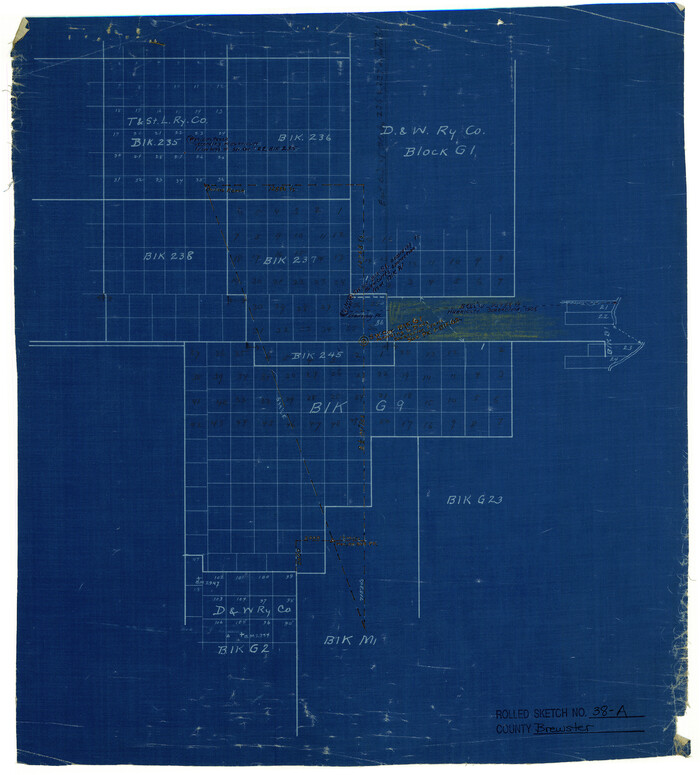
Brewster County Rolled Sketch 38A
Print $20.00
- Digital $50.00
Brewster County Rolled Sketch 38A
Size 15.6 x 14.1 inches
Map/Doc 5219
Presidio County Rolled Sketch 62

Print $20.00
- Digital $50.00
Presidio County Rolled Sketch 62
1916
Size 39.5 x 21.7 inches
Map/Doc 78468
Rusk County Sketch File 44

Print $12.00
Rusk County Sketch File 44
1951
Size 11.3 x 8.9 inches
Map/Doc 35585
Travis County Rolled Sketch 27

Print $20.00
- Digital $50.00
Travis County Rolled Sketch 27
1945
Size 23.5 x 17.8 inches
Map/Doc 8029
Travis County Working Sketch 1

Print $20.00
- Digital $50.00
Travis County Working Sketch 1
Size 30.9 x 17.6 inches
Map/Doc 69385
Sketch showing surveys on Harbor Island in Nueces County

Print $20.00
- Digital $50.00
Sketch showing surveys on Harbor Island in Nueces County
1978
Size 46.4 x 36.0 inches
Map/Doc 2020

The Republic County of Montgomery. December 29, 1845

Print $20.00
The Republic County of Montgomery. December 29, 1845
2020
Size 19.9 x 21.7 inches
Map/Doc 96241
Hardin County Working Sketch 32

Print $20.00
- Digital $50.00
Hardin County Working Sketch 32
1978
Size 41.7 x 38.0 inches
Map/Doc 63430
Flight Mission No. BRA-7M, Frame 185, Jefferson County

Print $20.00
- Digital $50.00
Flight Mission No. BRA-7M, Frame 185, Jefferson County
1953
Size 18.6 x 22.3 inches
Map/Doc 85553
Johnson County Rolled Sketch 4

Print $20.00
- Digital $50.00
Johnson County Rolled Sketch 4
Size 24.8 x 36.0 inches
Map/Doc 94047
[Longview and Sabine Valley Railway Company Blocks in Reagan & Upton Counties, Texas]
![75789, [Longview and Sabine Valley Railway Company Blocks in Reagan & Upton Counties, Texas], Maddox Collection](https://historictexasmaps.com/wmedia_w700/maps/75789.tif.jpg)
Print $20.00
- Digital $50.00
[Longview and Sabine Valley Railway Company Blocks in Reagan & Upton Counties, Texas]
Size 17.5 x 18.3 inches
Map/Doc 75789