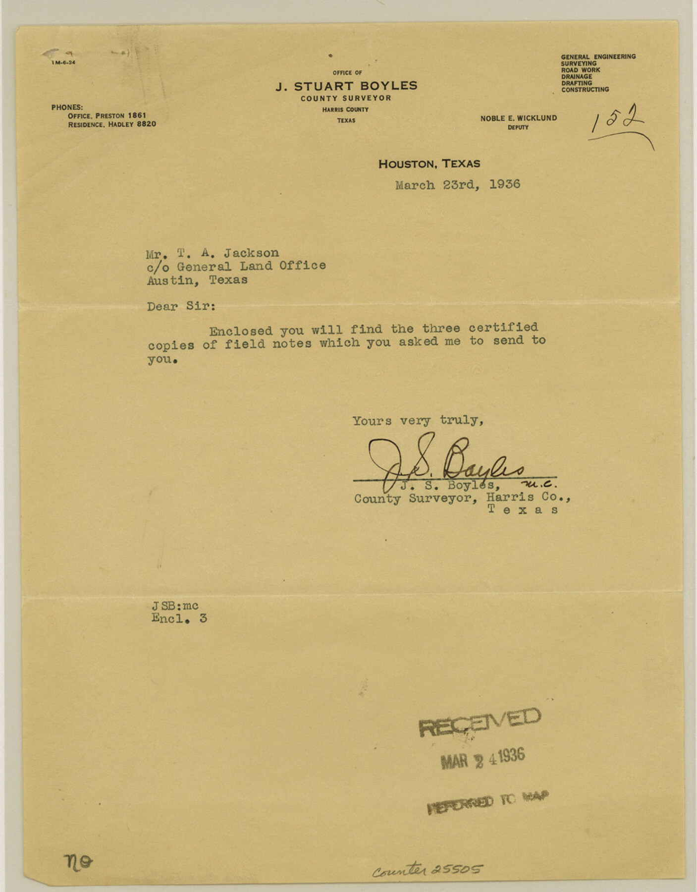
Harris County Sketch File 67
[Copies of three sets of fields notes - Ettienne Peltier, William M. Cooke and Richard Victor surveys]
-
Map/Doc
25505
-
Collection
General Map Collection
-
Object Dates
1936/3/23 (Creation Date)
1936/3/24 (File Date)
1936/3/3 (Correspondence Date)
1844 (Survey Date)
1936/3/23 (Correspondence Date)
-
People and Organizations
J.S. Boyles (Surveyor/Engineer)
C. Allen (Chainman)
Wm. R. Buck (Chainman)
S.D. Pelligrini (Surveyor/Engineer)
James W. Henderson (Surveyor/Engineer)
J. Saunders (Chainman)
T. Orneary (Chainman)
George H. Bringhurst (Surveyor/Engineer)
-
Counties
Harris
-
Subjects
Surveying Sketch File
-
Height x Width
11.4 x 8.9 inches
29.0 x 22.6 cm
-
Medium
paper, print
-
Features
Sims Bayou
Houston
Vince's Bayou
Part of: General Map Collection
Flight Mission No. CLL-1N, Frame 31, Willacy County

Print $20.00
- Digital $50.00
Flight Mission No. CLL-1N, Frame 31, Willacy County
1954
Size 18.5 x 22.2 inches
Map/Doc 87012
Donley County Sketch File 7

Print $20.00
- Digital $50.00
Donley County Sketch File 7
Size 38.3 x 38.2 inches
Map/Doc 10367
Wise County Working Sketch 17

Print $20.00
- Digital $50.00
Wise County Working Sketch 17
1972
Size 29.9 x 25.0 inches
Map/Doc 72631
Harris County Rolled Sketch 41

Print $20.00
- Digital $50.00
Harris County Rolled Sketch 41
1912
Size 21.0 x 34.1 inches
Map/Doc 6099
Angelina County Working Sketch 4

Print $20.00
- Digital $50.00
Angelina County Working Sketch 4
1910
Size 15.0 x 13.3 inches
Map/Doc 67084
Flight Mission No. CRK-3P, Frame 129, Refugio County

Print $20.00
- Digital $50.00
Flight Mission No. CRK-3P, Frame 129, Refugio County
1956
Size 18.5 x 22.4 inches
Map/Doc 86917
Flight Mission No. DQO-3K, Frame 19, Galveston County

Print $20.00
- Digital $50.00
Flight Mission No. DQO-3K, Frame 19, Galveston County
1952
Size 18.7 x 22.5 inches
Map/Doc 85060
Liberty County Working Sketch 85

Print $20.00
- Digital $50.00
Liberty County Working Sketch 85
1987
Size 27.2 x 28.3 inches
Map/Doc 70545
Copy of Surveyor's Field Book, Morris Browning - In Blocks 7, 5 & 4, I&GNRRCo., Hutchinson and Carson Counties, Texas

Print $2.00
- Digital $50.00
Copy of Surveyor's Field Book, Morris Browning - In Blocks 7, 5 & 4, I&GNRRCo., Hutchinson and Carson Counties, Texas
1888
Size 6.9 x 8.9 inches
Map/Doc 62273
Harris County Boundary File 39 (22)

Print $40.00
- Digital $50.00
Harris County Boundary File 39 (22)
Size 12.6 x 16.1 inches
Map/Doc 54368
Wise County Working Sketch 31

Print $20.00
- Digital $50.00
Wise County Working Sketch 31
2009
Size 27.9 x 37.5 inches
Map/Doc 89985
Palo Pinto County Working Sketch 25

Print $20.00
- Digital $50.00
Palo Pinto County Working Sketch 25
1991
Map/Doc 71408
You may also like
Kimble County Working Sketch Graphic Index, Sheet 2 (Sketches 47 to Most Recent)

Print $40.00
- Digital $50.00
Kimble County Working Sketch Graphic Index, Sheet 2 (Sketches 47 to Most Recent)
1930
Size 41.1 x 49.0 inches
Map/Doc 76607
Austin County Sketch File 1

Print $4.00
- Digital $50.00
Austin County Sketch File 1
Size 8.0 x 6.5 inches
Map/Doc 13853
Bowie County Working Sketch 1

Print $20.00
- Digital $50.00
Bowie County Working Sketch 1
Size 16.7 x 12.1 inches
Map/Doc 67405
[Scripture Addition to the City of Denton]
![90586, [Scripture Addition to the City of Denton], Twichell Survey Records](https://historictexasmaps.com/wmedia_w700/maps/90586-1.tif.jpg)
Print $20.00
- Digital $50.00
[Scripture Addition to the City of Denton]
Size 35.4 x 31.4 inches
Map/Doc 90586
Clay County Working Sketch 5

Print $20.00
- Digital $50.00
Clay County Working Sketch 5
1923
Size 41.2 x 35.9 inches
Map/Doc 68028
Upton County Rolled Sketch 2

Print $20.00
- Digital $50.00
Upton County Rolled Sketch 2
1884
Size 26.2 x 36.1 inches
Map/Doc 8065

Real County Working Sketch 6

Print $20.00
- Digital $50.00
Real County Working Sketch 6
1924
Size 21.2 x 9.3 inches
Map/Doc 71898
Williamson County Rolled Sketch 5

Print $20.00
- Digital $50.00
Williamson County Rolled Sketch 5
1940
Size 23.7 x 34.5 inches
Map/Doc 8263
A Map of the United States including every county enumerated in the last census & since formed with the population of the several states, railroads, canals, & c.

A Map of the United States including every county enumerated in the last census & since formed with the population of the several states, railroads, canals, & c.
Size 46.0 x 61.0 inches
Map/Doc 95918
Stonewall County

Print $20.00
- Digital $50.00
Stonewall County
1882
Size 27.8 x 20.8 inches
Map/Doc 4059
Real County Working Sketch Graphic Index, Sheet 2 (Sketches 43 to Most Recent)

Print $20.00
- Digital $50.00
Real County Working Sketch Graphic Index, Sheet 2 (Sketches 43 to Most Recent)
1972
Size 43.2 x 31.1 inches
Map/Doc 76679