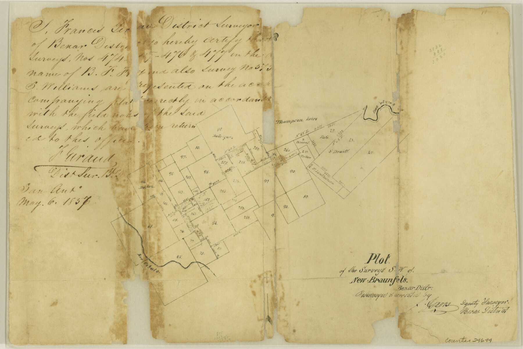
Guadalupe County Sketch File 1
[Sketch of surveys in northwest corner of the county between Guadalupe and Cibolo Rivers]
-
Map/Doc
24644
-
Collection
General Map Collection
-
Object Dates
1857/5/6 (Creation Date)
1857/5/30 (File Date)
-
People and Organizations
J. Groos (Surveyor/Engineer)
-
Counties
Guadalupe Bexar Comal
-
Subjects
Surveying Sketch File
-
Height x Width
8.9 x 13.4 inches
22.6 x 34.0 cm
-
Medium
paper, manuscript
-
Features
Guadalupe River
Rio Cibolo
Part of: General Map Collection
Flight Mission No. DIX-8P, Frame 63, Aransas County

Print $20.00
- Digital $50.00
Flight Mission No. DIX-8P, Frame 63, Aransas County
1956
Size 18.7 x 22.5 inches
Map/Doc 83894
Stonewall County Rolled Sketch 26

Print $40.00
- Digital $50.00
Stonewall County Rolled Sketch 26
1954
Size 49.4 x 32.8 inches
Map/Doc 9965
Louisiana and Texas Intracoastal Waterway - High Island to Port Bolivar Dredging - Sheet 5

Print $20.00
- Digital $50.00
Louisiana and Texas Intracoastal Waterway - High Island to Port Bolivar Dredging - Sheet 5
1943
Size 31.4 x 41.8 inches
Map/Doc 61824
Dallam County Sketch File 14

Print $4.00
- Digital $50.00
Dallam County Sketch File 14
1949
Size 11.3 x 8.8 inches
Map/Doc 20379
Part of Laguna Madre in Kenedy and Willacy Counties, showing Subdivision for Mineral Development

Print $40.00
- Digital $50.00
Part of Laguna Madre in Kenedy and Willacy Counties, showing Subdivision for Mineral Development
1946
Size 49.1 x 30.0 inches
Map/Doc 1924
Uvalde County Sketch File 20a

Print $20.00
- Digital $50.00
Uvalde County Sketch File 20a
1911
Size 22.7 x 23.8 inches
Map/Doc 12532
Liberty County Sketch File 13

Print $12.00
- Digital $50.00
Liberty County Sketch File 13
1858
Size 8.3 x 7.9 inches
Map/Doc 29909
Zapata County

Print $40.00
- Digital $50.00
Zapata County
1935
Size 56.7 x 43.2 inches
Map/Doc 63145
Flight Mission No. BQR-22K, Frame 41, Brazoria County

Print $20.00
- Digital $50.00
Flight Mission No. BQR-22K, Frame 41, Brazoria County
1953
Size 18.8 x 22.5 inches
Map/Doc 84125
Cottle County Sketch File 16

Print $8.00
- Digital $50.00
Cottle County Sketch File 16
1911
Size 10.7 x 8.7 inches
Map/Doc 19518
Andrews County Rolled Sketch 41

Print $20.00
- Digital $50.00
Andrews County Rolled Sketch 41
Size 18.0 x 24.0 inches
Map/Doc 77181
Connected Map of Austin's Colony

Print $40.00
- Digital $50.00
Connected Map of Austin's Colony
1837
Size 90.8 x 85.6 inches
Map/Doc 1944
You may also like
Montgomery County Sketch File 41

Print $8.00
- Digital $50.00
Montgomery County Sketch File 41
2004
Size 14.0 x 8.5 inches
Map/Doc 82447
Sabine River, Kane Bridge Sheet

Print $4.00
- Digital $50.00
Sabine River, Kane Bridge Sheet
Size 20.9 x 24.2 inches
Map/Doc 65135
San Saba County Sketch File 8

Print $6.00
- Digital $50.00
San Saba County Sketch File 8
Size 6.6 x 7.9 inches
Map/Doc 36430
The Judicial District/County of DeWitt. Abolished, Spring 1842

Print $20.00
The Judicial District/County of DeWitt. Abolished, Spring 1842
2020
Size 22.4 x 21.7 inches
Map/Doc 96326

McMullen County Sketch File 41

Print $20.00
- Digital $50.00
McMullen County Sketch File 41
1939
Size 20.6 x 17.1 inches
Map/Doc 12065
Pecos County Rolled Sketch 173

Print $20.00
- Digital $50.00
Pecos County Rolled Sketch 173
Size 32.2 x 35.6 inches
Map/Doc 9751
Jeff Davis County Sketch File R

Print $12.00
- Digital $50.00
Jeff Davis County Sketch File R
Size 6.0 x 8.7 inches
Map/Doc 28017
[Blocks O3 and O4 and Capitol Leagues in the vicinity]
![90391, [Blocks O3 and O4 and Capitol Leagues in the vicinity], Twichell Survey Records](https://historictexasmaps.com/wmedia_w700/maps/90391-1.tif.jpg)
Print $2.00
- Digital $50.00
[Blocks O3 and O4 and Capitol Leagues in the vicinity]
Size 8.4 x 10.5 inches
Map/Doc 90391
Pecos County Rolled Sketch 16

Print $40.00
- Digital $50.00
Pecos County Rolled Sketch 16
1882
Size 42.0 x 65.9 inches
Map/Doc 9682
Flight Mission No. DAH-9M, Frame 160, Orange County

Print $20.00
- Digital $50.00
Flight Mission No. DAH-9M, Frame 160, Orange County
1953
Size 18.4 x 22.2 inches
Map/Doc 86859