Fort Bend County Sketch File 17 1/2
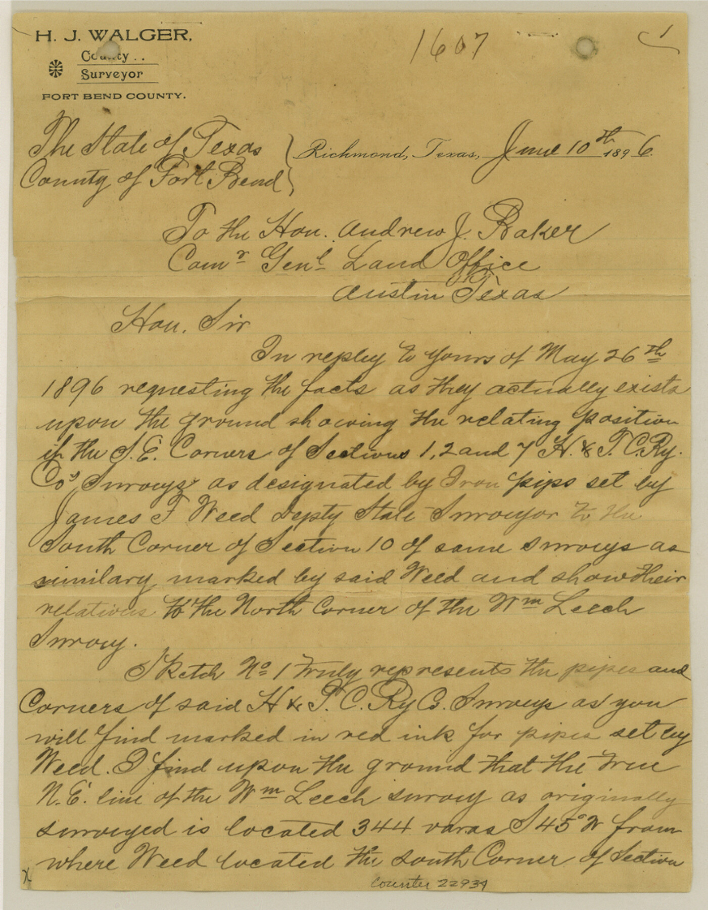
[Sketches and surveyor's report regarding H. & T. C. R.R. Co. surveys in the vicinity of Cottonwood Creek southwest from Richmond]
-
Map/Doc
22934
-
Collection
General Map Collection
-
Object Dates
6/10/1896 (Creation Date)
6/26/1896 (File Date)
-
People and Organizations
H.J. Walger (Surveyor/Engineer)
-
Counties
Fort Bend
-
Subjects
Surveying Sketch File
-
Height x Width
11.2 x 8.7 inches
28.5 x 22.1 cm
-
Medium
multi-page, multi-format
-
Features
Flat Creek
Cottonwood Creek
Coon Creek
Richmond
West Fork of Big Creek
Cow Creek
East Fork of Big Creek
Prairie Fork of Big Creek
Big Creek
Part of: General Map Collection
Runnels County Working Sketch 9

Print $40.00
- Digital $50.00
Runnels County Working Sketch 9
1948
Size 48.8 x 30.1 inches
Map/Doc 69712
Flight Mission No. DIX-10P, Frame 165, Aransas County

Print $20.00
- Digital $50.00
Flight Mission No. DIX-10P, Frame 165, Aransas County
1956
Size 18.6 x 22.3 inches
Map/Doc 83955
[Surveys along the Colorado River]
![112, [Surveys along the Colorado River], General Map Collection](https://historictexasmaps.com/wmedia_w700/maps/112.tif.jpg)
Print $2.00
- Digital $50.00
[Surveys along the Colorado River]
1841
Size 12.2 x 8.3 inches
Map/Doc 112
Flight Mission No. CUG-3P, Frame 166, Kleberg County

Print $20.00
- Digital $50.00
Flight Mission No. CUG-3P, Frame 166, Kleberg County
1956
Size 18.6 x 22.3 inches
Map/Doc 86286
Travis County State Real Property Sketch 9

Print $20.00
- Digital $50.00
Travis County State Real Property Sketch 9
2002
Size 30.6 x 42.5 inches
Map/Doc 82560
Red River County Rolled Sketch 7A

Print $20.00
- Digital $50.00
Red River County Rolled Sketch 7A
Size 28.3 x 33.1 inches
Map/Doc 7472
Chambers County Sketch File 37

Print $20.00
- Digital $50.00
Chambers County Sketch File 37
Size 25.0 x 43.8 inches
Map/Doc 10333

Parker County Sketch File 44

Print $6.00
- Digital $50.00
Parker County Sketch File 44
1874
Size 11.0 x 13.5 inches
Map/Doc 33608
Corpus Christi Pass, Texas

Print $20.00
- Digital $50.00
Corpus Christi Pass, Texas
1871
Size 26.2 x 18.3 inches
Map/Doc 72979
Wood County Rolled Sketch 9

Print $20.00
- Digital $50.00
Wood County Rolled Sketch 9
Size 30.6 x 18.1 inches
Map/Doc 8287
Map of the River Sabine from its mouth on the Gulf of Mexico in the Sea to Logan's Ferry in Latitude 31°58'24" North

Print $40.00
- Digital $50.00
Map of the River Sabine from its mouth on the Gulf of Mexico in the Sea to Logan's Ferry in Latitude 31°58'24" North
1842
Size 67.6 x 30.6 inches
Map/Doc 87152
You may also like
[Gulf Colorado & Santa Fe from 2178+36.0 to 3901+06.2]
![64698, [Gulf Colorado & Santa Fe from 2178+36.0 to 3901+06.2], General Map Collection](https://historictexasmaps.com/wmedia_w700/maps/64698.tif.jpg)
Print $40.00
- Digital $50.00
[Gulf Colorado & Santa Fe from 2178+36.0 to 3901+06.2]
Size 123.0 x 32.2 inches
Map/Doc 64698
Llano County Working Sketch 15

Print $20.00
- Digital $50.00
Llano County Working Sketch 15
2007
Size 46.0 x 26.2 inches
Map/Doc 87372
Mills County Working Sketch 23

Print $20.00
- Digital $50.00
Mills County Working Sketch 23
1985
Size 22.8 x 36.8 inches
Map/Doc 71053
Robertson County Working Sketch 8

Print $20.00
- Digital $50.00
Robertson County Working Sketch 8
1983
Size 36.7 x 38.7 inches
Map/Doc 63581
[Sketch of area south of Runnels County School Land League No. 3]
![91544, [Sketch of area south of Runnels County School Land League No. 3], Twichell Survey Records](https://historictexasmaps.com/wmedia_w700/maps/91544-1.tif.jpg)
Print $2.00
- Digital $50.00
[Sketch of area south of Runnels County School Land League No. 3]
Size 11.9 x 9.2 inches
Map/Doc 91544
Flight Mission No. CRC-3R, Frame 52, Chambers County

Print $20.00
- Digital $50.00
Flight Mission No. CRC-3R, Frame 52, Chambers County
1956
Size 18.7 x 22.3 inches
Map/Doc 89041
Map of the Southern Pacific and connecting lines

Print $20.00
- Digital $50.00
Map of the Southern Pacific and connecting lines
1897
Size 8.7 x 15.9 inches
Map/Doc 95763
Reagan County Working Sketch 48

Print $20.00
- Digital $50.00
Reagan County Working Sketch 48
1987
Size 31.6 x 46.1 inches
Map/Doc 71891
Anderson County Working Sketch 43

Print $20.00
- Digital $50.00
Anderson County Working Sketch 43
1988
Size 37.2 x 33.9 inches
Map/Doc 67043
Sketch showing parts of Terry, Yoakum, Hockley, Cochran Counties

Print $20.00
- Digital $50.00
Sketch showing parts of Terry, Yoakum, Hockley, Cochran Counties
Size 43.5 x 36.9 inches
Map/Doc 89883
Calhoun County Working Sketch 2b

Print $20.00
- Digital $50.00
Calhoun County Working Sketch 2b
1913
Size 17.3 x 15.8 inches
Map/Doc 67818
Sutton County Working Sketch 57

Print $20.00
- Digital $50.00
Sutton County Working Sketch 57
1958
Size 37.7 x 32.9 inches
Map/Doc 62400