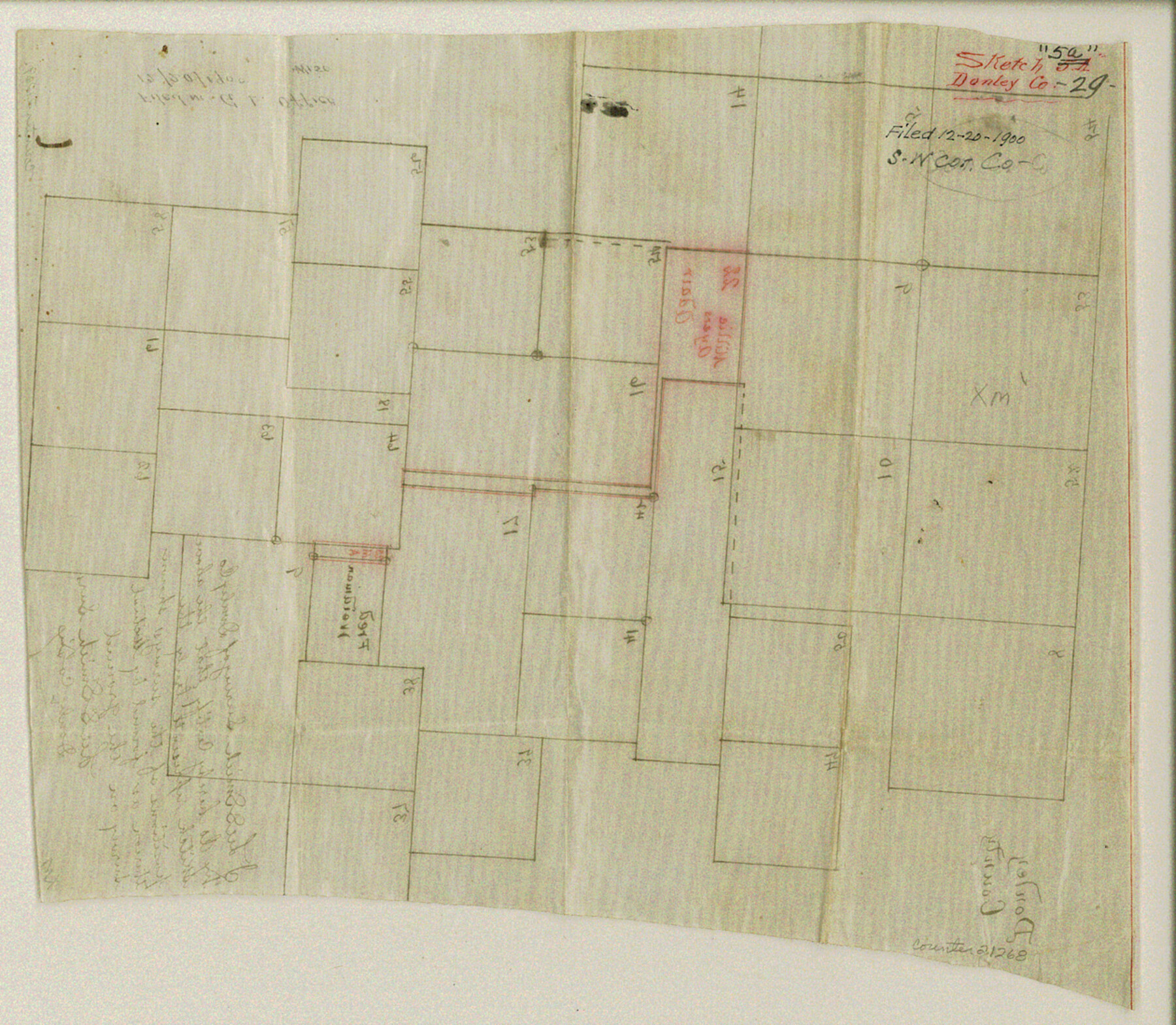
Donley County Sketch File 5a
[Sketch showing Millie Ayers Adair survey in southwest corner of county]
-
Map/Doc
21268
-
Collection
General Map Collection
-
Object Dates
1900/12/20 (File Date)
-
People and Organizations
Lee S. Smith (Surveyor/Engineer)
-
Counties
Donley
-
Subjects
Surveying Sketch File
-
Height x Width
11.0 x 12.6 inches
27.9 x 32.0 cm
-
Medium
paper, manuscript
Part of: General Map Collection
Glasscock County Rolled Sketch 2

Print $20.00
- Digital $50.00
Glasscock County Rolled Sketch 2
1906
Size 19.6 x 14.8 inches
Map/Doc 6013
Val Verde County Sketch File XXX4

Print $4.00
- Digital $50.00
Val Verde County Sketch File XXX4
Size 12.8 x 8.4 inches
Map/Doc 39098
[Map of Sabine County]
![4009, [Map of Sabine County], General Map Collection](https://historictexasmaps.com/wmedia_w700/maps/4009.tif.jpg)
Print $20.00
- Digital $50.00
[Map of Sabine County]
1839
Size 23.9 x 18.9 inches
Map/Doc 4009
Real County Rolled Sketch 18

Print $20.00
- Digital $50.00
Real County Rolled Sketch 18
Size 22.0 x 28.0 inches
Map/Doc 7466
Nueces County Sketch File 2

Print $24.00
- Digital $50.00
Nueces County Sketch File 2
1847
Size 7.6 x 12.5 inches
Map/Doc 32500
Val Verde County Working Sketch 63

Print $20.00
- Digital $50.00
Val Verde County Working Sketch 63
1959
Size 23.2 x 32.1 inches
Map/Doc 72198
Brewster County Rolled Sketch 20

Print $20.00
- Digital $50.00
Brewster County Rolled Sketch 20
Size 31.4 x 28.2 inches
Map/Doc 5199
La Salle County Sketch File 1

Print $5.00
- Digital $50.00
La Salle County Sketch File 1
1850
Size 14.2 x 9.2 inches
Map/Doc 29443
Fisher County Sketch File 8

Print $16.00
- Digital $50.00
Fisher County Sketch File 8
1898
Size 14.7 x 9.1 inches
Map/Doc 22567
Flight Mission No. DAG-21K, Frame 38, Matagorda County

Print $20.00
- Digital $50.00
Flight Mission No. DAG-21K, Frame 38, Matagorda County
1952
Size 18.6 x 22.3 inches
Map/Doc 86405
United States - Gulf Coast - From Latitude 26° 33' to the Rio Grande Texas

Print $20.00
- Digital $50.00
United States - Gulf Coast - From Latitude 26° 33' to the Rio Grande Texas
1913
Size 18.5 x 27.6 inches
Map/Doc 72841
Jackson County Working Sketch 1

Print $20.00
- Digital $50.00
Jackson County Working Sketch 1
1911
Size 20.6 x 13.0 inches
Map/Doc 66449
You may also like
Dimmit County Rolled Sketch 7

Print $20.00
- Digital $50.00
Dimmit County Rolled Sketch 7
1908
Size 25.0 x 30.5 inches
Map/Doc 5717
Flight Mission No. DAG-23K, Frame 20, Matagorda County

Print $20.00
- Digital $50.00
Flight Mission No. DAG-23K, Frame 20, Matagorda County
1953
Size 18.4 x 22.2 inches
Map/Doc 86482
Baylor County Sketch File 19

Print $4.00
- Digital $50.00
Baylor County Sketch File 19
1885
Size 11.5 x 8.8 inches
Map/Doc 14193
Tom Green County Rolled Sketch 5

Print $20.00
- Digital $50.00
Tom Green County Rolled Sketch 5
1947
Size 44.9 x 35.0 inches
Map/Doc 9997
Hutchinson County Rolled Sketch 40

Print $20.00
- Digital $50.00
Hutchinson County Rolled Sketch 40
1981
Size 25.7 x 37.3 inches
Map/Doc 6304
[Gonzales District]
![16837, [Gonzales District], General Map Collection](https://historictexasmaps.com/wmedia_w700/maps/16837.tif.jpg)
Print $20.00
- Digital $50.00
[Gonzales District]
1840
Size 42.8 x 37.0 inches
Map/Doc 16837
Map of Harrison County

Print $20.00
- Digital $50.00
Map of Harrison County
1840
Size 44.6 x 34.5 inches
Map/Doc 1515
General Highway Map, Moore County, Texas

Print $20.00
General Highway Map, Moore County, Texas
1961
Size 18.1 x 24.5 inches
Map/Doc 79604
Maps of Gulf Intracoastal Waterway, Texas - Sabine River to the Rio Grande and connecting waterways including ship channels

Print $20.00
- Digital $50.00
Maps of Gulf Intracoastal Waterway, Texas - Sabine River to the Rio Grande and connecting waterways including ship channels
1966
Size 14.5 x 22.2 inches
Map/Doc 61940
Crockett County Rolled Sketch 51

Print $20.00
- Digital $50.00
Crockett County Rolled Sketch 51
1940
Size 17.1 x 26.6 inches
Map/Doc 5597
Walker County Sketch File 8

Print $4.00
- Digital $50.00
Walker County Sketch File 8
1944
Size 9.7 x 6.8 inches
Map/Doc 39561
