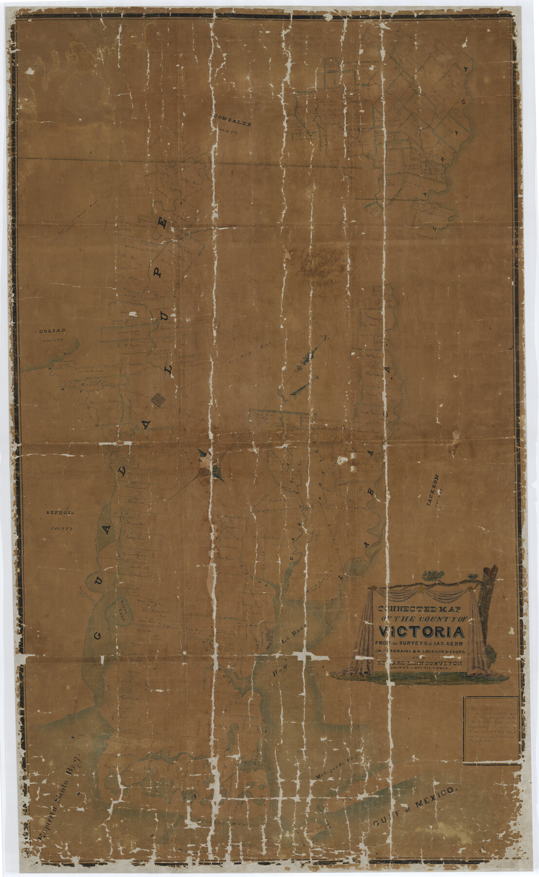
Connected Map of the County of Victoria
T-1-7
-
Map/Doc
1946
-
Collection
General Map Collection
-
Object Dates
1838 (Creation Date)
-
People and Organizations
Edward Linn (Draftsman)
James Kerr (Surveyor/Engineer)
Byrd Lockhart (Surveyor/Engineer)
Jose Maria Jesus Carbajal (Surveyor/Engineer)
-
Counties
Victoria Lavaca DeWitt Calhoun Jackson
-
Subjects
County
-
Height x Width
79.7 x 49.0 inches
202.4 x 124.5 cm
-
Comments
Colorful decorative title with drapery and tree.
Covers portions of present-day Calhoun, DeWitt, Jackson, Lavaca, and Victoria.
Conservation funded in 2002 with donations from Urban Surveying, Inc., Victoria Guadalupe Chapter DAR, Betty J. Bireley,
Part of: General Map Collection
Karte des Staates Texas (aufgenommen in die Union 1846) nach der neuesten Eintheilung

Print $20.00
- Digital $50.00
Karte des Staates Texas (aufgenommen in die Union 1846) nach der neuesten Eintheilung
1849
Size 13.6 x 16.6 inches
Map/Doc 90066
Burnet County Rolled Sketch 3

Print $20.00
- Digital $50.00
Burnet County Rolled Sketch 3
Size 23.7 x 26.2 inches
Map/Doc 5355
Map of Lee County Texas

Print $20.00
- Digital $50.00
Map of Lee County Texas
1879
Size 26.2 x 18.0 inches
Map/Doc 4578
Polk County Rolled Sketch 29

Print $86.00
- Digital $50.00
Polk County Rolled Sketch 29
1954
Size 9.3 x 14.9 inches
Map/Doc 48066
Harris County Sketch File 65

Print $20.00
- Digital $50.00
Harris County Sketch File 65
Size 23.5 x 35.1 inches
Map/Doc 11660
Parker County Sketch File D

Print $4.00
- Digital $50.00
Parker County Sketch File D
Size 9.9 x 8.2 inches
Map/Doc 33514
Chipman's Map of Briscoe, Hall, Motley, Cottle Counties

Print $40.00
- Digital $50.00
Chipman's Map of Briscoe, Hall, Motley, Cottle Counties
1911
Size 54.7 x 92.6 inches
Map/Doc 2051
Texas, Corpus Christi, Corpus Christi to Laguna Madre

Print $40.00
- Digital $50.00
Texas, Corpus Christi, Corpus Christi to Laguna Madre
1934
Size 35.1 x 48.6 inches
Map/Doc 73457
Matagorda County Working Sketch 33

Print $20.00
- Digital $50.00
Matagorda County Working Sketch 33
1998
Size 32.0 x 42.5 inches
Map/Doc 70891
McMullen County Working Sketch 42

Print $20.00
- Digital $50.00
McMullen County Working Sketch 42
1980
Size 35.6 x 32.6 inches
Map/Doc 70743
Aransas County Rolled Sketch 16

Digital $50.00
Aransas County Rolled Sketch 16
Size 44.1 x 92.5 inches
Map/Doc 8412
Floyd County Boundary File 2

Print $53.00
- Digital $50.00
Floyd County Boundary File 2
Size 8.9 x 4.2 inches
Map/Doc 53462
You may also like
Freestone County Working Sketch 15

Print $40.00
- Digital $50.00
Freestone County Working Sketch 15
1980
Size 56.5 x 33.7 inches
Map/Doc 69257
Cherokee County Sketch File 11

Print $4.00
- Digital $50.00
Cherokee County Sketch File 11
1852
Size 11.5 x 8.2 inches
Map/Doc 18138
Nueces County Sketch File 61

Print $4.00
- Digital $50.00
Nueces County Sketch File 61
1930
Size 10.5 x 8.6 inches
Map/Doc 32969
Limestone County Working Sketch 10

Print $20.00
- Digital $50.00
Limestone County Working Sketch 10
1922
Size 21.1 x 10.0 inches
Map/Doc 70560
Navigation Maps of Gulf Intracoastal Waterway, Port Arthur to Brownsville, Texas

Print $4.00
- Digital $50.00
Navigation Maps of Gulf Intracoastal Waterway, Port Arthur to Brownsville, Texas
1951
Size 16.8 x 21.6 inches
Map/Doc 65419
Menard County Sketch File 10

Print $20.00
- Digital $50.00
Menard County Sketch File 10
1885
Size 32.5 x 18.0 inches
Map/Doc 12074
General Highway Map, Callahan County, Texas

Print $20.00
General Highway Map, Callahan County, Texas
1940
Size 25.3 x 18.4 inches
Map/Doc 79037
Cochran County Rolled Sketch A

Print $40.00
- Digital $50.00
Cochran County Rolled Sketch A
Size 28.5 x 55.3 inches
Map/Doc 8604
Williamson County Working Sketch 10

Print $20.00
- Digital $50.00
Williamson County Working Sketch 10
1961
Size 31.1 x 20.0 inches
Map/Doc 72570
Kimble County Working Sketch 72

Print $20.00
- Digital $50.00
Kimble County Working Sketch 72
1966
Size 28.7 x 17.6 inches
Map/Doc 70140
Ochiltree County Rolled Sketch 2

Print $20.00
- Digital $50.00
Ochiltree County Rolled Sketch 2
Size 23.0 x 17.7 inches
Map/Doc 7172
Hays County Sketch File 1

Print $2.00
- Digital $50.00
Hays County Sketch File 1
1856
Size 12.6 x 8.3 inches
Map/Doc 26199