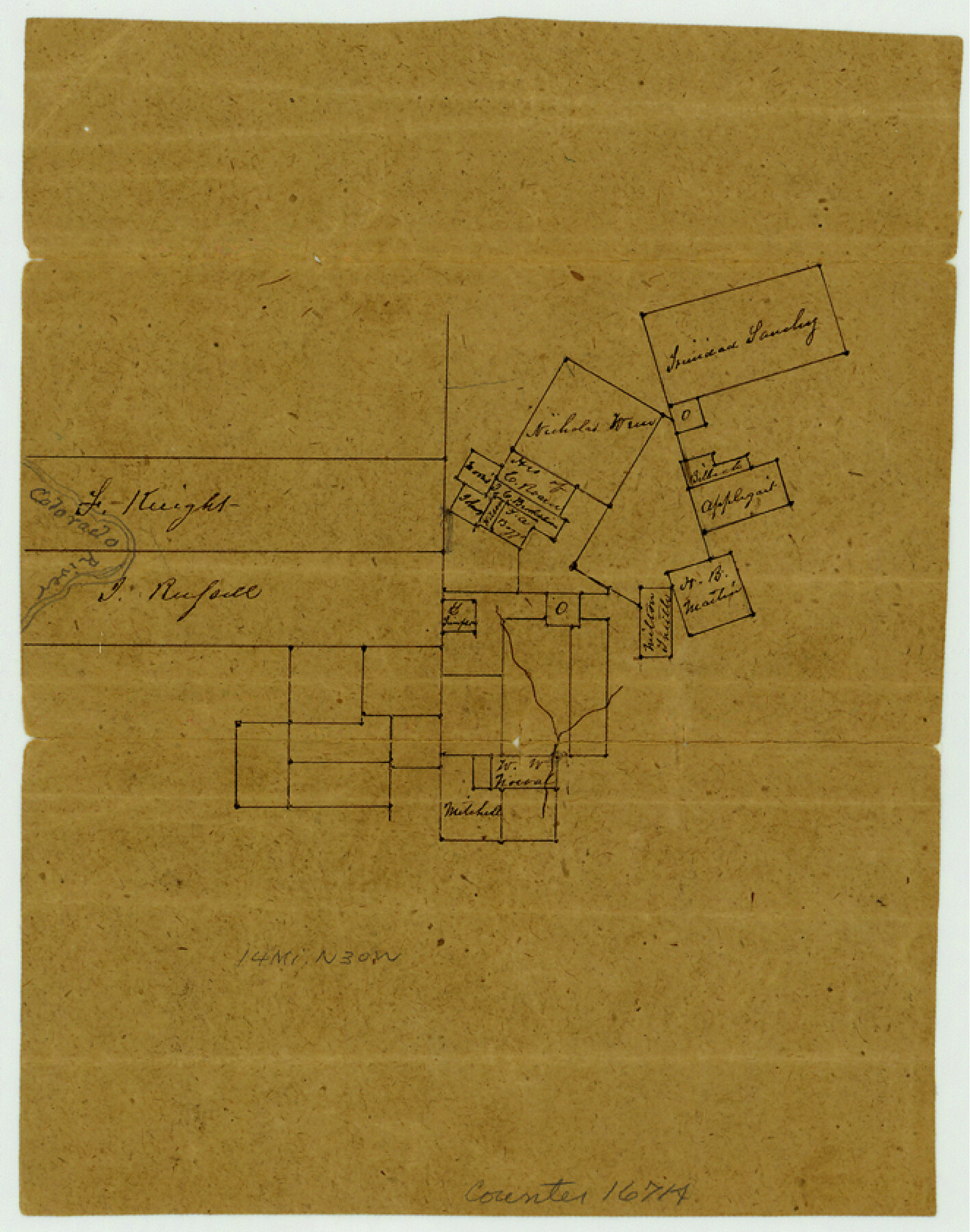
Burnet County Sketch File 21
[Sketch of F. Knight and J. Russell surveys on the Colorado River and area to the east all northwest of Burnet]
-
Map/Doc
16714
-
Collection
General Map Collection
-
Object Dates
1870/3/6 (File Date)
-
Counties
Burnet
-
Subjects
Surveying Sketch File
-
Height x Width
8.4 x 6.6 inches
21.3 x 16.8 cm
-
Medium
paper, manuscript
-
Features
Colorado River
Part of: General Map Collection
Newton County Sketch File 6

Print $4.00
- Digital $50.00
Newton County Sketch File 6
1872
Size 12.4 x 7.9 inches
Map/Doc 32372
St. L. S-W. Ry. of Texas Map of Hillsboro Branch in Navarro County, Texas M.P. 621 to M.P. 648

Print $40.00
- Digital $50.00
St. L. S-W. Ry. of Texas Map of Hillsboro Branch in Navarro County, Texas M.P. 621 to M.P. 648
1913
Size 28.0 x 431.2 inches
Map/Doc 94016
Van Zandt County

Print $20.00
- Digital $50.00
Van Zandt County
1921
Size 46.7 x 41.4 inches
Map/Doc 63104
Orange County Working Sketch 3

Print $20.00
- Digital $50.00
Orange County Working Sketch 3
1917
Size 12.7 x 20.3 inches
Map/Doc 71335

Bexar County Sketch File 36

Print $14.00
- Digital $50.00
Bexar County Sketch File 36
1868
Size 8.8 x 7.6 inches
Map/Doc 14500
Lee County Working Sketch Graphic Index

Print $20.00
- Digital $50.00
Lee County Working Sketch Graphic Index
1945
Size 38.2 x 44.6 inches
Map/Doc 76617
Map of Europe engraved to illustrate Mitchell's school and family geography

Print $20.00
- Digital $50.00
Map of Europe engraved to illustrate Mitchell's school and family geography
1839
Size 9.5 x 11.8 inches
Map/Doc 93502
Flight Mission No. DAG-17K, Frame 65, Matagorda County

Print $20.00
- Digital $50.00
Flight Mission No. DAG-17K, Frame 65, Matagorda County
1952
Size 17.5 x 16.1 inches
Map/Doc 86327
Hopkins County

Print $20.00
- Digital $50.00
Hopkins County
1942
Size 44.1 x 40.9 inches
Map/Doc 73183
Waller County Sketch File 10

Print $4.00
- Digital $50.00
Waller County Sketch File 10
1912
Size 12.4 x 8.6 inches
Map/Doc 39612

You may also like
Presidio County Sketch File 70b

Print $6.00
- Digital $50.00
Presidio County Sketch File 70b
Size 11.2 x 8.9 inches
Map/Doc 34671
General Highway Map, Lubbock County, Texas

Print $20.00
General Highway Map, Lubbock County, Texas
1940
Size 18.3 x 24.7 inches
Map/Doc 79180
Map of Hemphill County

Print $20.00
- Digital $50.00
Map of Hemphill County
1899
Size 41.2 x 38.5 inches
Map/Doc 95527
Freestone County Working Sketch 9

Print $20.00
- Digital $50.00
Freestone County Working Sketch 9
1975
Size 26.3 x 38.4 inches
Map/Doc 69251
Sketch showing Reed and Meeker Vacancy

Print $20.00
- Digital $50.00
Sketch showing Reed and Meeker Vacancy
Size 27.9 x 19.3 inches
Map/Doc 90288
Presidio County Working Sketch 27

Print $20.00
- Digital $50.00
Presidio County Working Sketch 27
1945
Size 32.4 x 13.4 inches
Map/Doc 71703
San Patricio County Rolled Sketch 21

Print $20.00
- Digital $50.00
San Patricio County Rolled Sketch 21
1935
Size 25.9 x 24.7 inches
Map/Doc 7580
Hardin County Rolled Sketch MH

Print $21.00
- Digital $50.00
Hardin County Rolled Sketch MH
1936
Size 10.1 x 15.2 inches
Map/Doc 45760
Wichita County Sketch File 9

Print $4.00
- Digital $50.00
Wichita County Sketch File 9
1878
Size 12.8 x 8.2 inches
Map/Doc 40050

Stonewall County Working Sketch 17

Print $20.00
- Digital $50.00
Stonewall County Working Sketch 17
1954
Size 31.5 x 24.7 inches
Map/Doc 62324
Morris County

Print $20.00
- Digital $50.00
Morris County
1906
Size 44.1 x 22.4 inches
Map/Doc 66944