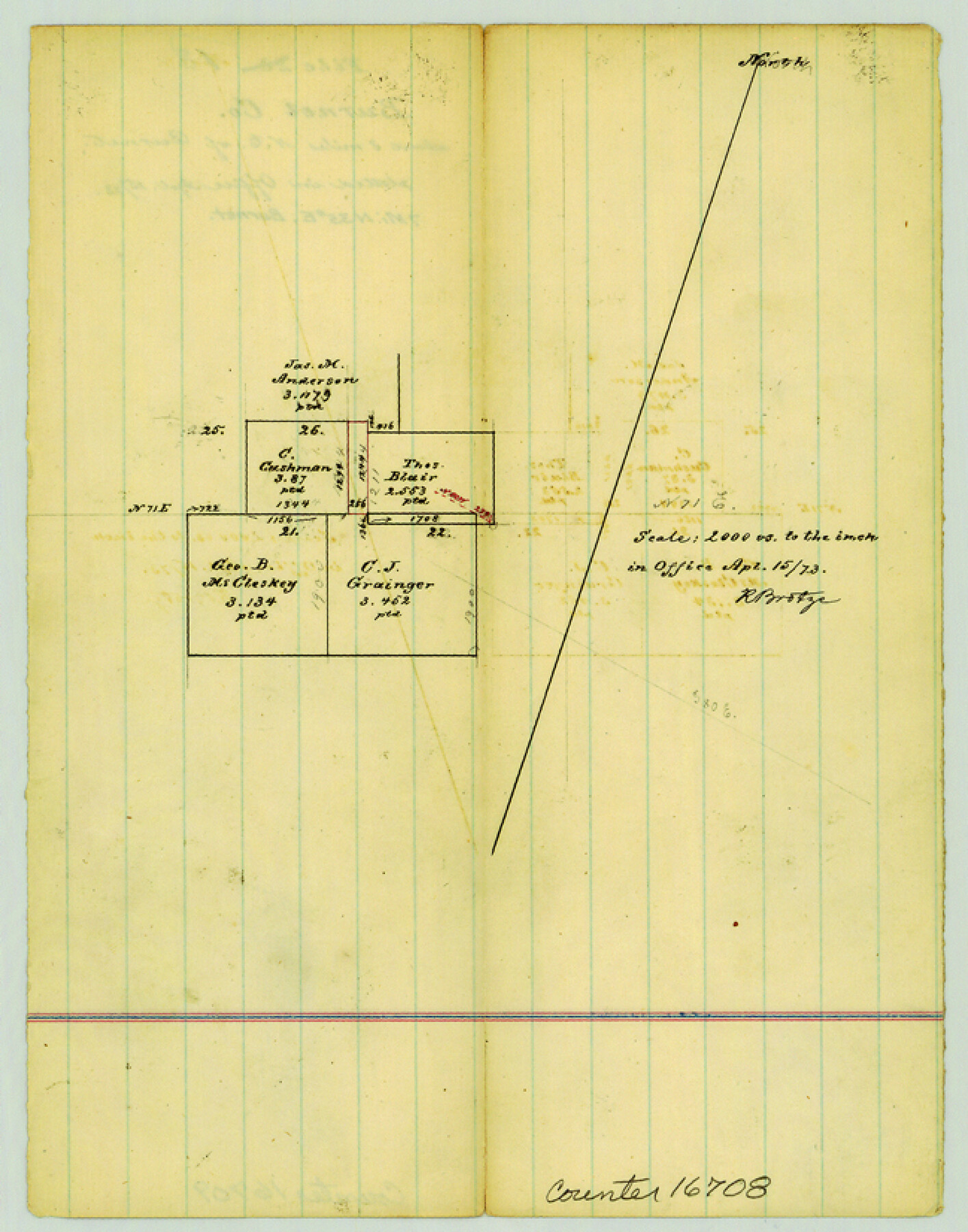
Burnet County Sketch File 18
[Office sketch of the Geo. B. McCleskey and C.J. Grainger surveys and surrounding area northeast of Burnet]
-
Map/Doc
16708
-
Collection
General Map Collection
-
Object Dates
1873/4/15 (Creation Date)
1873/4/15 (File Date)
-
People and Organizations
R. Brotze (Draftsman)
-
Counties
Burnet
-
Subjects
Surveying Sketch File
-
Height x Width
8.3 x 6.5 inches
21.1 x 16.5 cm
-
Medium
paper, manuscript
-
Scale
1" = 2000 varas
Part of: General Map Collection
Red River County Working Sketch 63

Print $20.00
- Digital $50.00
Red River County Working Sketch 63
1973
Size 43.6 x 37.0 inches
Map/Doc 72046
Rusk County Working Sketch 16

Print $20.00
- Digital $50.00
Rusk County Working Sketch 16
1956
Size 32.1 x 42.7 inches
Map/Doc 63651
Comal County Rolled Sketch 3

Print $20.00
- Digital $50.00
Comal County Rolled Sketch 3
1977
Size 19.0 x 17.3 inches
Map/Doc 5538
Erath County Working Sketch 45

Print $20.00
- Digital $50.00
Erath County Working Sketch 45
1982
Size 25.5 x 24.8 inches
Map/Doc 69126
[Right of Way & Track Map, The Texas & Pacific Ry. Co. Main Line]
![64675, [Right of Way & Track Map, The Texas & Pacific Ry. Co. Main Line], General Map Collection](https://historictexasmaps.com/wmedia_w700/maps/64675.tif.jpg)
Print $20.00
- Digital $50.00
[Right of Way & Track Map, The Texas & Pacific Ry. Co. Main Line]
Size 11.0 x 18.4 inches
Map/Doc 64675
Galveston County

Print $20.00
- Digital $50.00
Galveston County
1860
Size 20.2 x 31.4 inches
Map/Doc 3575
Lavaca County Rolled Sketch 8

Print $40.00
- Digital $50.00
Lavaca County Rolled Sketch 8
1982
Size 36.5 x 65.6 inches
Map/Doc 10289
Blanco County Working Sketch 39

Print $20.00
- Digital $50.00
Blanco County Working Sketch 39
1985
Size 11.9 x 18.4 inches
Map/Doc 67399
McLennan County Sketch File 2

Print $6.00
- Digital $50.00
McLennan County Sketch File 2
1856
Size 11.5 x 7.7 inches
Map/Doc 31230
Flight Mission No. CUI-1H, Frame 140, Milam County

Print $20.00
- Digital $50.00
Flight Mission No. CUI-1H, Frame 140, Milam County
1951
Size 18.4 x 22.2 inches
Map/Doc 86606
Orange County Boundary File 9

Print $16.00
- Digital $50.00
Orange County Boundary File 9
Size 11.2 x 8.7 inches
Map/Doc 57782
Township No. 4 South Range No. 19 West of the Indian Meridian

Print $20.00
- Digital $50.00
Township No. 4 South Range No. 19 West of the Indian Meridian
1875
Size 19.1 x 24.5 inches
Map/Doc 75183
You may also like
Glasscock County Rolled Sketch 10

Print $20.00
- Digital $50.00
Glasscock County Rolled Sketch 10
Size 47.6 x 45.9 inches
Map/Doc 9058
Brazoria County Working Sketch 34

Print $20.00
- Digital $50.00
Brazoria County Working Sketch 34
1981
Size 15.8 x 19.0 inches
Map/Doc 67519
Fayette County Boundary File 7

Print $40.00
- Digital $50.00
Fayette County Boundary File 7
Size 18.1 x 13.1 inches
Map/Doc 53400
Brewster County Sketch File S-1

Print $10.00
- Digital $50.00
Brewster County Sketch File S-1
1921
Size 13.3 x 8.8 inches
Map/Doc 15726

Padilla and Chambers Empresario Colony. February 12, 1830

Print $20.00
Padilla and Chambers Empresario Colony. February 12, 1830
2020
Size 14.7 x 21.7 inches
Map/Doc 96002
Jackson County Sketch File 7

Print $24.00
- Digital $50.00
Jackson County Sketch File 7
1895
Size 14.2 x 8.7 inches
Map/Doc 27649
From Citizens Living in Washington County for the Creation of a New County to be Called Washington, Undated

Print $20.00
From Citizens Living in Washington County for the Creation of a New County to be Called Washington, Undated
2020
Size 17.0 x 21.7 inches
Map/Doc 96406
[Surveys in the Bexar District along the Pedernales River]
![177, [Surveys in the Bexar District along the Pedernales River], General Map Collection](https://historictexasmaps.com/wmedia_w700/maps/177.tif.jpg)
Print $20.00
- Digital $50.00
[Surveys in the Bexar District along the Pedernales River]
1845
Size 18.7 x 11.0 inches
Map/Doc 177
Rusk County Sketch File 35

Print $6.00
Rusk County Sketch File 35
1950
Size 11.3 x 8.8 inches
Map/Doc 35573
Zapata County Rolled Sketch 24

Print $20.00
- Digital $50.00
Zapata County Rolled Sketch 24
Size 38.8 x 28.0 inches
Map/Doc 8318
Harrison County Sketch File 18

Print $20.00
- Digital $50.00
Harrison County Sketch File 18
1954
Size 23.2 x 26.9 inches
Map/Doc 11691