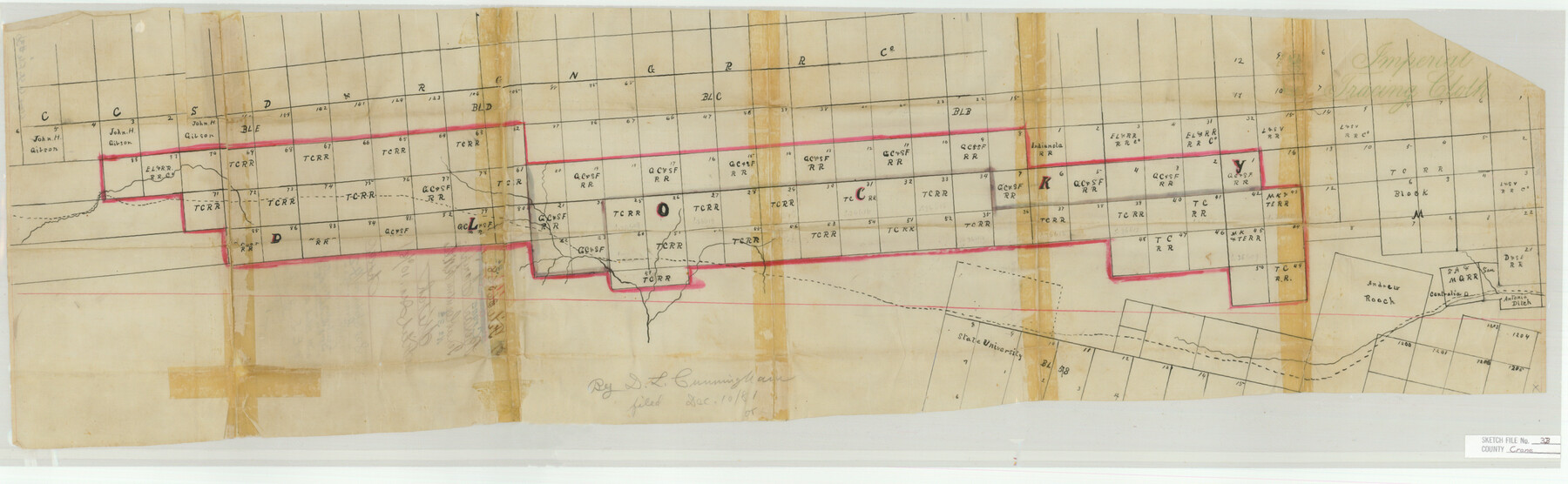
Crane County Sketch File 3b
Texas Central R. W. Co.
-
Map/Doc
11206
-
Collection
General Map Collection
-
Object Dates
1881/12/10 (Creation Date)
1881/12/10 (File Date)
-
People and Organizations
D.L. Cunningham (Surveyor/Engineer)
D.L. Cunningham (Draftsman)
-
Counties
Crane Upton Reagan
-
Subjects
Surveying Sketch File
-
Height x Width
11.9 x 38.6 inches
30.2 x 98.0 cm
-
Medium
linen, manuscript
Part of: General Map Collection
Van Zandt County

Print $20.00
- Digital $50.00
Van Zandt County
1972
Size 47.6 x 42.0 inches
Map/Doc 95662
Denton County Sketch File 27

Print $4.00
- Digital $50.00
Denton County Sketch File 27
1858
Size 7.9 x 12.1 inches
Map/Doc 20754
Gillespie County Boundary File 6

Print $2.00
- Digital $50.00
Gillespie County Boundary File 6
Size 11.3 x 8.9 inches
Map/Doc 53770
University Lands Blocks 29-33, Crockett County, Texas

Print $20.00
- Digital $50.00
University Lands Blocks 29-33, Crockett County, Texas
1936
Size 29.2 x 42.4 inches
Map/Doc 2407
Flight Mission No. DCL-6C, Frame 27, Kenedy County

Print $20.00
- Digital $50.00
Flight Mission No. DCL-6C, Frame 27, Kenedy County
1943
Size 18.7 x 22.4 inches
Map/Doc 85884
Marion County Sketch File 9

Print $4.00
- Digital $50.00
Marion County Sketch File 9
Size 9.4 x 7.8 inches
Map/Doc 30577
Gillespie County

Print $20.00
- Digital $50.00
Gillespie County
1873
Size 16.0 x 22.4 inches
Map/Doc 3580
Henderson County Sketch File 11

Print $2.00
- Digital $50.00
Henderson County Sketch File 11
Size 8.5 x 3.7 inches
Map/Doc 26348
Fayette County Working Sketch 8

Print $20.00
- Digital $50.00
Fayette County Working Sketch 8
1981
Size 14.4 x 11.5 inches
Map/Doc 69172
Erath County Working Sketch 12

Print $20.00
- Digital $50.00
Erath County Working Sketch 12
1964
Size 22.3 x 23.1 inches
Map/Doc 69093
Val Verde County Working Sketch 117

Print $20.00
- Digital $50.00
Val Verde County Working Sketch 117
1993
Size 20.8 x 36.8 inches
Map/Doc 82845
Liberty County Sketch File 59

Print $6.00
- Digital $50.00
Liberty County Sketch File 59
1943
Size 14.2 x 8.8 inches
Map/Doc 30068
You may also like

Howard County Working Sketch 4

Print $20.00
- Digital $50.00
Howard County Working Sketch 4
1940
Size 21.5 x 18.3 inches
Map/Doc 66270
Waco Manufacturing Company Block 1, G. H. & H. Block 5, Capitol Leagues 229, 230, 234-237]
![90726, Waco Manufacturing Company Block 1, G. H. & H. Block 5, Capitol Leagues 229, 230, 234-237], Twichell Survey Records](https://historictexasmaps.com/wmedia_w700/maps/90726-1.tif.jpg)
Print $20.00
- Digital $50.00
Waco Manufacturing Company Block 1, G. H. & H. Block 5, Capitol Leagues 229, 230, 234-237]
1902
Size 14.5 x 21.6 inches
Map/Doc 90726
Flight Mission No. DAG-21K, Frame 129, Matagorda County

Print $20.00
- Digital $50.00
Flight Mission No. DAG-21K, Frame 129, Matagorda County
1952
Size 18.6 x 22.5 inches
Map/Doc 86455
The Republic County of Bexar. North View. Proposed, Fall 1837-December 31, 1838

Print $20.00
The Republic County of Bexar. North View. Proposed, Fall 1837-December 31, 1838
2020
Size 14.0 x 21.1 inches
Map/Doc 96094
Nueces County Sketch File 33

Print $20.00
- Digital $50.00
Nueces County Sketch File 33
1908
Size 22.0 x 19.2 inches
Map/Doc 42188
Flight Mission No. DAG-26K, Frame 57, Matagorda County

Print $20.00
- Digital $50.00
Flight Mission No. DAG-26K, Frame 57, Matagorda County
1953
Size 18.5 x 22.6 inches
Map/Doc 86577
[H. & T. C. RR. Co. Block 48 and vicinity]
![90647, [H. & T. C. RR. Co. Block 48 and vicinity], Twichell Survey Records](https://historictexasmaps.com/wmedia_w700/maps/90647-1.tif.jpg)
Print $20.00
- Digital $50.00
[H. & T. C. RR. Co. Block 48 and vicinity]
Size 35.4 x 24.4 inches
Map/Doc 90647
Arthur E. Miller Irrigated Farm West Half Section 19, Block D6

Print $20.00
- Digital $50.00
Arthur E. Miller Irrigated Farm West Half Section 19, Block D6
Size 11.9 x 21.8 inches
Map/Doc 92317
Post Route Map of Texas (Inset 1: Dallas-Fort Worth Area; Inset 2: Texas Panhandle)

Print $40.00
- Digital $50.00
Post Route Map of Texas (Inset 1: Dallas-Fort Worth Area; Inset 2: Texas Panhandle)
1939
Size 56.9 x 39.3 inches
Map/Doc 93668
Houston Ship Channel, Alexander Island to Carpenter Bayou

Print $40.00
- Digital $50.00
Houston Ship Channel, Alexander Island to Carpenter Bayou
1992
Size 35.3 x 49.3 inches
Map/Doc 69917
Van Zandt County Working Sketch 11

Print $20.00
- Digital $50.00
Van Zandt County Working Sketch 11
1982
Size 15.2 x 9.3 inches
Map/Doc 72261