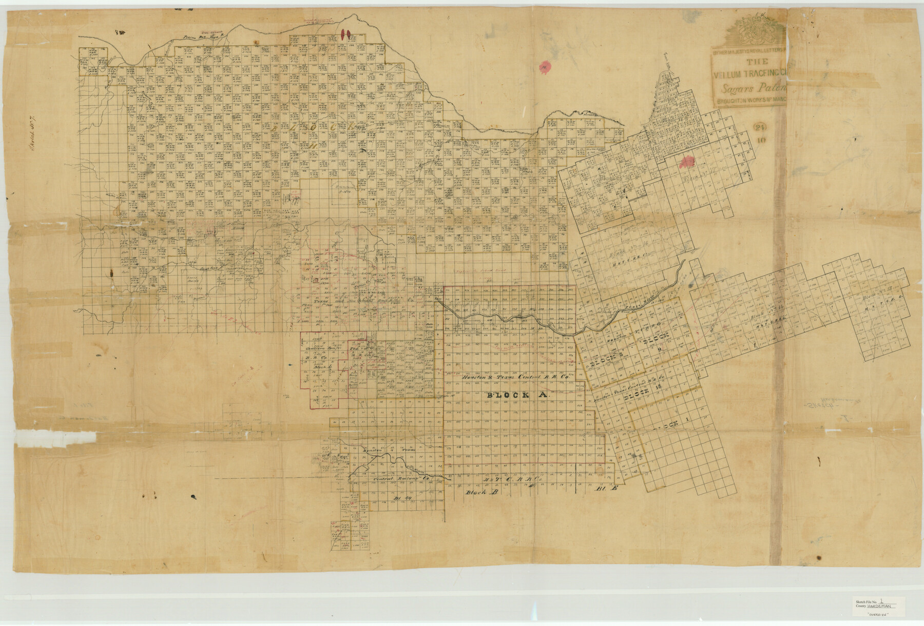
Hardeman County Sketch File 1
[Sketch of large area spanning the entire county as well as parts of adjacent counties]
-
Map/Doc
10477
-
Collection
General Map Collection
-
Counties
Hardeman Foard King Knox Wilbarger Cottle Childress Hall
-
Subjects
Surveying Sketch File
-
Height x Width
31.0 x 45.7 inches
78.7 x 116.1 cm
-
Medium
paper, manuscript
-
Features
Shirley's Creek
Robinson's Creek
Prairie Dog Town River
Thornton's Creek
North Fork of Wichita River
North Wichita River
Dixie Mountain
Pool Creek
Mollie's Creek
Deyman's Creek
South Fork of Pease River
Pease River
Conklin's Creek
Jayne's Creek
Buffalo Creek
Wanderer's Creek
Burr's Creek
Groesbeeck's [sic] Creek
White's Creek
Hutchin's Creek
Baker's Creek
Normwood [sic] Springs
Flour's Creek
Ross Creek
Part of: General Map Collection
Anderson County

Print $40.00
- Digital $50.00
Anderson County
1942
Size 54.8 x 48.8 inches
Map/Doc 95415
Uvalde County Sketch File 16

Print $14.00
- Digital $50.00
Uvalde County Sketch File 16
1876
Size 12.8 x 8.4 inches
Map/Doc 38988
Harris County NRC Article 33.136 Sketch 11

Print $28.00
- Digital $50.00
Harris County NRC Article 33.136 Sketch 11
2007
Size 24.0 x 36.0 inches
Map/Doc 94658
Polk County Working Sketch 12

Print $20.00
- Digital $50.00
Polk County Working Sketch 12
1942
Size 26.6 x 17.3 inches
Map/Doc 71627
Webb County Sketch File 8

Print $4.00
- Digital $50.00
Webb County Sketch File 8
1875
Size 8.3 x 8.7 inches
Map/Doc 39741
[Map to illustrate possible mineral resources on the lands belonging to the University of Texas]
![62963, [Map to illustrate possible mineral resources on the lands belonging to the University of Texas], General Map Collection](https://historictexasmaps.com/wmedia_w700/maps/62963.tif.jpg)
Print $2.00
- Digital $50.00
[Map to illustrate possible mineral resources on the lands belonging to the University of Texas]
Size 10.2 x 7.7 inches
Map/Doc 62963
Greer County Sketch File 4

Print $4.00
- Digital $50.00
Greer County Sketch File 4
1883
Size 8.6 x 5.5 inches
Map/Doc 24519
[Surveys along Neils and Turkey Creeks]
![69761, [Surveys along Neils and Turkey Creeks], General Map Collection](https://historictexasmaps.com/wmedia_w700/maps/69761.tif.jpg)
Print $2.00
- Digital $50.00
[Surveys along Neils and Turkey Creeks]
1846
Size 10.8 x 7.9 inches
Map/Doc 69761
Maps & Lists Showing Prison Lands (Oil & Gas) Leased as of June 1955

Digital $50.00
Maps & Lists Showing Prison Lands (Oil & Gas) Leased as of June 1955
Size 11.4 x 7.1 inches
Map/Doc 62865
Gaines County Sketch File 12

Print $4.00
- Digital $50.00
Gaines County Sketch File 12
1950
Size 14.3 x 8.8 inches
Map/Doc 23198
Bosque County Working Sketch 2

Print $20.00
- Digital $50.00
Bosque County Working Sketch 2
Size 19.7 x 19.6 inches
Map/Doc 67435
Flight Mission No. BRE-4P, Frame 168, Nueces County

Print $20.00
- Digital $50.00
Flight Mission No. BRE-4P, Frame 168, Nueces County
1956
Size 18.7 x 22.6 inches
Map/Doc 86831
You may also like
Pecos County Working Sketch 61

Print $20.00
- Digital $50.00
Pecos County Working Sketch 61
1952
Size 28.4 x 22.7 inches
Map/Doc 71533
Harris County Working Sketch 69

Print $20.00
- Digital $50.00
Harris County Working Sketch 69
1956
Size 32.7 x 28.2 inches
Map/Doc 65961
Coke County Rolled Sketch 16

Print $20.00
- Digital $50.00
Coke County Rolled Sketch 16
1950
Size 44.0 x 34.3 inches
Map/Doc 8630
Lampasas County Sketch File 21

Print $14.00
- Digital $50.00
Lampasas County Sketch File 21
2001
Size 14.2 x 8.8 inches
Map/Doc 29436
Webb County Working Sketch 90

Print $20.00
- Digital $50.00
Webb County Working Sketch 90
1982
Size 26.9 x 25.5 inches
Map/Doc 72457
El Paso County Sketch File 19

Print $30.00
- Digital $50.00
El Paso County Sketch File 19
1905
Size 13.3 x 8.7 inches
Map/Doc 22009
McMullen County Rolled Sketch 21

Print $40.00
- Digital $50.00
McMullen County Rolled Sketch 21
Size 68.9 x 40.0 inches
Map/Doc 9502

Reeves County Working Sketch 43

Print $20.00
- Digital $50.00
Reeves County Working Sketch 43
1974
Size 43.2 x 37.1 inches
Map/Doc 63486
Map of Wichita County

Print $20.00
- Digital $50.00
Map of Wichita County
1874
Size 22.8 x 21.0 inches
Map/Doc 4142
Culberson County Rolled Sketch 37

Print $20.00
- Digital $50.00
Culberson County Rolled Sketch 37
Size 29.5 x 24.6 inches
Map/Doc 78464
Current Miscellaneous File 16

Print $20.00
- Digital $50.00
Current Miscellaneous File 16
1951
Size 10.7 x 8.2 inches
Map/Doc 73830