[Surveys in the Bexar District along the Guadalupe River]
Print $3.00
- Digital $50.00
[Surveys in the Bexar District along the Guadalupe River]
1841
Size: 17.2 x 10.8 inches
124
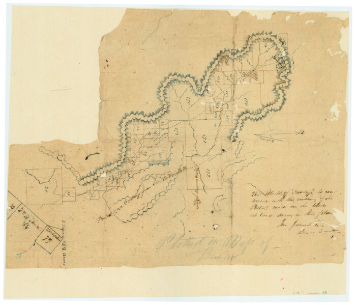
[Surveys in the Bexar District along the Guadalupe River and Cibolo Creek]
Print $20.00
- Digital $50.00
[Surveys in the Bexar District along the Guadalupe River and Cibolo Creek]
1846
Size: 9.6 x 18.3 inches
3169
[Surveys in the Bexar District along the Cibolo Creek]
Print $20.00
- Digital $50.00
[Surveys in the Bexar District along the Cibolo Creek]
1846
Size: 17.0 x 17.8 inches
86
[Surveys in the Bexar District along the Cibolo Creek]
Print $2.00
- Digital $50.00
[Surveys in the Bexar District along the Cibolo Creek]
1847
Size: 13.0 x 7.4 inches
98
[Surveys in the Bexar District along the Balcones, Cibolo and Leon Creeks]
Print $3.00
- Digital $50.00
[Surveys in the Bexar District along the Balcones, Cibolo and Leon Creeks]
1842
Size: 10.6 x 12.4 inches
63
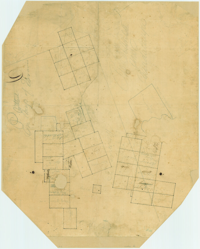
[Surveys along the Guadalupe River and Blanco Creek]
Print $20.00
- Digital $50.00
[Surveys along the Guadalupe River and Blanco Creek]
Size: 19.5 x 15.7 inches
45
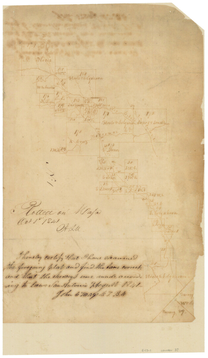
[Surveys along the Cibolo, Balcones and Leon Creeks]
Print $2.00
- Digital $50.00
[Surveys along the Cibolo, Balcones and Leon Creeks]
1841
Size: 13.3 x 7.8 inches
37
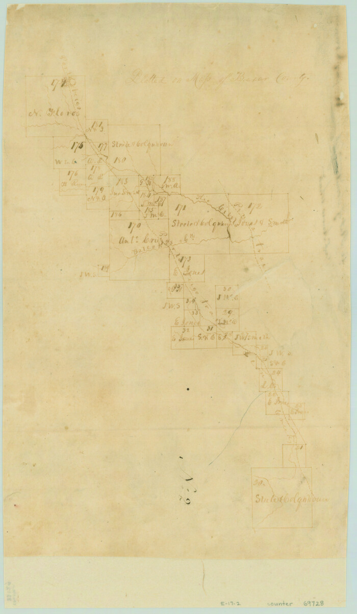
[Surveys along the Cibolo, Balcones and Leon Creeks]
Print $20.00
- Digital $50.00
[Surveys along the Cibolo, Balcones and Leon Creeks]
1841
Size: 14.5 x 21.0 inches
69728
[San Antonio & Aransas Pass Railway Co.]
Print $20.00
- Digital $50.00
[San Antonio & Aransas Pass Railway Co.]
Size: 18.5 x 29.4 inches
64260
[San Antonio & Aransas Pass Railway Co.]
Print $20.00
- Digital $50.00
[San Antonio & Aransas Pass Railway Co.]
Size: 22.9 x 35.1 inches
64261
[San Antonio & Aransas Pass Railway Co.]
Print $40.00
- Digital $50.00
[San Antonio & Aransas Pass Railway Co.]
Size: 15.7 x 86.4 inches
64262
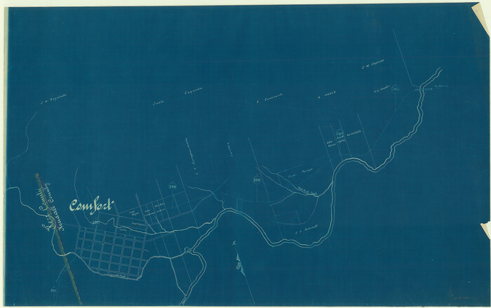
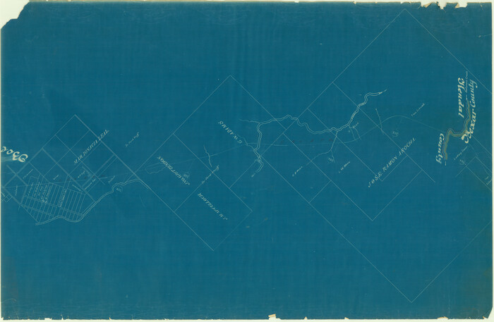
[Map showing S. A. & A. P. Ry. from San Antonio to Kendall County line]
Print $40.00
- Digital $50.00
[Map showing S. A. & A. P. Ry. from San Antonio to Kendall County line]
1895
Size: 25.5 x 70.7 inches
64255
Water-Shed of the Colorado River

Print $40.00
- Digital $50.00
Water-Shed of the Colorado River
1925
Size: 37.1 x 79.8 inches
65261
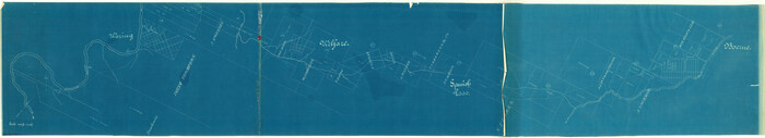
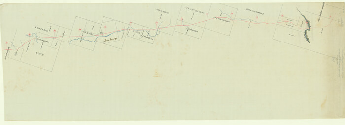
Right of Way & Track Map, San Antonio & Aransas Pass Railway Co.

Print $40.00
- Digital $50.00
Right of Way & Track Map, San Antonio & Aransas Pass Railway Co.
1919
Size: 25.3 x 56.5 inches
64213
Map of Kendall County, Texas

Print $20.00
- Digital $50.00
Map of Kendall County, Texas
1879
Size: 20.3 x 20.6 inches
533
Map of Kendall County

Print $20.00
- Digital $50.00
Map of Kendall County
1879
Size: 20.4 x 20.8 inches
3752
Map of Kendall County

Print $20.00
- Digital $50.00
Map of Kendall County
1862
Size: 21.0 x 20.0 inches
3754
Map of Kendall County

Print $20.00
- Digital $50.00
Map of Kendall County
1899
Size: 37.9 x 33.9 inches
4678
Map of Kendall County

Print $20.00
- Digital $50.00
Map of Kendall County
1899
Size: 36.7 x 34.4 inches
4999
Map of Kendall County

Print $20.00
- Digital $50.00
Map of Kendall County
1899
Size: 36.8 x 34.2 inches
66887
Kerr County Working Sketch 7

Print $20.00
- Digital $50.00
Kerr County Working Sketch 7
1947
Size: 38.9 x 30.8 inches
70038
Kerr County Sketch File 2

Print $8.00
- Digital $50.00
Kerr County Sketch File 2
1859
Size: 10.5 x 7.5 inches
28856
Kerr County Sketch File 1d

Print $6.00
- Digital $50.00
Kerr County Sketch File 1d
1856
Size: 8.1 x 7.6 inches
28853
Kerr County Sketch File 1c

Print $4.00
- Digital $50.00
Kerr County Sketch File 1c
1951
Size: 12.3 x 8.3 inches
28851
Kerr County Sketch File 18

Print $20.00
- Digital $50.00
Kerr County Sketch File 18
1950
Size: 16.9 x 20.3 inches
11921
Kerr County Sketch File 14

Print $20.00
- Digital $50.00
Kerr County Sketch File 14
Size: 14.9 x 17.8 inches
11918
Kendall County Working Sketch Graphic Index

Print $20.00
- Digital $50.00
Kendall County Working Sketch Graphic Index
1946
Size: 40.3 x 34.8 inches
76602
Kendall County Working Sketch 9

Print $40.00
- Digital $50.00
Kendall County Working Sketch 9
1953
Size: 52.8 x 37.2 inches
66681
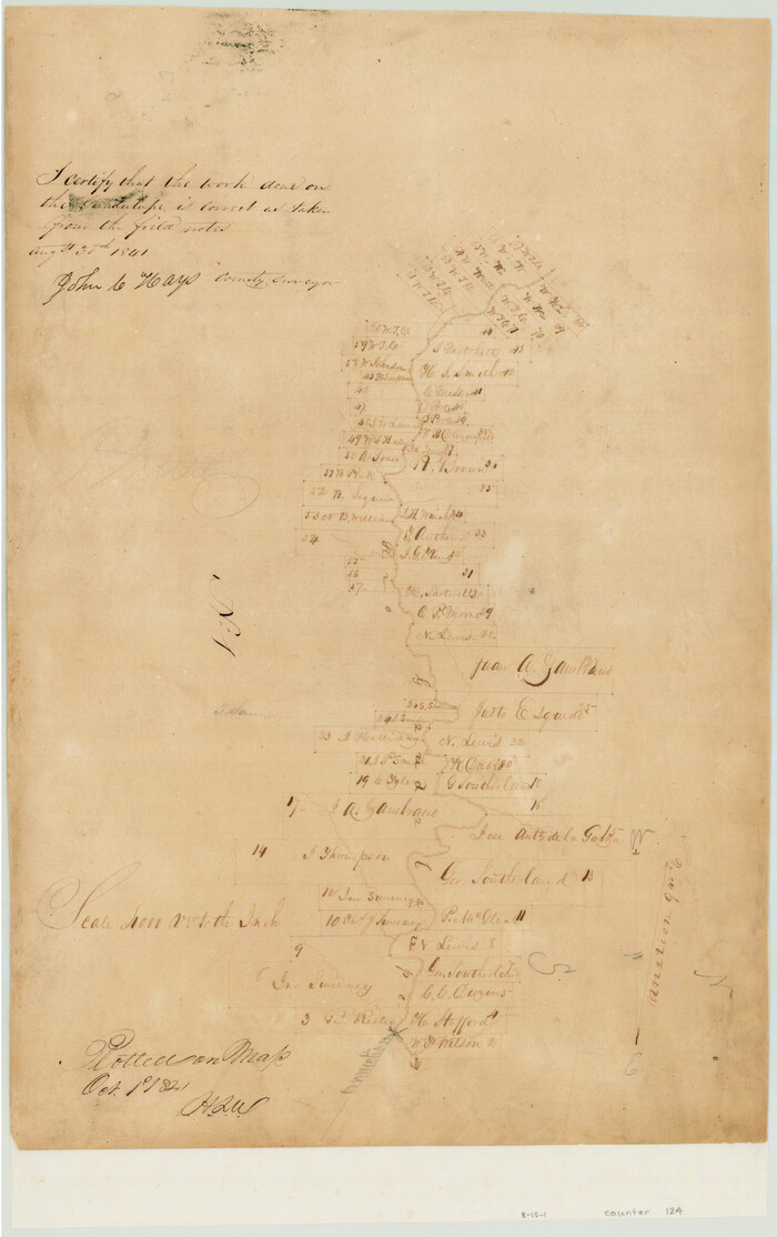
[Surveys in the Bexar District along the Guadalupe River]
Print $3.00
- Digital $50.00
[Surveys in the Bexar District along the Guadalupe River]
1841
-
Size
17.2 x 10.8 inches
-
Map/Doc
124
-
Creation Date
1841
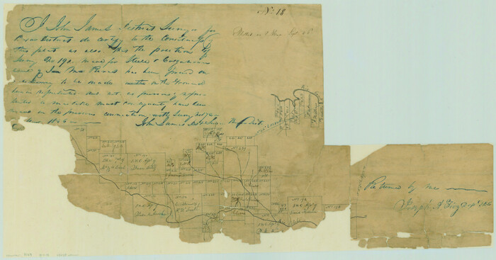
[Surveys in the Bexar District along the Guadalupe River and Cibolo Creek]
Print $20.00
- Digital $50.00
[Surveys in the Bexar District along the Guadalupe River and Cibolo Creek]
1846
-
Size
9.6 x 18.3 inches
-
Map/Doc
3169
-
Creation Date
1846
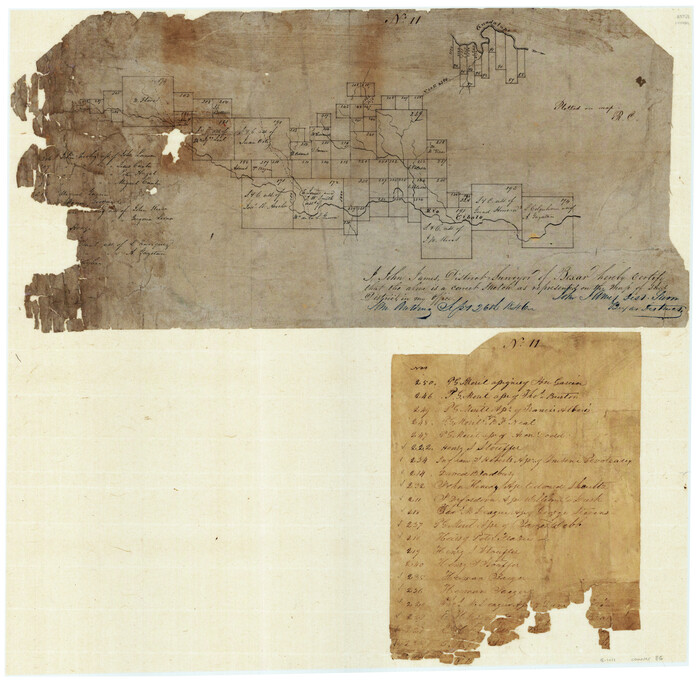
[Surveys in the Bexar District along the Cibolo Creek]
Print $20.00
- Digital $50.00
[Surveys in the Bexar District along the Cibolo Creek]
1846
-
Size
17.0 x 17.8 inches
-
Map/Doc
86
-
Creation Date
1846
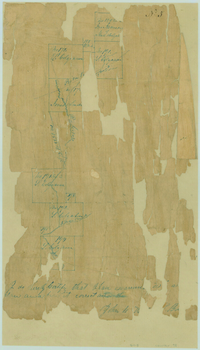
[Surveys in the Bexar District along the Cibolo Creek]
Print $2.00
- Digital $50.00
[Surveys in the Bexar District along the Cibolo Creek]
1847
-
Size
13.0 x 7.4 inches
-
Map/Doc
98
-
Creation Date
1847
[Surveys in the Bexar District along the Balcones, Cibolo and Leon Creeks]
Print $3.00
- Digital $50.00
[Surveys in the Bexar District along the Balcones, Cibolo and Leon Creeks]
1842
-
Size
10.6 x 12.4 inches
-
Map/Doc
63
-
Creation Date
1842
[Surveys along the Guadalupe River and Blanco Creek]
Print $20.00
- Digital $50.00
[Surveys along the Guadalupe River and Blanco Creek]
-
Size
19.5 x 15.7 inches
-
Map/Doc
45
[Surveys along the Cibolo, Balcones and Leon Creeks]
Print $2.00
- Digital $50.00
[Surveys along the Cibolo, Balcones and Leon Creeks]
1841
-
Size
13.3 x 7.8 inches
-
Map/Doc
37
-
Creation Date
1841
[Surveys along the Cibolo, Balcones and Leon Creeks]
Print $20.00
- Digital $50.00
[Surveys along the Cibolo, Balcones and Leon Creeks]
1841
-
Size
14.5 x 21.0 inches
-
Map/Doc
69728
-
Creation Date
1841
[San Antonio & Aransas Pass Railway Co.]
Print $20.00
- Digital $50.00
[San Antonio & Aransas Pass Railway Co.]
-
Size
18.5 x 29.4 inches
-
Map/Doc
64260
[San Antonio & Aransas Pass Railway Co.]
Print $20.00
- Digital $50.00
[San Antonio & Aransas Pass Railway Co.]
-
Size
22.9 x 35.1 inches
-
Map/Doc
64261
[San Antonio & Aransas Pass Railway Co.]
Print $40.00
- Digital $50.00
[San Antonio & Aransas Pass Railway Co.]
-
Size
15.7 x 86.4 inches
-
Map/Doc
64262
[Map showing S. A. & A. P. Ry. from San Antonio to Kendall County line]
Print $40.00
- Digital $50.00
[Map showing S. A. & A. P. Ry. from San Antonio to Kendall County line]
1895
-
Size
25.5 x 70.7 inches
-
Map/Doc
64255
-
Creation Date
1895
Water-Shed of the Colorado River
Print $40.00
- Digital $50.00
Water-Shed of the Colorado River
1925
-
Size
37.1 x 79.8 inches
-
Map/Doc
65261
-
Creation Date
1925
Texas Hill Country Trail Region

Texas Hill Country Trail Region
2017
-
Size
18.2 x 24.3 inches
-
Map/Doc
96871
-
Creation Date
2017
Texas Hill Country Trail Region

Texas Hill Country Trail Region
-
Size
18.1 x 24.2 inches
-
Map/Doc
96872
Right of Way & Track Map, San Antonio & Aransas Pass Railway Co.
Print $40.00
- Digital $50.00
Right of Way & Track Map, San Antonio & Aransas Pass Railway Co.
1919
-
Size
25.3 x 56.5 inches
-
Map/Doc
64213
-
Creation Date
1919
Map of Kendall County, Texas
Print $20.00
- Digital $50.00
Map of Kendall County, Texas
1879
-
Size
20.3 x 20.6 inches
-
Map/Doc
533
-
Creation Date
1879
Map of Kendall County
Print $20.00
- Digital $50.00
Map of Kendall County
1879
-
Size
20.4 x 20.8 inches
-
Map/Doc
3752
-
Creation Date
1879
Map of Kendall County
Print $20.00
- Digital $50.00
Map of Kendall County
1862
-
Size
21.0 x 20.0 inches
-
Map/Doc
3754
-
Creation Date
1862
Map of Kendall County
Print $20.00
- Digital $50.00
Map of Kendall County
1899
-
Size
37.9 x 33.9 inches
-
Map/Doc
4678
-
Creation Date
1899
Map of Kendall County
Print $20.00
- Digital $50.00
Map of Kendall County
1899
-
Size
36.7 x 34.4 inches
-
Map/Doc
4999
-
Creation Date
1899
Map of Kendall County
Print $20.00
- Digital $50.00
Map of Kendall County
1899
-
Size
36.8 x 34.2 inches
-
Map/Doc
66887
-
Creation Date
1899
Kerr County Working Sketch 7
Print $20.00
- Digital $50.00
Kerr County Working Sketch 7
1947
-
Size
38.9 x 30.8 inches
-
Map/Doc
70038
-
Creation Date
1947
Kerr County Sketch File 2
Print $8.00
- Digital $50.00
Kerr County Sketch File 2
1859
-
Size
10.5 x 7.5 inches
-
Map/Doc
28856
-
Creation Date
1859
Kerr County Sketch File 1d
Print $6.00
- Digital $50.00
Kerr County Sketch File 1d
1856
-
Size
8.1 x 7.6 inches
-
Map/Doc
28853
-
Creation Date
1856
Kerr County Sketch File 1c
Print $4.00
- Digital $50.00
Kerr County Sketch File 1c
1951
-
Size
12.3 x 8.3 inches
-
Map/Doc
28851
-
Creation Date
1951
Kerr County Sketch File 18
Print $20.00
- Digital $50.00
Kerr County Sketch File 18
1950
-
Size
16.9 x 20.3 inches
-
Map/Doc
11921
-
Creation Date
1950
Kerr County Sketch File 14
Print $20.00
- Digital $50.00
Kerr County Sketch File 14
-
Size
14.9 x 17.8 inches
-
Map/Doc
11918
Kendall County Working Sketch Graphic Index
Print $20.00
- Digital $50.00
Kendall County Working Sketch Graphic Index
1946
-
Size
40.3 x 34.8 inches
-
Map/Doc
76602
-
Creation Date
1946
Kendall County Working Sketch 9
Print $40.00
- Digital $50.00
Kendall County Working Sketch 9
1953
-
Size
52.8 x 37.2 inches
-
Map/Doc
66681
-
Creation Date
1953