A New Map of Texas with the Contiguous American & Mexican States

Print $20.00
A New Map of Texas with the Contiguous American & Mexican States
1835
Size: 13.5 x 16.1 inches
76185
Map of the City of Galveston, situated on the East End of Galveston Island, Texas

Print $20.00
Map of the City of Galveston, situated on the East End of Galveston Island, Texas
1869
Size: 33.3 x 46.6 inches
76186
City of San Antonio, Texas

Print $20.00
City of San Antonio, Texas
1889
Size: 34.2 x 34.1 inches
76187
Missouri, Kansas, and Texas Railway

Print $20.00
Missouri, Kansas, and Texas Railway
1878
Size: 16.5 x 12.2 inches
76188
Mexico and Internal Provinces

Print $20.00
Mexico and Internal Provinces
1822
Size: 17.8 x 22.5 inches
76189
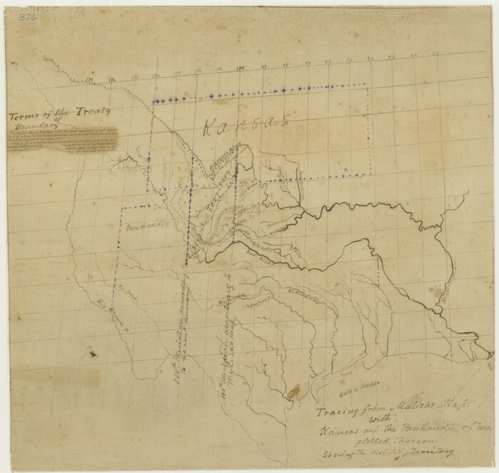
Tracing From [Melish's] Map with Kansas and the Panhandle of Texas plotted thereon Showing the disputed Territory
Print $20.00
Tracing From [Melish's] Map with Kansas and the Panhandle of Texas plotted thereon Showing the disputed Territory
1818
Size: 18.8 x 19.8 inches
76190
Map of Mexico, Texas, Old and New California, and Yucatan

Print $20.00
Map of Mexico, Texas, Old and New California, and Yucatan
1847
Size: 17.9 x 24.4 inches
76191
Richardson's New Map of the State of Texas Corrected for the Texas Almanac

Print $20.00
Richardson's New Map of the State of Texas Corrected for the Texas Almanac
1870
Size: 17.8 x 25.9 inches
76192
Map of Texas with Parts of the Adjoining States

Print $20.00
Map of Texas with Parts of the Adjoining States
1836
Size: 29.5 x 23.6 inches
76193
Mappa Geographica Regionem Mexicanam et Floridam, Terrasque adjacentes, ut et Anteriores Americae Insulas, Curfus itidem et Reditus Navigantuim verfus flumen Missisipi et alias Colonias ob oculos ponens, cura et fumptibus

Print $20.00
Mappa Geographica Regionem Mexicanam et Floridam, Terrasque adjacentes, ut et Anteriores Americae Insulas, Curfus itidem et Reditus Navigantuim verfus flumen Missisipi et alias Colonias ob oculos ponens, cura et fumptibus
1725
Size: 20.0 x 24.0 inches
76196
Map of Texas and the Countries Adjacent compiled in the Bureau of the Corps of Topographical Engineers from the Best Authorities

Print $20.00
Map of Texas and the Countries Adjacent compiled in the Bureau of the Corps of Topographical Engineers from the Best Authorities
1844
Size: 24.5 x 35.8 inches
76197
Map of Texas, compiled from surveys on record in the General Land Office of the Republic

Print $20.00
Map of Texas, compiled from surveys on record in the General Land Office of the Republic
1839
Size: 32.0 x 24.9 inches
76198
New Commercial Map of Texas

Print $20.00
New Commercial Map of Texas
1900
Size: 28.1 x 34.0 inches
76199
Mapa Original de Texas por El Ciudadano Estevan F. Austin Presentado al Exmo. Sr. Presidente por su autor 1829

Print $20.00
Mapa Original de Texas por El Ciudadano Estevan F. Austin Presentado al Exmo. Sr. Presidente por su autor 1829
1829
Size: 33.4 x 28.1 inches
76201
Phelps and Watson's Historical and Military Map of the Border and Southern States

Print $20.00
Phelps and Watson's Historical and Military Map of the Border and Southern States
1863
Size: 25.5 x 36.3 inches
76202
The City of Austin and Suburbs

Print $20.00
The City of Austin and Suburbs
1919
Size: 24.1 x 19.1 inches
76203
Plan of the City of Austin

Print $20.00
Plan of the City of Austin
1839
Size: 24.2 x 19.4 inches
76204
Partial View of Austin, Texas

Print $20.00
Partial View of Austin, Texas
1895
Size: 28.4 x 41.8 inches
76205
Plan of the City of Austin

Print $20.00
Plan of the City of Austin
1853
Size: 13.9 x 11.5 inches
76207
Pocket Map of the State of Texas reduced from their original map of the State and drawn by Chas. W. Pressler and A. B. Langermann

Print $20.00
Pocket Map of the State of Texas reduced from their original map of the State and drawn by Chas. W. Pressler and A. B. Langermann
1879
Size: 24.4 x 26.3 inches
76208
Map of Texas Compiled from surveys recorded in the General Land Office

Print $20.00
Map of Texas Compiled from surveys recorded in the General Land Office
1851
Size: 31.4 x 25.3 inches
76209
"Texas New Yorker's" Railroad Map of Texas

Print $20.00
"Texas New Yorker's" Railroad Map of Texas
1874
Size: 22.8 x 32.3 inches
76210
The Texas New Yorker's Map of the U. S. Accompanying the Map of Texas

Print $20.00
The Texas New Yorker's Map of the U. S. Accompanying the Map of Texas
1874
Size: 32.3 x 22.8 inches
76211
Preliminary Chart No. 31 of the Sea Coast of the United States from Galveston Bay to Matagorda Bay, Texas

Print $20.00
Preliminary Chart No. 31 of the Sea Coast of the United States from Galveston Bay to Matagorda Bay, Texas
1857
Size: 21.6 x 37.2 inches
76212
Railroad and County Map of Texas

Print $20.00
Railroad and County Map of Texas
1901
Size: 33.1 x 37.1 inches
76213
Special Map of the Great Southwest for Burke's Texas Almanac

Print $20.00
Special Map of the Great Southwest for Burke's Texas Almanac
1885
Size: 42.1 x 28.5 inches
76214
A New Map of Texas with the Contiguous American & Mexican States
Print $20.00
A New Map of Texas with the Contiguous American & Mexican States
1835
-
Size
13.5 x 16.1 inches
-
Map/Doc
76185
-
Creation Date
1835
Map of the City of Galveston, situated on the East End of Galveston Island, Texas
Print $20.00
Map of the City of Galveston, situated on the East End of Galveston Island, Texas
1869
-
Size
33.3 x 46.6 inches
-
Map/Doc
76186
-
Creation Date
1869
City of San Antonio, Texas
Print $20.00
City of San Antonio, Texas
1889
-
Size
34.2 x 34.1 inches
-
Map/Doc
76187
-
Creation Date
1889
Missouri, Kansas, and Texas Railway
Print $20.00
Missouri, Kansas, and Texas Railway
1878
-
Size
16.5 x 12.2 inches
-
Map/Doc
76188
-
Creation Date
1878
Mexico and Internal Provinces
Print $20.00
Mexico and Internal Provinces
1822
-
Size
17.8 x 22.5 inches
-
Map/Doc
76189
-
Creation Date
1822
Tracing From [Melish's] Map with Kansas and the Panhandle of Texas plotted thereon Showing the disputed Territory
Print $20.00
Tracing From [Melish's] Map with Kansas and the Panhandle of Texas plotted thereon Showing the disputed Territory
1818
-
Size
18.8 x 19.8 inches
-
Map/Doc
76190
-
Creation Date
1818
Map of Mexico, Texas, Old and New California, and Yucatan
Print $20.00
Map of Mexico, Texas, Old and New California, and Yucatan
1847
-
Size
17.9 x 24.4 inches
-
Map/Doc
76191
-
Creation Date
1847
Richardson's New Map of the State of Texas Corrected for the Texas Almanac
Print $20.00
Richardson's New Map of the State of Texas Corrected for the Texas Almanac
1870
-
Size
17.8 x 25.9 inches
-
Map/Doc
76192
-
Creation Date
1870
Map of Texas with Parts of the Adjoining States
Print $20.00
Map of Texas with Parts of the Adjoining States
1836
-
Size
29.5 x 23.6 inches
-
Map/Doc
76193
-
Creation Date
1836
Map of Texas

Print $20.00
Map of Texas
1910
-
Size
18.9 x 21.2 inches
-
Map/Doc
76194
-
Creation Date
1910
Houston Street Guide

Print $20.00
Houston Street Guide
1913
-
Size
26.5 x 30.0 inches
-
Map/Doc
76195
-
Creation Date
1913
Mappa Geographica Regionem Mexicanam et Floridam, Terrasque adjacentes, ut et Anteriores Americae Insulas, Curfus itidem et Reditus Navigantuim verfus flumen Missisipi et alias Colonias ob oculos ponens, cura et fumptibus
Print $20.00
Mappa Geographica Regionem Mexicanam et Floridam, Terrasque adjacentes, ut et Anteriores Americae Insulas, Curfus itidem et Reditus Navigantuim verfus flumen Missisipi et alias Colonias ob oculos ponens, cura et fumptibus
1725
-
Size
20.0 x 24.0 inches
-
Map/Doc
76196
-
Creation Date
1725
Map of Texas and the Countries Adjacent compiled in the Bureau of the Corps of Topographical Engineers from the Best Authorities
Print $20.00
Map of Texas and the Countries Adjacent compiled in the Bureau of the Corps of Topographical Engineers from the Best Authorities
1844
-
Size
24.5 x 35.8 inches
-
Map/Doc
76197
-
Creation Date
1844
Map of Texas, compiled from surveys on record in the General Land Office of the Republic
Print $20.00
Map of Texas, compiled from surveys on record in the General Land Office of the Republic
1839
-
Size
32.0 x 24.9 inches
-
Map/Doc
76198
-
Creation Date
1839
New Commercial Map of Texas
Print $20.00
New Commercial Map of Texas
1900
-
Size
28.1 x 34.0 inches
-
Map/Doc
76199
-
Creation Date
1900
Map of the Rio Grande

Print $20.00
Map of the Rio Grande
1878
-
Size
21.4 x 24.3 inches
-
Map/Doc
76200
-
Creation Date
1878
Mapa Original de Texas por El Ciudadano Estevan F. Austin Presentado al Exmo. Sr. Presidente por su autor 1829
Print $20.00
Mapa Original de Texas por El Ciudadano Estevan F. Austin Presentado al Exmo. Sr. Presidente por su autor 1829
1829
-
Size
33.4 x 28.1 inches
-
Map/Doc
76201
-
Creation Date
1829
Phelps and Watson's Historical and Military Map of the Border and Southern States
Print $20.00
Phelps and Watson's Historical and Military Map of the Border and Southern States
1863
-
Size
25.5 x 36.3 inches
-
Map/Doc
76202
-
Creation Date
1863
The City of Austin and Suburbs
Print $20.00
The City of Austin and Suburbs
1919
-
Size
24.1 x 19.1 inches
-
Map/Doc
76203
-
Creation Date
1919
Plan of the City of Austin
Print $20.00
Plan of the City of Austin
1839
-
Size
24.2 x 19.4 inches
-
Map/Doc
76204
-
Creation Date
1839
Partial View of Austin, Texas
Print $20.00
Partial View of Austin, Texas
1895
-
Size
28.4 x 41.8 inches
-
Map/Doc
76205
-
Creation Date
1895
Map of Hyde Park

Print $20.00
- Digital $50.00
Map of Hyde Park
1895
-
Size
41.7 x 28.8 inches
-
Map/Doc
76206
-
Creation Date
1895
Plan of the City of Austin
Print $20.00
Plan of the City of Austin
1853
-
Size
13.9 x 11.5 inches
-
Map/Doc
76207
-
Creation Date
1853
Pocket Map of the State of Texas reduced from their original map of the State and drawn by Chas. W. Pressler and A. B. Langermann
Print $20.00
Pocket Map of the State of Texas reduced from their original map of the State and drawn by Chas. W. Pressler and A. B. Langermann
1879
-
Size
24.4 x 26.3 inches
-
Map/Doc
76208
-
Creation Date
1879
Map of Texas Compiled from surveys recorded in the General Land Office
Print $20.00
Map of Texas Compiled from surveys recorded in the General Land Office
1851
-
Size
31.4 x 25.3 inches
-
Map/Doc
76209
-
Creation Date
1851
"Texas New Yorker's" Railroad Map of Texas
Print $20.00
"Texas New Yorker's" Railroad Map of Texas
1874
-
Size
22.8 x 32.3 inches
-
Map/Doc
76210
-
Creation Date
1874
The Texas New Yorker's Map of the U. S. Accompanying the Map of Texas
Print $20.00
The Texas New Yorker's Map of the U. S. Accompanying the Map of Texas
1874
-
Size
32.3 x 22.8 inches
-
Map/Doc
76211
-
Creation Date
1874
Preliminary Chart No. 31 of the Sea Coast of the United States from Galveston Bay to Matagorda Bay, Texas
Print $20.00
Preliminary Chart No. 31 of the Sea Coast of the United States from Galveston Bay to Matagorda Bay, Texas
1857
-
Size
21.6 x 37.2 inches
-
Map/Doc
76212
-
Creation Date
1857
Railroad and County Map of Texas
Print $20.00
Railroad and County Map of Texas
1901
-
Size
33.1 x 37.1 inches
-
Map/Doc
76213
-
Creation Date
1901
Special Map of the Great Southwest for Burke's Texas Almanac
Print $20.00
Special Map of the Great Southwest for Burke's Texas Almanac
1885
-
Size
42.1 x 28.5 inches
-
Map/Doc
76214
-
Creation Date
1885