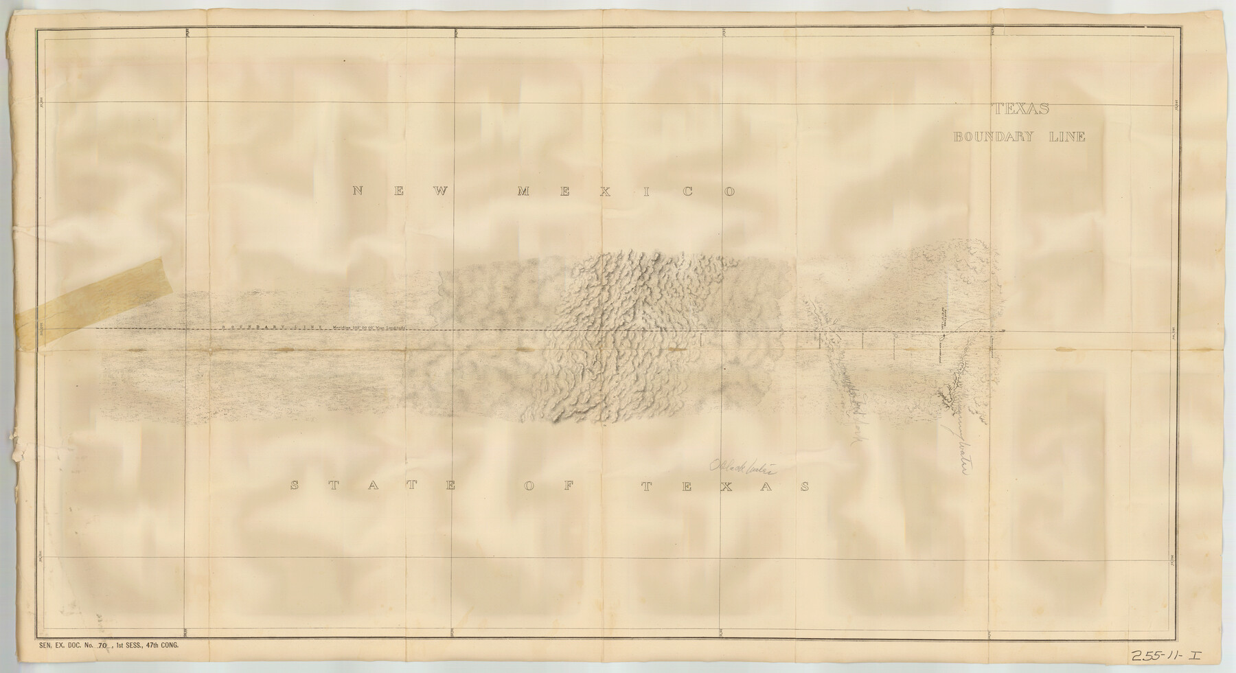
Texas Boundary Line
255-11-I
-
Map/Doc
92078
-
Collection
Twichell Survey Records
-
People and Organizations
Department of the Interior (Surveyor/Engineer)
-
Height x Width
21.6 x 11.9 inches
54.9 x 30.2 cm
-
Comments
See counters 92068 to 92082 for complete set of these boundary maps (sheet K not among maps received with collection).
Part of: Twichell Survey Records
General Highway Map of Gaines County, Texas

Print $20.00
- Digital $50.00
General Highway Map of Gaines County, Texas
1951
Size 19.0 x 26.2 inches
Map/Doc 92644
Gordon Addition to Idalou

Print $20.00
- Digital $50.00
Gordon Addition to Idalou
1954
Size 22.6 x 10.8 inches
Map/Doc 92827
Plat Showing Land Owned by City of Lubbock out of Section 3, Block O

Print $20.00
- Digital $50.00
Plat Showing Land Owned by City of Lubbock out of Section 3, Block O
Size 40.4 x 31.1 inches
Map/Doc 92876
[Sketch showing Block M-3]
![91707, [Sketch showing Block M-3], Twichell Survey Records](https://historictexasmaps.com/wmedia_w700/maps/91707-1.tif.jpg)
Print $2.00
- Digital $50.00
[Sketch showing Block M-3]
Size 14.4 x 6.6 inches
Map/Doc 91707
Sketch showing Damon's Mound and adjacent surveys

Print $20.00
- Digital $50.00
Sketch showing Damon's Mound and adjacent surveys
Size 19.4 x 17.7 inches
Map/Doc 90218
[T. & P. Block 35, Townships 1N - 5N]
![93138, [T. & P. Block 35, Townships 1N - 5N], Twichell Survey Records](https://historictexasmaps.com/wmedia_w700/maps/93138-1.tif.jpg)
Print $40.00
- Digital $50.00
[T. & P. Block 35, Townships 1N - 5N]
Size 23.8 x 87.2 inches
Map/Doc 93138
[Sketch showing H. T. & B. RR. Co. Sections 125 and 126, B. H. Epperson, Mary Fury, Henry Rogers and Wm. H. Sergeant]
![90882, [Sketch showing H. T. & B. RR. Co. Sections 125 and 126, B. H. Epperson, Mary Fury, Henry Rogers and Wm. H. Sergeant], Twichell Survey Records](https://historictexasmaps.com/wmedia_w700/maps/90882-1.tif.jpg)
Print $20.00
- Digital $50.00
[Sketch showing H. T. & B. RR. Co. Sections 125 and 126, B. H. Epperson, Mary Fury, Henry Rogers and Wm. H. Sergeant]
Size 14.5 x 19.4 inches
Map/Doc 90882
[Sketch of area just south of Levi Pruitt survey]
![91855, [Sketch of area just south of Levi Pruitt survey], Twichell Survey Records](https://historictexasmaps.com/wmedia_w700/maps/91855-1.tif.jpg)
Print $20.00
- Digital $50.00
[Sketch of area just south of Levi Pruitt survey]
1924
Size 17.0 x 17.8 inches
Map/Doc 91855
[Block 6T, Portions of Blocks 44, 2T, and 3T, and vicinity]
![91526, [Block 6T, Portions of Blocks 44, 2T, and 3T, and vicinity], Twichell Survey Records](https://historictexasmaps.com/wmedia_w700/maps/91526-1.tif.jpg)
Print $20.00
- Digital $50.00
[Block 6T, Portions of Blocks 44, 2T, and 3T, and vicinity]
Size 14.2 x 15.9 inches
Map/Doc 91526
Borden County Working Sketch of Geo. Spiller's Resurvey of Block 97 made in 1887

Print $3.00
- Digital $50.00
Borden County Working Sketch of Geo. Spiller's Resurvey of Block 97 made in 1887
1903
Size 10.1 x 16.6 inches
Map/Doc 90211
[Southwest 1/4 of Northwest 1/4 of County in vicinity of surveys 1281, 1282, 1297 and 1302]
![90897, [Southwest 1/4 of Northwest 1/4 of County in vicinity of surveys 1281, 1282, 1297 and 1302], Twichell Survey Records](https://historictexasmaps.com/wmedia_w700/maps/90897-1.tif.jpg)
Print $20.00
- Digital $50.00
[Southwest 1/4 of Northwest 1/4 of County in vicinity of surveys 1281, 1282, 1297 and 1302]
Size 21.5 x 14.2 inches
Map/Doc 90897
[Block RG, Sections 1, 2, and 16, North Line of San Augustine County School Land]
![91392, [Block RG, Sections 1, 2, and 16, North Line of San Augustine County School Land], Twichell Survey Records](https://historictexasmaps.com/wmedia_w700/maps/91392-1.tif.jpg)
Print $20.00
- Digital $50.00
[Block RG, Sections 1, 2, and 16, North Line of San Augustine County School Land]
Size 25.7 x 12.4 inches
Map/Doc 91392
You may also like
Kinney County Sketch File B

Print $8.00
- Digital $50.00
Kinney County Sketch File B
1873
Size 11.9 x 8.1 inches
Map/Doc 29119
Culberson County Sketch File 22

Print $6.00
- Digital $50.00
Culberson County Sketch File 22
1934
Size 11.8 x 8.8 inches
Map/Doc 20234
Liberty County Rolled Sketch M

Print $40.00
- Digital $50.00
Liberty County Rolled Sketch M
1953
Size 23.6 x 56.6 inches
Map/Doc 10651

Etats-Unis de l'Amérique Septentrionale avec les Isles Royale, de Terre Neuve de St. Jean, L'Acadie &c.

Print $20.00
- Digital $50.00
Etats-Unis de l'Amérique Septentrionale avec les Isles Royale, de Terre Neuve de St. Jean, L'Acadie &c.
1785
Size 20.9 x 28.2 inches
Map/Doc 93679
Red River County Working Sketch 19

Print $40.00
- Digital $50.00
Red River County Working Sketch 19
1955
Size 55.0 x 38.6 inches
Map/Doc 72002
Val Verde County Rolled Sketch 45

Print $20.00
- Digital $50.00
Val Verde County Rolled Sketch 45
Size 20.8 x 23.1 inches
Map/Doc 8118
Andrews County Working Sketch 6

Print $20.00
- Digital $50.00
Andrews County Working Sketch 6
1954
Size 18.4 x 42.9 inches
Map/Doc 67052
Live Oak County Working Sketch 28

Print $20.00
- Digital $50.00
Live Oak County Working Sketch 28
1982
Size 33.3 x 21.1 inches
Map/Doc 70613
Colton's New Map of the State of Texas Compiled from J. DeCordova's large Map

Print $20.00
Colton's New Map of the State of Texas Compiled from J. DeCordova's large Map
1858
Size 17.0 x 26.2 inches
Map/Doc 79736
Pecos County Working Sketch 73

Print $40.00
- Digital $50.00
Pecos County Working Sketch 73
1957
Size 110.6 x 38.7 inches
Map/Doc 71545
University Land Field Notes for Blocks 19 and 20 in Pecos County

University Land Field Notes for Blocks 19 and 20 in Pecos County
Map/Doc 81724