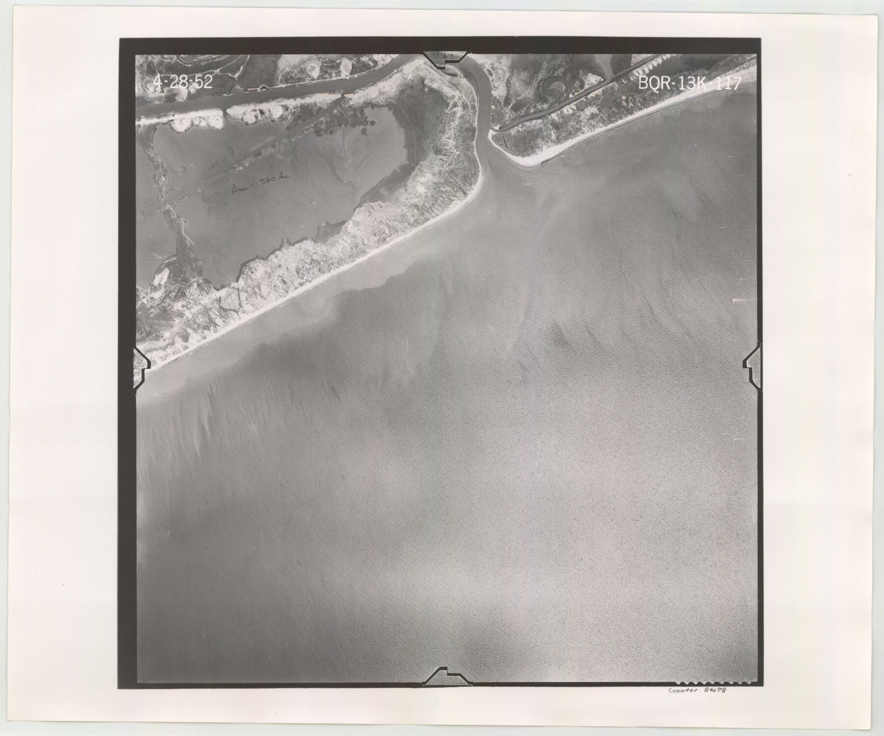
Flight Mission No. BQR-13K, Frame 117, Brazoria County
BQR-13K-117
-
Map/Doc
84078
-
Collection
General Map Collection
-
Object Dates
1952/4/28 (Creation Date)
-
People and Organizations
U. S. Department of Agriculture (Publisher)
-
Counties
Brazoria
-
Subjects
Aerial Photograph
-
Height x Width
18.6 x 22.4 inches
47.2 x 56.9 cm
-
Comments
Flown by Aero Exploration Company of Tulsa, Oklahoma.
Part of: General Map Collection
Kimble County Working Sketch 10

Print $20.00
- Digital $50.00
Kimble County Working Sketch 10
1921
Size 14.7 x 15.5 inches
Map/Doc 70078
Victoria County Rolled Sketch 1

Print $20.00
- Digital $50.00
Victoria County Rolled Sketch 1
1902
Size 20.5 x 17.5 inches
Map/Doc 8150
Harris County Working Sketch 24

Print $20.00
- Digital $50.00
Harris County Working Sketch 24
1928
Size 29.3 x 15.9 inches
Map/Doc 65916
Real County Working Sketch 31

Print $20.00
- Digital $50.00
Real County Working Sketch 31
1948
Size 20.2 x 25.2 inches
Map/Doc 71923
State University and PSL Blocks 1 through 77 in Andrews, Culberson, Crane, Ector, El Paso, Gaines, Loving, Martin, Reeves, Tom Green, Ward County, and Winkler Counties

State University and PSL Blocks 1 through 77 in Andrews, Culberson, Crane, Ector, El Paso, Gaines, Loving, Martin, Reeves, Tom Green, Ward County, and Winkler Counties
Map/Doc 81652
Dawson County Rolled Sketch 6

Print $20.00
- Digital $50.00
Dawson County Rolled Sketch 6
1913
Size 22.0 x 30.1 inches
Map/Doc 8771

Culberson County Sketch File RJ

Print $20.00
- Digital $50.00
Culberson County Sketch File RJ
1927
Size 16.9 x 24.4 inches
Map/Doc 5789
Montgomery County Sketch File 4

Print $8.00
- Digital $50.00
Montgomery County Sketch File 4
1854
Size 12.0 x 8.1 inches
Map/Doc 31775
Midland County Working Sketch 21

Print $40.00
- Digital $50.00
Midland County Working Sketch 21
1956
Size 69.0 x 27.9 inches
Map/Doc 71002
[Surveys on the Trinity River]
![342, [Surveys on the Trinity River], General Map Collection](https://historictexasmaps.com/wmedia_w700/maps/342.tif.jpg)
Print $2.00
- Digital $50.00
[Surveys on the Trinity River]
Size 6.6 x 4.6 inches
Map/Doc 342
Hardin County Sketch File 14

Print $4.00
- Digital $50.00
Hardin County Sketch File 14
1866
Size 13.0 x 8.0 inches
Map/Doc 25120
You may also like
Uvalde County Sketch File 17

Print $20.00
- Digital $50.00
Uvalde County Sketch File 17
1882
Size 17.5 x 17.9 inches
Map/Doc 12531
Wilson County Working Sketch 3

Print $20.00
- Digital $50.00
Wilson County Working Sketch 3
1952
Size 33.6 x 33.2 inches
Map/Doc 72583
Denton County Sketch File 42

Print $4.00
- Digital $50.00
Denton County Sketch File 42
1960
Size 11.4 x 8.9 inches
Map/Doc 20792
United States - Gulf Coast Texas - Southern part of Laguna Madre

Print $20.00
- Digital $50.00
United States - Gulf Coast Texas - Southern part of Laguna Madre
1941
Size 18.4 x 27.5 inches
Map/Doc 72948
Events of the Texas Revolution

Events of the Texas Revolution
2023
Size 8.5 x 11.0 inches
Map/Doc 97188
Baylor County Sketch File 10A

Print $40.00
- Digital $50.00
Baylor County Sketch File 10A
Size 19.6 x 29.0 inches
Map/Doc 10905
Medina County Working Sketch Graphic Index

Print $40.00
- Digital $50.00
Medina County Working Sketch Graphic Index
1976
Size 52.8 x 42.8 inches
Map/Doc 76639
Wilson County Working Sketch 4

Print $20.00
- Digital $50.00
Wilson County Working Sketch 4
1953
Size 30.8 x 28.5 inches
Map/Doc 72584
Burnet County Boundary File 7a

Print $30.00
- Digital $50.00
Burnet County Boundary File 7a
Size 14.1 x 8.5 inches
Map/Doc 50902
Commemorative Map of the Republic of Texas, 1845

Print $27.06
Commemorative Map of the Republic of Texas, 1845
1986
Size 32.7 x 26.7 inches
Map/Doc 89023
El Paso County Sketch File 6

Print $24.00
- Digital $50.00
El Paso County Sketch File 6
Size 13.4 x 8.8 inches
Map/Doc 21958
Flight Mission No. CZW-1R, Frame 116, Hardeman County

Print $20.00
- Digital $50.00
Flight Mission No. CZW-1R, Frame 116, Hardeman County
1956
Size 18.6 x 19.0 inches
Map/Doc 85235