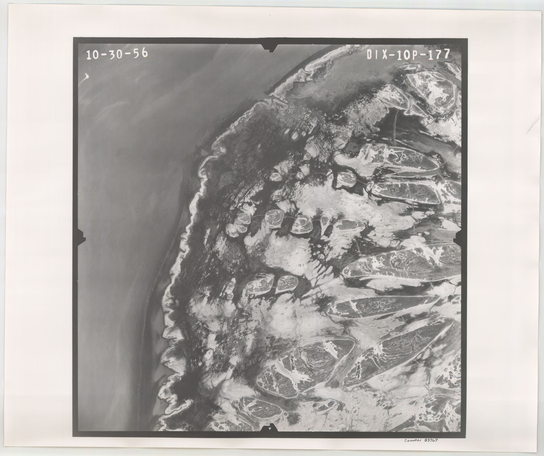
Flight Mission No. DIX-10P, Frame 177, Aransas County
DIX-10P-177
-
Map/Doc
83967
-
Collection
General Map Collection
-
Object Dates
1956/10/30 (Creation Date)
-
People and Organizations
U. S. Department of Agriculture (Publisher)
-
Counties
Aransas
-
Subjects
Aerial Photograph
-
Height x Width
18.6 x 22.3 inches
47.2 x 56.6 cm
-
Comments
Flown by V. L. Beavers and Associates of San Antonio, Texas.
Part of: General Map Collection
Flight Mission No. BRE-1P, Frame 47, Nueces County

Print $20.00
- Digital $50.00
Flight Mission No. BRE-1P, Frame 47, Nueces County
1956
Size 18.4 x 22.3 inches
Map/Doc 86636
Donley County Rolled Sketch 1

Print $20.00
- Digital $50.00
Donley County Rolled Sketch 1
1939
Size 19.6 x 15.1 inches
Map/Doc 5728
Palo Pinto County Rolled Sketch 11

Print $20.00
- Digital $50.00
Palo Pinto County Rolled Sketch 11
1976
Size 20.5 x 19.9 inches
Map/Doc 7191
Hudspeth County Working Sketch 16

Print $40.00
- Digital $50.00
Hudspeth County Working Sketch 16
Size 22.2 x 56.6 inches
Map/Doc 69649
Marion County

Print $20.00
- Digital $50.00
Marion County
1943
Size 29.2 x 46.3 inches
Map/Doc 73229
Coke County Rolled Sketch 21

Print $20.00
- Digital $50.00
Coke County Rolled Sketch 21
1954
Size 14.0 x 24.4 inches
Map/Doc 5522
[Surveys in Vehlein's Colony along Long King's Creek]
![83, [Surveys in Vehlein's Colony along Long King's Creek], General Map Collection](https://historictexasmaps.com/wmedia_w700/maps/83.tif.jpg)
Print $20.00
- Digital $50.00
[Surveys in Vehlein's Colony along Long King's Creek]
Size 13.3 x 19.0 inches
Map/Doc 83
Flight Mission No. BRA-3M, Frame 123, Jefferson County

Print $20.00
- Digital $50.00
Flight Mission No. BRA-3M, Frame 123, Jefferson County
1953
Size 18.5 x 21.7 inches
Map/Doc 85397
Williamson County Sketch File 4

Print $26.00
- Digital $50.00
Williamson County Sketch File 4
1849
Size 15.9 x 10.4 inches
Map/Doc 40304
Flight Mission No. DAG-17K, Frame 128, Matagorda County

Print $20.00
- Digital $50.00
Flight Mission No. DAG-17K, Frame 128, Matagorda County
1952
Size 18.6 x 22.3 inches
Map/Doc 86348
Parker County Sketch File 48

Print $20.00
- Digital $50.00
Parker County Sketch File 48
1858
Size 17.6 x 22.3 inches
Map/Doc 12152
[Aransas Bay]
![72971, [Aransas Bay], General Map Collection](https://historictexasmaps.com/wmedia_w700/maps/72971.tif.jpg)
Print $20.00
- Digital $50.00
[Aransas Bay]
1846
Size 18.2 x 24.7 inches
Map/Doc 72971
You may also like
[Sketch for Mineral Application 27670 - Strip between Simon Sanchez leagues and Trinity River]
![2865, [Sketch for Mineral Application 27670 - Strip between Simon Sanchez leagues and Trinity River], General Map Collection](https://historictexasmaps.com/wmedia_w700/maps/2865-1.tif.jpg)
Print $40.00
- Digital $50.00
[Sketch for Mineral Application 27670 - Strip between Simon Sanchez leagues and Trinity River]
1934
Size 17.3 x 50.5 inches
Map/Doc 2865
The Republic County of Victoria. Spring 1842

Print $20.00
The Republic County of Victoria. Spring 1842
2020
Size 24.3 x 21.7 inches
Map/Doc 96300

Topography and water depth as shown by the U.S. Coast Survey of 1888

Print $20.00
- Digital $50.00
Topography and water depth as shown by the U.S. Coast Survey of 1888
1890
Size 17.0 x 18.8 inches
Map/Doc 390
Galveston County NRC Article 33.136 Sketch 73

Print $28.00
- Digital $50.00
Galveston County NRC Article 33.136 Sketch 73
2013
Size 31.7 x 24.0 inches
Map/Doc 94995
Duval County Working Sketch 22

Print $20.00
- Digital $50.00
Duval County Working Sketch 22
1942
Size 21.9 x 26.0 inches
Map/Doc 68746
La Salle County Rolled Sketch 28

Print $90.00
- Digital $50.00
La Salle County Rolled Sketch 28
1956
Size 51.1 x 49.1 inches
Map/Doc 9561
Flight Mission No. DQN-1K, Frame 120, Calhoun County

Print $20.00
- Digital $50.00
Flight Mission No. DQN-1K, Frame 120, Calhoun County
1953
Size 18.5 x 22.2 inches
Map/Doc 84186
Starr County Rolled Sketch 28

Print $20.00
- Digital $50.00
Starr County Rolled Sketch 28
1941
Size 29.0 x 20.6 inches
Map/Doc 7811
Atascosa County Working Sketch 39

Print $20.00
- Digital $50.00
Atascosa County Working Sketch 39
2011
Size 43.2 x 34.8 inches
Map/Doc 90068
Flight Mission No. CRC-4R, Frame 181, Chambers County

Print $20.00
- Digital $50.00
Flight Mission No. CRC-4R, Frame 181, Chambers County
1956
Size 18.5 x 22.2 inches
Map/Doc 84932
Baylor County Rolled Sketch 10

Print $20.00
- Digital $50.00
Baylor County Rolled Sketch 10
Size 28.0 x 14.0 inches
Map/Doc 5127