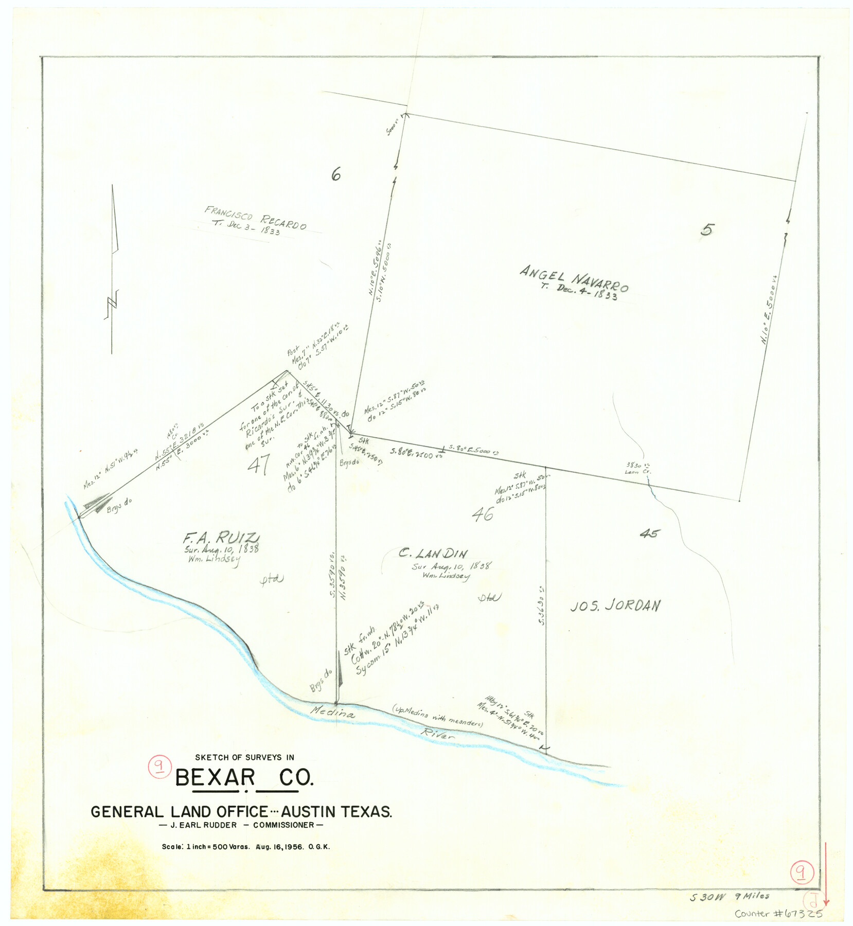
Bexar County Working Sketch 9
-
Map/Doc
67325
-
Collection
General Map Collection
-
Object Dates
8/16/1956 (Creation Date)
-
People and Organizations
J. Earl Rudder (GLO Commissioner)
Otto G. Kurio (Draftsman)
-
Counties
Bexar
-
Subjects
Surveying Working Sketch
-
Height x Width
23.4 x 21.6 inches
59.4 x 54.9 cm
-
Scale
1" = 500 varas
-
Comments
Surveys located about nine miles South 30 degrees West of San Antonio, Texas.
Part of: General Map Collection
Pecos County Rolled Sketch 70

Print $40.00
- Digital $50.00
Pecos County Rolled Sketch 70
1929
Size 49.3 x 21.6 inches
Map/Doc 9708
Flight Mission No. BRE-1P, Frame 105, Nueces County

Print $20.00
- Digital $50.00
Flight Mission No. BRE-1P, Frame 105, Nueces County
1956
Size 18.4 x 22.2 inches
Map/Doc 86676
Mitchell County Sketch File 11

Print $6.00
- Digital $50.00
Mitchell County Sketch File 11
1910
Size 11.2 x 8.8 inches
Map/Doc 31700
Hansford County

Print $20.00
- Digital $50.00
Hansford County
1932
Size 38.7 x 38.0 inches
Map/Doc 73169
Coke County Working Sketch 10

Print $20.00
- Digital $50.00
Coke County Working Sketch 10
1937
Size 25.1 x 26.7 inches
Map/Doc 68047
Gregg County Rolled Sketch 15

Print $40.00
- Digital $50.00
Gregg County Rolled Sketch 15
1941
Size 42.7 x 57.1 inches
Map/Doc 9066
Morris County Rolled Sketch 2A

Print $20.00
- Digital $50.00
Morris County Rolled Sketch 2A
Size 35.2 x 27.7 inches
Map/Doc 10270
Fractional Township No. 8 South Range No. 22 East of the Indian Meridian, Indian Territory

Print $20.00
- Digital $50.00
Fractional Township No. 8 South Range No. 22 East of the Indian Meridian, Indian Territory
1897
Size 19.2 x 24.2 inches
Map/Doc 75239
Schleicher County Working Sketch 11

Print $20.00
- Digital $50.00
Schleicher County Working Sketch 11
1924
Size 18.9 x 13.8 inches
Map/Doc 63813
Val Verde County Rolled Sketch 65

Print $20.00
- Digital $50.00
Val Verde County Rolled Sketch 65
1956
Size 43.0 x 45.0 inches
Map/Doc 10083
Presidio County Sketch File 72

Print $6.00
- Digital $50.00
Presidio County Sketch File 72
1943
Size 13.3 x 8.8 inches
Map/Doc 34679
Flight Mission No. DQO-3K, Frame 82, Galveston County

Print $20.00
- Digital $50.00
Flight Mission No. DQO-3K, Frame 82, Galveston County
1952
Size 18.7 x 22.5 inches
Map/Doc 85087
You may also like
Map Showing the Barranco Blanco, Rincon del Oso, and Rincon de Corpus Christi Grants

Print $40.00
- Digital $50.00
Map Showing the Barranco Blanco, Rincon del Oso, and Rincon de Corpus Christi Grants
1886
Size 58.8 x 80.1 inches
Map/Doc 16781
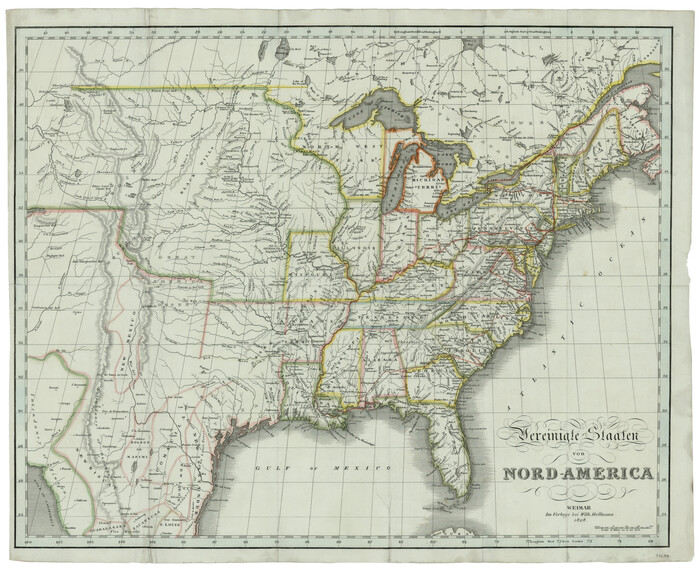
Vereinigte Staaten von Nord America
Print $20.00
- Digital $50.00
Vereinigte Staaten von Nord America
1828
Size 17.6 x 21.9 inches
Map/Doc 93644
Maps of Gulf Intracoastal Waterway, Texas - Sabine River to the Rio Grande and connecting waterways including ship channels

Print $20.00
- Digital $50.00
Maps of Gulf Intracoastal Waterway, Texas - Sabine River to the Rio Grande and connecting waterways including ship channels
1966
Size 14.6 x 22.3 inches
Map/Doc 61925
Clarendon, Texas, Donley Co.

Print $20.00
Clarendon, Texas, Donley Co.
1890
Size 17.4 x 28.6 inches
Map/Doc 93468
Nueces County Rolled Sketch 28

Print $20.00
- Digital $50.00
Nueces County Rolled Sketch 28
Size 16.8 x 25.1 inches
Map/Doc 6874
Val Verde County Sketch File 51c

Print $6.00
- Digital $50.00
Val Verde County Sketch File 51c
1959
Size 10.9 x 16.9 inches
Map/Doc 39332
Right of Way and Track Map, The Missouri, Kansas and Texas Ry. of Texas operated by the Missouri, Kansas and Texas Ry. of Texas, Henrietta Division

Print $40.00
- Digital $50.00
Right of Way and Track Map, The Missouri, Kansas and Texas Ry. of Texas operated by the Missouri, Kansas and Texas Ry. of Texas, Henrietta Division
1918
Size 25.1 x 56.4 inches
Map/Doc 64074

West End Place Part of NW Quarter Section 44, Block AK

Print $20.00
- Digital $50.00
West End Place Part of NW Quarter Section 44, Block AK
Size 16.0 x 16.4 inches
Map/Doc 92346
Flight Mission No. DCL-7C, Frame 58, Kenedy County

Print $20.00
- Digital $50.00
Flight Mission No. DCL-7C, Frame 58, Kenedy County
1943
Size 15.3 x 15.1 inches
Map/Doc 86046
Karnes County Rolled Sketch 3

Print $20.00
- Digital $50.00
Karnes County Rolled Sketch 3
1959
Size 27.9 x 41.6 inches
Map/Doc 6454
Baylor County Sketch File A4

Print $8.00
- Digital $50.00
Baylor County Sketch File A4
Size 14.0 x 8.7 inches
Map/Doc 14084