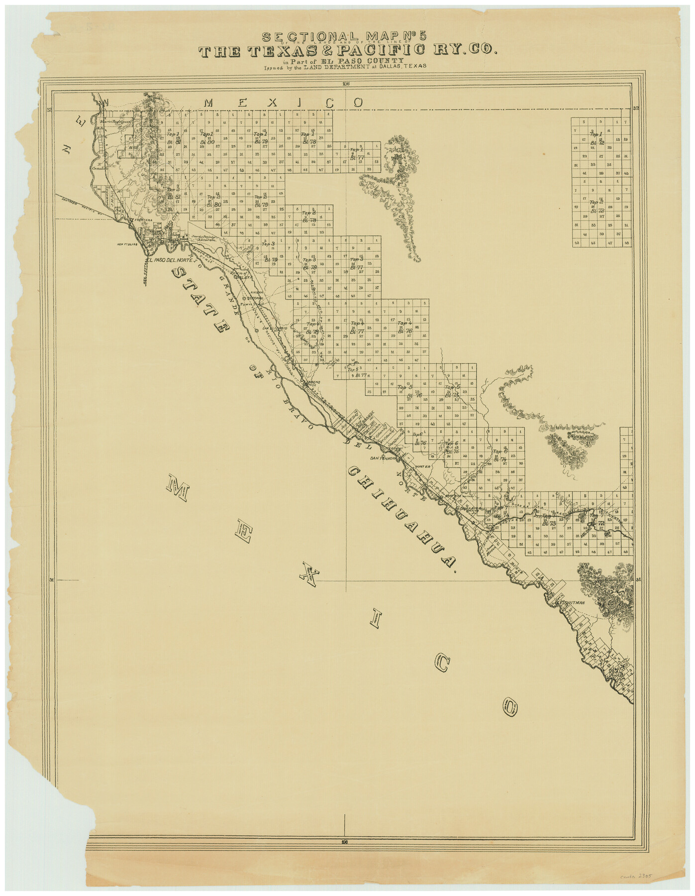
Sectional Map No. 5 of the lands and of the line of the Texas & Pacific Ry. Co. in part of El Paso County
N-2-76
-
Map/Doc
2305
-
Collection
General Map Collection
-
Object Dates
1885 (Creation Date)
-
People and Organizations
T. & P. RY. CO. (Author)
-
Counties
El Paso
-
Subjects
County
-
Height x Width
22.5 x 17.9 inches
57.2 x 45.5 cm
-
Comments
Shows lands sold and available for sale.
Part of: General Map Collection
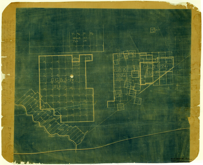
Bosque County Sketch File 31

Print $6.00
- Digital $50.00
Bosque County Sketch File 31
1867
Size 8.5 x 10.5 inches
Map/Doc 14830
Surveys made on La Parita, March 1847

Print $2.00
- Digital $50.00
Surveys made on La Parita, March 1847
1847
Size 10.1 x 7.5 inches
Map/Doc 222
Bexar County Sketch File 9

Print $4.00
- Digital $50.00
Bexar County Sketch File 9
1853
Size 8.2 x 13.2 inches
Map/Doc 14479
Dickens County Boundary File 4

Print $52.00
- Digital $50.00
Dickens County Boundary File 4
Size 14.2 x 8.7 inches
Map/Doc 52546
Franklin County Sketch File 7

Print $6.00
- Digital $50.00
Franklin County Sketch File 7
1852
Size 8.1 x 10.1 inches
Map/Doc 23020
Montague County Working Sketch 25

Print $20.00
- Digital $50.00
Montague County Working Sketch 25
1955
Size 42.4 x 28.4 inches
Map/Doc 71091
Strip Map of Texas-Oklahoma Boundary from Denison East to the Oklahoma-Arkansas State Line

Print $40.00
- Digital $50.00
Strip Map of Texas-Oklahoma Boundary from Denison East to the Oklahoma-Arkansas State Line
1933
Size 38.7 x 116.3 inches
Map/Doc 75926
Upton County Rolled Sketch 4

Print $20.00
- Digital $50.00
Upton County Rolled Sketch 4
Size 34.4 x 42.8 inches
Map/Doc 76025
Dimmit County Working Sketch 52

Print $20.00
- Digital $50.00
Dimmit County Working Sketch 52
1989
Size 25.2 x 37.0 inches
Map/Doc 68713
Cameron County Rolled Sketch 7

Print $20.00
- Digital $50.00
Cameron County Rolled Sketch 7
1926
Size 27.4 x 31.8 inches
Map/Doc 8563
Tarrant County Sketch File 14

Print $7.00
- Digital $50.00
Tarrant County Sketch File 14
1859
Size 10.2 x 8.4 inches
Map/Doc 37705
Collin County Working Sketch Graphic Index

Print $20.00
- Digital $50.00
Collin County Working Sketch Graphic Index
1975
Size 41.4 x 39.0 inches
Map/Doc 76498
You may also like
Culberson County Rolled Sketch 19A
Print $20.00
- Digital $50.00
Culberson County Rolled Sketch 19A
Size 23.2 x 28.6 inches
Map/Doc 5652
Pecos County Rolled Sketch 112

Print $20.00
- Digital $50.00
Pecos County Rolled Sketch 112
1941
Size 39.0 x 37.0 inches
Map/Doc 9720
Sketch of Crosby Co.

Print $20.00
- Digital $50.00
Sketch of Crosby Co.
1884
Size 14.8 x 12.5 inches
Map/Doc 506
Map of Nacogdoches County

Print $20.00
- Digital $50.00
Map of Nacogdoches County
1846
Size 42.7 x 40.0 inches
Map/Doc 87358
Atascosa County Rolled Sketch 22

Print $40.00
- Digital $50.00
Atascosa County Rolled Sketch 22
1917
Size 26.3 x 57.2 inches
Map/Doc 8434
[Subdivision of Lgs. 109-112, Crosby County School Land]
![90154, [Subdivision of Lgs. 109-112, Crosby County School Land], Twichell Survey Records](https://historictexasmaps.com/wmedia_w700/maps/90154-1.tif.jpg)
Print $20.00
- Digital $50.00
[Subdivision of Lgs. 109-112, Crosby County School Land]
Size 11.8 x 21.3 inches
Map/Doc 90154
Tom Green County Rolled Sketch 4

Print $20.00
- Digital $50.00
Tom Green County Rolled Sketch 4
Size 28.2 x 23.6 inches
Map/Doc 7994
Bailey County Working Sketch 6

Print $20.00
- Digital $50.00
Bailey County Working Sketch 6
1966
Size 37.0 x 34.5 inches
Map/Doc 67593
Fort Bend County State Real Property Sketch 6

Print $40.00
- Digital $50.00
Fort Bend County State Real Property Sketch 6
1986
Size 34.9 x 43.6 inches
Map/Doc 61680
Karnes County Sketch File 16

Print $20.00
- Digital $50.00
Karnes County Sketch File 16
1950
Size 14.4 x 30.7 inches
Map/Doc 11905
Newton County Rolled Sketch 10

Print $40.00
- Digital $50.00
Newton County Rolled Sketch 10
1949
Size 27.4 x 59.6 inches
Map/Doc 9575
Jasper County Working Sketch 22

Print $20.00
- Digital $50.00
Jasper County Working Sketch 22
1943
Size 21.0 x 15.4 inches
Map/Doc 66484